Category:The World Factbook (2004)
Jump to navigation
Jump to search
Media in category "The World Factbook (2004)"
The following 199 files are in this category, out of 199 total.
-
 Afghanistan-CIA WFB Map.png 326 × 349; 15 KB
-
 Akrotiri-CIA WFB Map.png 326 × 351; 7 KB
-
 Albania-CIA WFB Map (2004).png 326 × 350; 10 KB
-
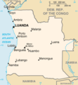 Angola map.png 326 × 351; 11 KB
-
 Antarctica-CIA WFB Map.png 330 × 355; 9 KB
-
 Arctic Ocean - en.png 329 × 330; 14 KB
-
 Ar-map.png 328 × 712; 24 KB
-
 Atlantic Ocean - en.png 328 × 328; 12 KB
-
 Atlantic Ocean - hi.png 328 × 328; 12 KB
-
 Atlantic Ocean hu.png 756 × 756; 165 KB
-
 Australia-CIA WFB Map (2004).png 328 × 352; 13 KB
-
 Au-map (2004).png 329 × 353; 12 KB
-
 Bahamas, The-CIA WFB Map (2004).png 330 × 355; 10 KB
-
 Bahrain map.png 334 × 355; 9 KB
-
 Baker Island-CIA WFB Map.png 330 × 355; 3 KB
-
 Bg-map.png 325 × 348; 16 KB
-
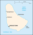 Bb-map.png 330 × 354; 5 KB
-
 Bassas da India-CIA WFB Map.png 330 × 355; 5 KB
-
 Belgium-CIA WFB Map.png 330 × 353; 13 KB
-
 Belize-CIA WFB Map (2004).png 330 × 354; 8 KB
-
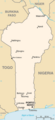 Benin-CIA WFB Map.png 326 × 710; 11 KB
-
 Bermuda-CIA WFB Map (2004).png 330 × 354; 7 KB
-
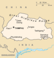 Bt-map.png 326 × 351; 7 KB
-
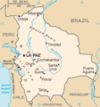 Bl-map.png 327 × 350; 12 KB
-
 Botswana-CIA WFB Map.png 329 × 353; 13 KB
-
 Bouvet Island-CIA WFB Map.png 327 × 352; 6 KB
-
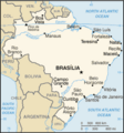 Brazil map en 2004.png 330 × 354; 15 KB
-
 British Indian Ocean Territory-CIA WFB Map (2004).png 329 × 355; 5 KB
-
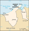 Brunei-CIA WFB Map.png 330 × 355; 8 KB
-
 Bulgaria-CIA WFB Map (2004).png 328 × 351; 11 KB
-
 Burkina Faso map.png 326 × 351; 10 KB
-
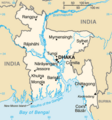
 Burma-CIA WFB Map (2004).png 296 × 642; 18 KB
-
 Cambodia-CIA WFB Map.png 330 × 355; 13 KB
-
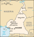 Cameroon-CIA WFB Map.png 330 × 355; 9 KB
-
 Canada-CIA WFB Map.png 634 × 325; 28 KB
-
 Cape Verde-CIA WFB Map.png 330 × 355; 8 KB
-
 Central African Republic-CIA WFB Map (2004).png 326 × 350; 10 KB
-
 Chad-CIA WFB Map (2004).png 327 × 714; 12 KB
-
 Chile-CIA WFB Map.png 330 × 714; 24 KB
-
 China-CIA WFB Map (2004).png 633 × 324; 28 KB
-
 Christmas Island-CIA WFB Map.png 330 × 355; 4 KB
-
 Clipperton Island-CIA WFB Map.png 330 × 355; 5 KB
-
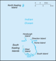 Cocos (Keeling) Islands-CIA WFB Map.png 329 × 355; 5 KB
-
 Cocos (Keeling) Islands-CIA WFB Map hu.png 658 × 710; 63 KB
-
 Colombia-CIA WFB Map.png 330 × 354; 13 KB
-
 Comoros-CIA WFB Map.png 330 × 355; 5 KB
-
 Congo, Democratic Republic of the-CIA WFB Map.png 330 × 355; 13 KB
-
 Congo, Republic of the-CIA WFB Map.png 332 × 355; 11 KB
-
 Cook-Islands-map.gif 325 × 350; 5 KB
-
 Coral Sea Islands-CIA WFB Map.png 330 × 355; 12 KB
-
 Costa Rica-CIA WFB Map (2004).png 329 × 355; 9 KB
-
 Cote d'Ivoire-CIA WFB Map.png 330 × 352; 14 KB
-
 Cuba-CIA WFB Map.png 634 × 323; 15 KB
-
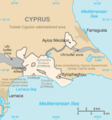
 Cyprus-CIA WFB Map.png 630 × 321; 12 KB
-
 Denmark-CIA WFB Map.png 330 × 354; 15 KB
-
 Dhekelia-CIA WFB Map.png 326 × 350; 10 KB
-
 Djibouti-CIA WFB Map.png 322 × 344; 9 KB
-
 Dominica-CIA WFB Map (2004).png 330 × 354; 5 KB
-
 Dominican Republic-CIA WFB Map.png 329 × 352; 9 KB
-
 Ecuador-CIA WFB Map.png 329 × 352; 12 KB
-
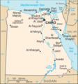 Egypt-CIA WFB Map.png 329 × 352; 12 KB
-
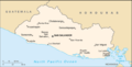 El Salvador-CIA WFB Map (2004).png 634 × 324; 10 KB
-
 Equatorial Guinea-CIA WFB Map.png 330 × 355; 8 KB
-
 Ethiopia-CIA WFB Map (2004).png 330 × 355; 12 KB
-
 Europa Island-CIA WFB Map.png 331 × 356; 9 KB
-
 European Union-CIA WFB Map (2004).png 633 × 654; 33 KB
-
 Falklandsmap.gif 350 × 376; 12 KB
-
 Fo-map.gif 330 × 355; 9 KB
-
 Fiji-CIA WFB Map.png 330 × 355; 4 KB
-
 Fiji-CIA WFB Map hu.png 651 × 700; 61 KB
-
 Finland-CIA WFB Map.png 328 × 713; 24 KB
-
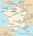 France-CIA WFB Map.png 327 × 349; 15 KB
-
 French Southern and Antarctic Lands-CIA WFB Map (2004).png 330 × 355; 3 KB
-
 Gambia, The-CIA WFB Map (2004).png 637 × 323; 12 KB
-
 Gaza Strip-CIA WFB Map (2004).png 328 × 352; 8 KB
-
 Germany-CIA WFB Map.png 328 × 352; 16 KB
-
 Gibraltar map.png 330 × 355; 8 KB
-
 Glorioso Islands-CIA WFB Map.png 328 × 353; 6 KB
-
 Grenada-CIA WFB Map (2004).png 331 × 355; 6 KB
-
 Guam-CIA WFB Map.png 360 × 387; 7 KB
-
 Guatemala-CIA WFB Map.png 330 × 355; 9 KB
-
 Guinea-CIA WFB Map (2004).png 325 × 350; 11 KB
-
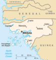 Guinea bissau sm03.png 325 × 350; 9 KB
-
 Guyana-CIA WFB Map (2004).png 329 × 706; 10 KB
-
 Heard Island and McDonald Islands-CIA WFB Map.png 365 × 392; 4 KB
-
 Holy See (Vatican City)-CIA WFB Map.png 330 × 355; 8 KB
-
 Honduras-CIA WFB Map.png 330 × 354; 12 KB
-
 Honduras-CIA WFB Map hu.png 746 × 800; 190 KB
-
 Hong Kong-CIA WFB Map.png 329 × 353; 14 KB
-
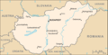 Hungary-CIA WFB Map (2004).png 635 × 324; 14 KB
-
 India-CIA WFB Map (2004).png 327 × 351; 16 KB
-
 Indonesia-CIA WFB Map (2004).png 636 × 326; 24 KB
-
 Iran-CIA WFB Map.png 332 × 353; 14 KB
-
 Iraq-CIA WFB Map.png 326 × 351; 11 KB
-
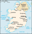 Ireland-CIA WFB Map.png 330 × 355; 12 KB
-
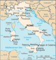 Italy-CIA WFB Map (2004).png 329 × 353; 16 KB
-
 Japan-CIA WFB Map (2004).png 329 × 353; 13 KB
-
 Kenya-CIA WFB Map (2004).png 330 × 353; 10 KB
-
 Kiribati CIA WFB map (2004).png 330 × 354; 10 KB
-
 Korea, North-CIA WFB Map.png 326 × 351; 11 KB
-
 Korea, South-CIA WFB Map (2004).png 330 × 354; 12 KB
-
 Kuwait-CIA WFB Map (2004).png 341 × 367; 10 KB
-
 Laos-CIA WFB Map.png 330 × 355; 12 KB
-
 Lebanon-CIA WFB Map (2004).png 330 × 354; 10 KB
-
 Lesotho-CIA WFB Map.png 330 × 354; 7 KB
-
 Li-map.png 327 × 349; 10 KB
-
 Liechtenstein-CIA WFB Map (2004).png 330 × 355; 6 KB
-
 Lu-map.png 330 × 354; 7 KB
-
 Macau-CIA WFB Map (2004).png 330 × 708; 15 KB
-
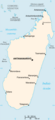
 Madagascar map.png 326 × 711; 12 KB
-
 Madagascar map hu.png 489 × 1,067; 139 KB
-
 Malawi-CIA WFB Map.png 332 × 717; 16 KB
-
 Malaysia-CIA WFB Map.png 633 × 322; 19 KB
-
 Maldives-CIA WFB Map.png 329 × 354; 4 KB
-
 Mali map.png 350 × 376; 11 KB
-
 Malta CIA map HU.png 632 × 679; 87 KB
-
 Malta-CIA WFB Map.png 330 × 355; 6 KB
-
 Malta-CIA WFB Map-zh.png 330 × 355; 13 KB
-
 Martinique-Map.png 330 × 355; 6 KB
-
 Mauritania-CIA WFB Map.png 328 × 353; 10 KB
-
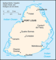 Mauritius-CIA WFB Map.png 330 × 355; 9 KB
-
 Mexico-CIA WFB Map (2004).png 633 × 323; 19 KB
-
 Monaco-CIA WFB Map.png 330 × 355; 7 KB
-
 Mongolia CIA map.png 630 × 318; 12 KB
-
 Morocco-CIA WFB Map (2004).png 329 × 352; 10 KB
-
 Mozambique-CIA WFB Map.png 332 × 716; 14 KB
-
 Namibia-CIA WFB Map (2004).png 330 × 355; 9 KB
-
 Nauru-CIA WFB Map.png 330 × 355; 8 KB
-
 Nepal-CIA WFB Map.png 634 × 323; 16 KB
-
 Netherlands-CIA WFB Map (2004).png 330 × 355; 10 KB
-
 Netherlands Antilles-CIA WFB Map (2004).png 329 × 354; 6 KB
-
 New Caledonia-CIA WFB Map (2004).png 324 × 350; 8 KB
-
 New Zealand-CIA WFB Map.png 330 × 707; 11 KB
-
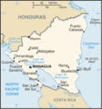 Nicaragua-CIA WFB Map.png 330 × 353; 12 KB
-
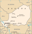 Niger-CIA WFB Map.png 329 × 352; 11 KB
-
 Nigeria-CIA WFB Map.png 331 × 352; 14 KB
-
 Norway-CIA WFB Map.png 328 × 713; 22 KB
-
 Oman-CIA WFB Map (2004).png 328 × 352; 10 KB
-
 Pakistan-CIA WFB Map (2004).png 330 × 354; 14 KB
-
 Panama-CIA WFB Map.png 633 × 323; 15 KB
-
 Papua New Guinea-CIA WFB Map.png 325 × 350; 10 KB
-
 Paraguay-CIA WFB Map (2004).png 330 × 355; 9 KB
-
 Peru-CIA WFB Map.png 330 × 354; 14 KB
-
 Poland-CIA WFB Map (2004).png 327 × 353; 15 KB
-
 Portugal-CIA WFB Map (2004).png 340 × 733; 12 KB
-
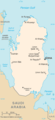 Qatar-CIA WFB Map (2004).png 324 × 709; 16 KB
-
 Reunion-CIA WFB Map.png 325 × 350; 5 KB
-
 Romania-CIA WFB Map (2004).png 316 × 339; 13 KB
-
 Russia-CIA WFB Map.png 634 × 323; 30 KB
-
 Rwanda-CIA WFB Map.png 330 × 352; 13 KB
-
 Sc-map.gif 330 × 355; 7 KB
-
 Saint Lucia-CIA WFB Map (2004).png 330 × 355; 6 KB
-
 Saint Vincent and the Grenadines-CIA WFB Map (2004).png 330 × 355; 7 KB
-
 Samoa-CIA WFB Map (2004).png 633 × 321; 9 KB
-
 San Marino-CIA WFB Map.png 330 × 355; 6 KB
-
 Sao Tome and Principe-CIA WFB Map.png 329 × 355; 5 KB
-
 Saudi Arabia-CIA WFB Map.png 328 × 352; 12 KB
-
 Se-map-zh.gif 328 × 353; 26 KB
-
 Senegal-CIA WFB Map (2004).png 328 × 354; 10 KB
-
 Se-map.gif 328 × 353; 5 KB
-
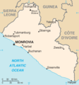
 Sierra Leone-CIA WFB Map.png 330 × 355; 9 KB
-
 CIA World Factbook map of Singapore (English, 2004).png 329 × 354; 11 KB
-
 Solomon Islands-CIA WFB Map.png 329 × 355; 6 KB
-
 Solomon Islands-CIA WFB Map hu.png 877 × 947; 127 KB
-
 Somalia-CIA WFB Map (2004).png 330 × 355; 9 KB
-
 South Africa-CIA WFB Map.png 329 × 353; 11 KB
-
 Sp-map.png 326 × 350; 17 KB
-
 Ceylan-map.png 325 × 349; 9 KB
-
 Sudan-CIA WFB Map (2004).png 329 × 353; 13 KB
-
 Suriname-CIA WFB Map (2004).png 328 × 353; 9 KB
-
 CIA WFB Map Eswatini.png 328 × 353; 7 KB
-
 Sweden-CIA WFB Map.png 328 × 714; 30 KB
-
 Switzerland-CIA WFB Map.png 634 × 323; 15 KB
-
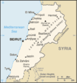
 Syria-CIA WFB Map.png 328 × 352; 12 KB
-
 Taiwan-CIA WFB Map (2004).png 330 × 354; 7 KB
-
 Tanzania-CIA WFB Map (2004).png 330 × 351; 14 KB
-
 Thailand-CIA WFB Map (2004).png 331 × 708; 20 KB
-
 Togo-CIA WFB Map (2004).png 338 × 727; 15 KB
-
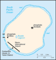
 Tonga-CIA WFB Map.png 364 × 391; 6 KB
-
 Td-map.png 336 × 361; 7 KB
-
 Tunisia map-EN.png 330 × 710; 12 KB
-
 Turkey-CIA WFB Map.png 634 × 324; 19 KB
-
 Tuvalu-CIA WFB Map.png 329 × 352; 5 KB
-
 Uganda-CIA WFB Map.png 330 × 354; 28 KB
-
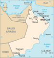
 United Arab Emirates-CIA WFB Map.png 635 × 323; 15 KB
-
 United Kingdom-CIA WFB Map.png 312 × 676; 20 KB
-
 Uruguay-CIA WFB Map (2004).png 330 × 354; 11 KB
-
 Vanuatu-CIA WFB Map.png 329 × 708; 8 KB
-
 Vanuatu-CIA WFB Map hu.png 395 × 850; 58 KB
-
 Map of Venezuela non-Esequibo.jpg 351 × 377; 109 KB
-
 Venezuela-CIA WFB Map (2004).png 329 × 353; 11 KB
-
 Vietnam-CIA WFB Map.png 330 × 713; 19 KB
-
 Carte de Wallis-et-Futuna mk.png 326 × 350; 10 KB
-
 Wallis and Futuna-CIA WFB Map.png 330 × 354; 3 KB
-
 Western Sahara-CIA WFB Map (2004).png 364 × 390; 8 KB
-
 WFB 2004.jpg 481 × 625; 77 KB
-
 Yemen-CIA WFB Map.png 330 × 355; 10 KB
-
 Zambia-CIA WFB Map.png 330 × 353; 14 KB
-
 Zimbabwe-CIA WFB Map.png 344 × 368; 12 KB


.png)


.png)
.png)
.png)


.png)

.png)


.png)

.png)

.png)


.png)
.png)

.png)


_Islands-CIA_WFB_Map.png)
_Islands-CIA_WFB_Map_hu.png)


.png)


.png)


.png)

.png)

.png)


.png)
.png)
.png)


.png)


.png)

.png)

-CIA_WFB_Map.png)


.png)
.png)
.png)


.png)
.png)
.png)
.png)

.png)
.png)

.png)


.png)

.png)


.png)


.png)

.png)


.png)
.png)
.png)


.png)
.png)


.png)

.png)
.png)
.png)

.png)


.png)
.png)
.png)


.png)


.png)


.png)


.png)
.png)


.png)
.png)
.png)
.png)


.png)


.png)


.png)


