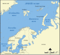
File:Norveško more.svg
From Wikimedia Commons, the free media repository
Jump to navigation
Jump to search

Size of this PNG preview of this SVG file: 657 × 600 pixels. Other resolutions: 263 × 240 pixels | 526 × 480 pixels | 841 × 768 pixels | 1,122 × 1,024 pixels | 2,243 × 2,048 pixels | 1,000 × 913 pixels.
Original file (SVG file, nominally 1,000 × 913 pixels, file size: 492 KB)
File information
Structured data
Captions
Captions
Add a one-line explanation of what this file represents
Summary
[edit]| DescriptionNorveško more.svg |
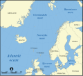
Bosanski: Mapa prikazuje Norveško more, Danski prolaz, Sjeverno more i Grenlandsko more. |
| Date | |
| Source | Norwegian Sea map.png |
| Author |
|
| Other versions |
[edit]
|
Licensing
[edit]I, the copyright holder of this work, hereby publish it under the following licenses:

|
Permission is granted to copy, distribute and/or modify this document under the terms of the GNU Free Documentation License, Version 1.2 or any later version published by the Free Software Foundation; with no Invariant Sections, no Front-Cover Texts, and no Back-Cover Texts. A copy of the license is included in the section entitled GNU Free Documentation License.http://www.gnu.org/copyleft/fdl.htmlGFDLGNU Free Documentation Licensetruetrue |
| This file is licensed under the Creative Commons Attribution-Share Alike 3.0 Unported license. | ||
| ||
| This licensing tag was added to this file as part of the GFDL licensing update.http://creativecommons.org/licenses/by-sa/3.0/CC BY-SA 3.0Creative Commons Attribution-Share Alike 3.0truetrue |
You may select the license of your choice.
File history
Click on a date/time to view the file as it appeared at that time.
| Date/Time | Thumbnail | Dimensions | User | Comment | |
|---|---|---|---|---|---|
| current | 09:46, 19 June 2015 |  | 1,000 × 913 (492 KB) | Golden Bosnian Lily (talk | contribs) | - |
| 09:35, 19 June 2015 |  | 1,000 × 913 (492 KB) | Golden Bosnian Lily (talk | contribs) | User created page with UploadWizard |
You cannot overwrite this file.
File usage on Commons
The following 29 pages use this file:
- File:Bahari ya Barents.png
- File:Barents Sea map.png
- File:Barents Sea map GR.png
- File:Barents Sea map hr.svg
- File:Barents Sea map hu.svg
- File:Barents Sea map ru.svg
- File:Barents sea map blank.png
- File:Barents sea map de.png
- File:Barents sp.png
- File:Carte de la mer de Norvège-Jan-Mayen-localisation.png
- File:Carte de la mer de Norvège.png
- File:Karte Europäisches Nordmeer.png
- File:Norra meri.png
- File:Norveško more.svg
- File:Norvég-tenger térkép 2.png
- File:Norvég tenger térkép.png
- File:Norwegian Sea blank map.png
- File:Norwegian Sea map-da.png
- File:Norwegian Sea map.png
- File:Norwegian Sea map ce.svg
- File:Norwegian Sea map ch.png
- File:Norwegian Sea map cs.png
- File:Norwegian Sea map it.png
- File:Norwegian Sea map mk.svg
- File:Norwegian Sea map no.png
- File:Norwegian Sea map ru.svg
- File:Norwegian Sea map sv.png
- File:Norwegian Sea map uk.svg
- Template:Other versions/Norwegian Sea
File usage on other wikis
The following other wikis use this file:
- Usage on bs.wikipedia.org
- Usage on sh.wikipedia.org
Metadata
This file contains additional information such as Exif metadata which may have been added by the digital camera, scanner, or software program used to create or digitize it. If the file has been modified from its original state, some details such as the timestamp may not fully reflect those of the original file. The timestamp is only as accurate as the clock in the camera, and it may be completely wrong.
| Width | 1000 |
|---|---|
| Height | 913 |


