Category:Maps of the Barents Sea
Jump to navigation
Jump to search
Subcategories
This category has the following 2 subcategories, out of 2 total.
B
P
- Maps of the Pechora Sea (3 F)
Media in category "Maps of the Barents Sea"
The following 72 files are in this category, out of 72 total.
-
"Fretum Nassouium vulgo de Straet Nassou. " (21630353374).jpg 3,908 × 1,782; 1.12 MB
-
1 20000 Heinäsaaret 1925.jpg 8,268 × 9,485; 6.96 MB
-
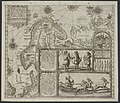
1598 map of the Polar Regions by Willem Barentsz.jpg 13,719 × 10,160; 30.66 MB
-
Admiralty Chart No 2962 The North Cape to Einsamkeit Island, Published 1898, New Edition 1925.jpg 16,348 × 11,107; 23.86 MB
-
Bahari ya Barents.png 986 × 898; 481 KB
-
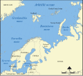
Barents Sea in its region.svg 500 × 281; 4.83 MB
-
Barents sea map blank.png 1,200 × 1,098; 252 KB
-
Barents sea map de.png 1,188 × 1,085; 252 KB
-
Barents Sea map GR.png 1,200 × 1,098; 309 KB
-
Barents Sea map hr.svg 512 × 466; 375 KB
-
Barents Sea map hu.svg 1,583 × 1,445; 801 KB
-
Barents Sea map ru.svg 1,006 × 921; 634 KB
-
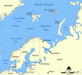
Barents Sea map.png 1,187 × 1,084; 654 KB
-
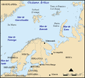
Barents sp.png 655 × 599; 170 KB
-
Barents third voyage.jpg 2,000 × 1,511; 965 KB
-
Barents-region.PNG 244 × 273; 20 KB
-
Barentskartet, 1598 (12068020364).jpg 2,842 × 2,091; 3.85 MB
-
Barentsz Full Map.jpg 1,000 × 742; 258 KB
-
Barentszzee.PNG 882 × 512; 14 KB
-
Barentszzee.png 800 × 587; 55 KB
-
Convoy PQ 17 map.jpg 1,200 × 1,283; 374 KB
-
Disparition Lefebvre Lepetit Vergeat 1920.jpg 591 × 479; 100 KB
-
Finnmark - no-nb krt 00728.jpg 8,417 × 5,983; 20.88 MB
-
Forminsket utgave av Barentskartet - no-nb krt 00487.jpg 4,418 × 3,449; 3.45 MB
-
Kara seaDY.PNG 710 × 534; 18 KB
-
Kara seaKNP.PNG 710 × 534; 18 KB
-
Kara seaKV.PNG 710 × 534; 18 KB
-
Kara seaMZ.PNG 710 × 534; 18 KB
-
Karte Europäisches Nordmeer.png 1,000 × 913; 291 KB
-
Linschoten Map of Scandinavia.jpg 1,536 × 1,316; 540 KB
-
Linschotens nordenkart, 1601 (12067624705) (2).jpg 4,400 × 3,609; 22.96 MB
-
Linschotens nordenkart, 1601 (12067624705).jpg 4,037 × 3,455; 22.29 MB
-
Map Barentszzee and Karazee.jpg 2,254 × 1,594; 694 KB
-
Map borderline at sea Norway Russia.gif 709 × 1,106; 265 KB
-
Map of Northern Fleet bases DEU.svg 400 × 348; 56 KB
-
Map of Northern Fleet bases ENG.svg 400 × 348; 80 KB
-
Map of Northern Fleet bases RUS.svg 400 × 348; 80 KB
-
Map of Northern Fleet bases SP.svg 424 × 381; 68 KB
-
Map of Northern Fleet bases.png 400 × 348; 39 KB
-
Map of the Nordic Seas.jpg 722 × 579; 212 KB
-
Mer de Barents carte.png 1,200 × 1,098; 313 KB
-
No-nb bldsa 3e073.jpg 4,347 × 3,325; 2.58 MB
-
No-nb bldsa q3e006.jpg 5,105 × 4,576; 5.44 MB
-
Norveško more.svg 1,000 × 913; 492 KB
-
Norvég-tenger térkép 2.png 1,000 × 913; 416 KB
-
Norwegian Sea map ce.svg 857 × 783; 473 KB
-
Norwegian Sea map cs.png 1,000 × 913; 414 KB
-
Norwegian Sea map hr.svg 857 × 783; 533 KB
-
Norwegian Sea map it.png 1,000 × 913; 413 KB
-
Norwegian Sea map mk.svg 857 × 783; 483 KB
-
Norwegian Sea map no.png 1,000 × 913; 406 KB
-
Norwegian Sea map ru.svg 857 × 783; 574 KB
-
Norwegian Sea map sv.png 1,000 × 913; 360 KB
-
Norwegian Sea map.png 1,000 × 913; 513 KB
-
OD Kontinentalsokkelkart 2016.pdf 5,075 × 6,735; 5.92 MB
-
Operational Navigation Chart A-2, 2nd edition.jpg 9,254 × 6,659; 13.7 MB
-
Operational Navigation Chart B-1, 3rd edition.jpg 9,254 × 6,672; 10.24 MB
-
Operational Navigation Chart B-2, 3rd edition.jpg 9,254 × 6,716; 13.42 MB
-
Operational Navigation Chart C-2, 13th edition.jpg 9,040 × 6,591; 18.48 MB
-
Operational Navigation Chart C-3, 6th edition.jpg 9,106 × 6,653; 15.26 MB
-
Pontanus 1611 Arctic Map.jpg 2,852 × 2,142; 802 KB
-
Sedov Foka path.PNG 399 × 711; 153 KB
-
Shtokman field.png 627 × 479; 46 KB
-
Smutthullet.png 740 × 761; 157 KB
-
БСЭ1. Баренцово море 1.jpg 1,110 × 1,183; 835 KB
-
БСЭ1. Баренцово море 2.jpg 1,927 × 1,316; 1.17 MB
-
БСЭ1. Баренцово море 3.jpg 1,943 × 1,347; 1.22 MB
-
Поморский пролив.png 746 × 448; 45 KB


