File:Nieuwe en nauwkeurige kaart van een gedeelte van Noord Amerika, behelzende Nieuw Engeland, New York, Pensylvania, New Jersey, Connecticut, Rhode Island, een stuk van Virginia, Kanada en Halifax, ter LOC 74692123.tif
Jump to navigation
Jump to search

Size of this JPG preview of this TIF file: 784 × 600 pixels. Other resolutions: 314 × 240 pixels | 628 × 480 pixels | 1,004 × 768 pixels | 1,280 × 979 pixels | 2,560 × 1,958 pixels | 9,267 × 7,088 pixels.
Original file (9,267 × 7,088 pixels, file size: 187.93 MB, MIME type: image/tiff)
Captions
Captions
Add a one-line explanation of what this file represents
Summary
[edit]| Description |
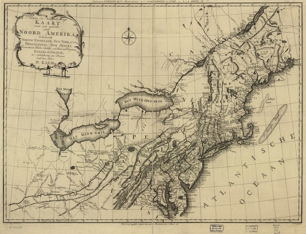
English: Scale ca. 1:2,300,000. Relief shown pictorially. "Het oorspronglyke volgens acte van't Parlement deh 7 Maart 1771." LC Maps of North America, 1750-1789, 727 Available also through the Library of Congress Web site as a raster image. Vault AACR2: 651 |
||
| Title | Nieuwe en nauwkeurige kaart van een gedeelte van Noord Amerika, behelzende Nieuw Engeland, New York, Pensylvania, New Jersey, Connecticut, Rhode Island, een stuk van Virginia, Kanada en Halifax, ter opheldering der reizen van den Heer P. Kalm. | ||
| Shelf ID | G3710 1771 .H9 | ||
| Date | |||
| Source | https://www.loc.gov/item/74692123/ | ||
| Author | Huyser, C. J. De.; Mol, P.; Brink, G. V. D. Jz.; Schoonhoven (J.) & Comp | ||
| Permission (Reusing this file) |
|
||
| Other versions |
|
||
| Location | Northeastern States · United States | ||
| Part of | Military Battles And Campaigns · American Memory · Catalog · Geography And Map Division · American Revolution And Its Era: Maps And Charts Of North America And The West Indies, 1750-1789 | ||
| Subject | Northeastern States · Maps · Early Works To 1800 · United States |


Licensing
[edit]|
This is a faithful photographic reproduction of a two-dimensional, public domain work of art. The work of art itself is in the public domain for the following reason:
The official position taken by the Wikimedia Foundation is that "faithful reproductions of two-dimensional public domain works of art are public domain".
This photographic reproduction is therefore also considered to be in the public domain in the United States. In other jurisdictions, re-use of this content may be restricted; see Reuse of PD-Art photographs for details. | ||||
File history
Click on a date/time to view the file as it appeared at that time.
| Date/Time | Thumbnail | Dimensions | User | Comment | |
|---|---|---|---|---|---|
| current | 11:00, 2 June 2018 |  | 9,267 × 7,088 (187.93 MB) | Fæ (talk | contribs) | LOC Maps https://www.loc.gov/item/74692123/ #2319 |
You cannot overwrite this file.
File usage on Commons
The following page uses this file: