File:New Jersey. LOC 74691925.jpg
Jump to navigation
Jump to search

Size of this preview: 463 × 600 pixels. Other resolutions: 185 × 240 pixels | 370 × 480 pixels | 593 × 768 pixels | 790 × 1,024 pixels | 1,581 × 2,048 pixels | 6,398 × 8,289 pixels.
Original file (6,398 × 8,289 pixels, file size: 9.61 MB, MIME type: image/jpeg)
Captions
Captions
Add a one-line explanation of what this file represents
Summary
[edit]| Description |
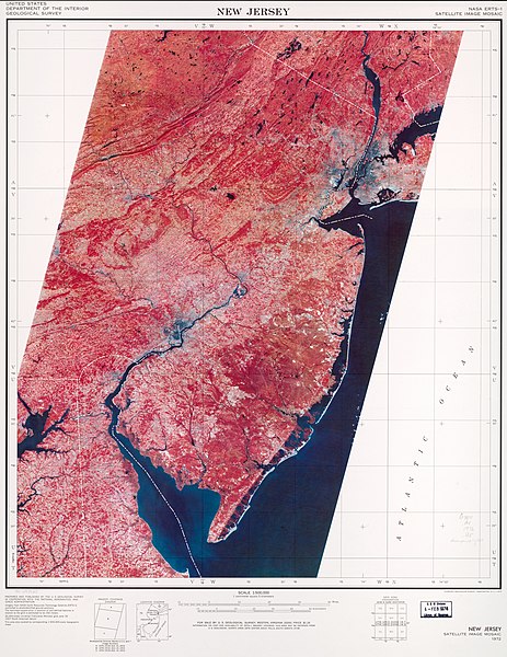
English: Scale 1:500,000; 1 cm. equals 5 kilometers. "Satellite image mosaic." "Nasa Erts-1." "The three images (1079-15124, 15131, and 15133) were acquired from an altitude of 915 kilometers (569 mi.) on October 10, 1972 ... " Includes "Imagery coverage diagram," "Location diagram," and "Grid zone designation." Accompanied by text. 1 l. Available also through the Library of Congress Web site as a raster image. AACR2 |
||
| Title | New Jersey. | ||
| Shelf ID | G3811.A4 1972 .U5 | ||
| Date | |||
| Source | https://www.loc.gov/item/74691925/ | ||
| Author | Geological Survey (U.S.) | ||
| Permission (Reusing this file) |
|
||
| Other versions |
|
||
| Location | New Jersey · United States | ||
| Part of | American Memory · General Maps · Catalog · Geography And Map Division | ||
| Subject | New Jersey · United States · Remote-Sensing Maps |


Licensing
[edit]
| This work is from the Library of Congress. According to the library, there are no known copyright restrictions on the use of this work. |  |
File history
Click on a date/time to view the file as it appeared at that time.
| Date/Time | Thumbnail | Dimensions | User | Comment | |
|---|---|---|---|---|---|
| current | 05:13, 24 August 2018 | | 6,398 × 8,289 (9.61 MB) | Fæ (talk | contribs) | LOC Maps https://www.loc.gov/item/74691925/ #4458 |
You cannot overwrite this file.
File usage on Commons
The following page uses this file: