File:Netherlands Groningen location map.svg
Jump to navigation
Jump to search

Size of this PNG preview of this SVG file: 539 × 600 pixels. Other resolutions: 216 × 240 pixels | 431 × 480 pixels | 690 × 768 pixels | 921 × 1,024 pixels | 1,841 × 2,048 pixels | 899 × 1,000 pixels.
Original file (SVG file, nominally 899 × 1,000 pixels, file size: 94 KB)
Captions
Captions
Add a one-line explanation of what this file represents
Summary
[edit]
| Description |
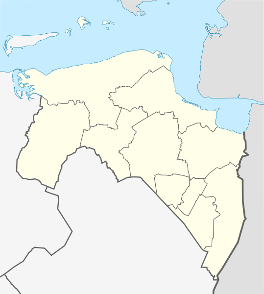
English: Location map of province Groningen in the Netherlands
Equirectangular projection, N/S stretching 167 %. Geographic limits of the map:
Deutsch: Positionskarte von der Provinz Groningen in den Niederlanden
Quadratische Plattkarte, N-S-Streckung 167 %. Geographische Begrenzung der Karte:
|
| Date | |
| Source | Own work |
| Author | Erik Frohne |
| Other versions | File:OSM - provincie Groningen.PNG |

|
This map has been made or improved in the German Kartenwerkstatt (Map Lab). You can propose maps to improve as well.
|
Licensing
[edit]
I, the copyright holder of this work, hereby publish it under the following licenses:

|
Permission is granted to copy, distribute and/or modify this document under the terms of the GNU Free Documentation License, Version 1.2 or any later version published by the Free Software Foundation; with no Invariant Sections, no Front-Cover Texts, and no Back-Cover Texts. A copy of the license is included in the section entitled GNU Free Documentation License. |
This file is licensed under the Creative Commons Attribution-Share Alike 3.0 Unported license.
- You are free:
- to share – to copy, distribute and transmit the work
- to remix – to adapt the work
- Under the following conditions:
- attribution – You must give appropriate credit, provide a link to the license, and indicate if changes were made. You may do so in any reasonable manner, but not in any way that suggests the licensor endorses you or your use.
- share alike – If you remix, transform, or build upon the material, you must distribute your contributions under the same or compatible license as the original.
You may select the license of your choice.
File history
Click on a date/time to view the file as it appeared at that time.
| Date/Time | Thumbnail | Dimensions | User | Comment | |
|---|---|---|---|---|---|
| current | 01:12, 1 January 2021 | | 899 × 1,000 (94 KB) | NordNordWest (talk | contribs) | upd 2021 |
| 11:50, 30 December 2018 |  | 899 × 1,000 (95 KB) | NordNordWest (talk | contribs) | upd 2019 | |
| 17:29, 30 December 2017 |  | 899 × 1,000 (102 KB) | NordNordWest (talk | contribs) | upd | |
| 18:42, 29 December 2013 |  | 899 × 1,000 (104 KB) | NordNordWest (talk | contribs) | update 2013 | |
| 15:05, 9 April 2009 |  | 899 × 1,000 (190 KB) | Erik Frohne (talk | contribs) | {{Information |Description={{en|1=Location map of province Groningen in the Netherlands Equirectangular projection, N/S stretching 167 %. Geographic limits of the map: * N: 53.60° N * S: 52.80° N * W: 6.10° E * E: 7.30° E}} {{de|1=Positionskarte v |
You cannot overwrite this file.
File usage on Commons
The following page uses this file:
File usage on other wikis
The following other wikis use this file:
- Usage on ba.wikipedia.org
- Usage on bg.wikipedia.org
- Usage on cs.wikipedia.org
- Usage on de.wikipedia.org
- Rottumeroog
- Stadion Oosterpark
- Euroborg
- Zuidlaardermeer
- Punt van Reide
- Rottumerplaat
- Simonszand
- Zuiderduintjes
- Wikipedia:Kartenwerkstatt/Positionskarten/Europa
- Windpark Westereems
- Vorlage:Positionskarte Niederlande Groningen
- Gjaltema-Stadion aan de Langeleegte
- Eemscentrale
- Westerwolder Aa
- Kraftwerk Eemshaven (RWE)
- Kraftwerk Magnum
- Leuchtturm Watum
- Leuchtturm Delfzijl (1888)
- Bert-Swart-Brücke
- MartiniPlaza
- Usage on de.wikivoyage.org
- Usage on eo.wikipedia.org
- Groningo (urbo)
- Ŝablono:Informkesto nederlanda municipo
- Flughaveno Groningen-Eelde
- Heiligerlee
- Dolardo
- Ŝablono:Informkesto nederlanda municipo/dokumentado
- Ŝablono:Situo sur mapo Nederlando Groningen
- Granda Placo (Groningen)
- Preĝejo de Sankta Walfridus
- Fraeylemaborg
- Huis te Glimmen
- Nieuwe Compagnie
- Noordlaarderbos
- Quintus-arbaro
- Ennemaborg
- Oostwold (Oldambt)
- Rottumeroog
- Usage on es.wikipedia.org
- Usage on fa.wikipedia.org
- Usage on frr.wikipedia.org
- Usage on fr.wikipedia.org
View more global usage of this file.