Category:Location maps of provinces of the Netherlands
Jump to navigation
Jump to search
Media in category "Location maps of provinces of the Netherlands"
The following 13 files are in this category, out of 13 total.
-
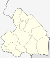
Netherlands Drenthe location map.svg 861 × 1,000; 87 KB
-
Netherlands Flevoland location map.svg 956 × 1,000; 150 KB
-
Netherlands Friesland location map.svg 1,000 × 914; 171 KB
-
Netherlands Gelderland location map.svg 1,000 × 698; 162 KB
-
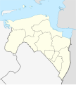
Netherlands Groningen location map.svg 899 × 1,000; 94 KB
-
Netherlands Limburg location map.svg 470 × 1,000; 78 KB
-
Netherlands North Brabant location map.svg 1,000 × 563; 244 KB
-
Netherlands North Holland location map.svg 607 × 1,000; 233 KB
-
Netherlands Overijssel location map.svg 948 × 1,000; 203 KB
-
Netherlands South Holland location map.svg 1,000 × 928; 274 KB
-
Netherlands Utrecht location map.svg 1,002 × 817; 84 KB
-
Netherlands Utrecht –2019 location map.svg 1,000 × 815; 75 KB
-
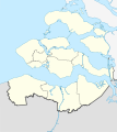
Netherlands Zeeland location map.svg 890 × 1,000; 262 KB


