File:Navigation à vapeur dans le bassin de la Méditerranée et chemins de fer de l'Europe Central 1872.tif
Jump to navigation
Jump to search

Size of this JPG preview of this TIF file: 800 × 539 pixels. Other resolutions: 320 × 216 pixels | 640 × 432 pixels | 1,024 × 691 pixels | 1,280 × 863 pixels | 2,560 × 1,726 pixels | 12,519 × 8,442 pixels.
Original file (12,519 × 8,442 pixels, file size: 302.42 MB, MIME type: image/tiff)
Captions
Captions
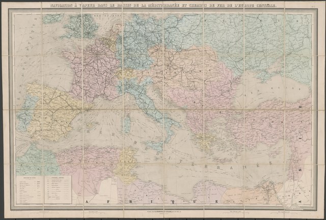
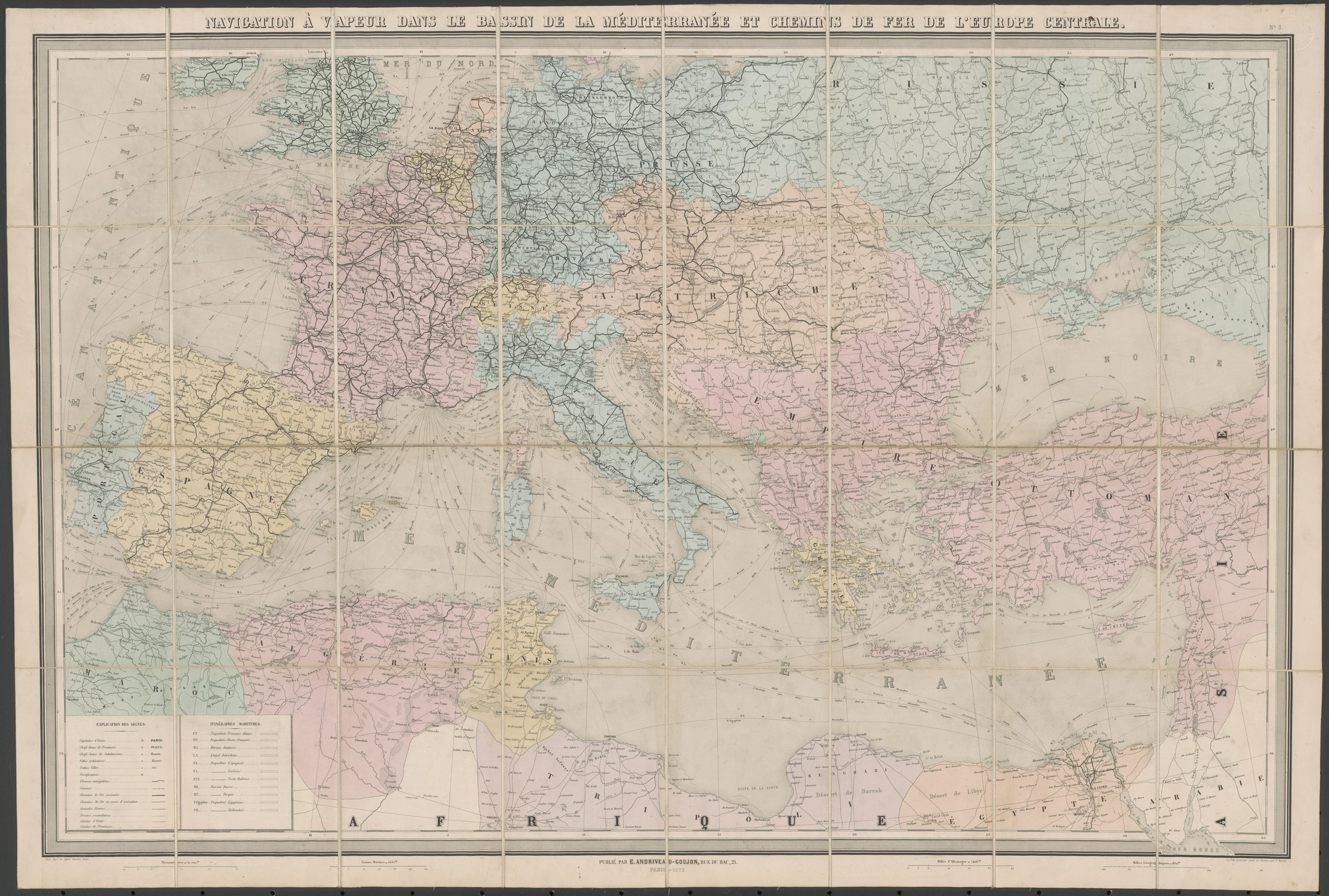
Map of ship connections in the Mediterranean Sea and train connections in Central Europe in 1872
Summary
[edit]| Warning | The original file is very high-resolution. It might not load properly or could cause your browser to freeze when opened at full size. |
|---|
| Description |
English: Map of ship connections in the Mediterranean Sea and train connections in Central Europe in 1872 |
|||||||||||||
| Date | ||||||||||||||
| Source | http://nla.gov.au/nla.obj-231518498 | |||||||||||||
| Author |
|
|||||||||||||
Licensing
[edit]|
This work is in the public domain in its country of origin and other countries and areas where the copyright term is the author's life plus 70 years or fewer. This work is in the public domain in the United States because it was published (or registered with the U.S. Copyright Office) before January 1, 1929. | |
| This file has been identified as being free of known restrictions under copyright law, including all related and neighboring rights. | |
File history
Click on a date/time to view the file as it appeared at that time.
| Date/Time | Thumbnail | Dimensions | User | Comment | |
|---|---|---|---|---|---|
| current | 17:48, 6 February 2019 |  | 12,519 × 8,442 (302.42 MB) | Balkanique (talk | contribs) | User created page with UploadWizard |
You cannot overwrite this file.
File usage on Commons
There are no pages that use this file.