File:Nanchang Metro map sb zh-hans.pdf
Jump to navigation
Jump to search

Size of this JPG preview of this PDF file: 780 × 600 pixels. Other resolutions: 312 × 240 pixels | 624 × 480 pixels | 999 × 768 pixels | 1,280 × 985 pixels | 2,166 × 1,666 pixels.
Original file (2,166 × 1,666 pixels, file size: 73 KB, MIME type: application/pdf)
Captions
Captions
Add a one-line explanation of what this file represents
| Description |
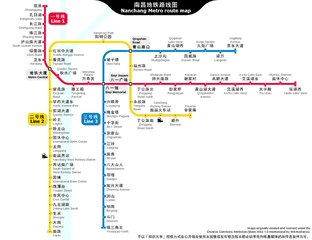
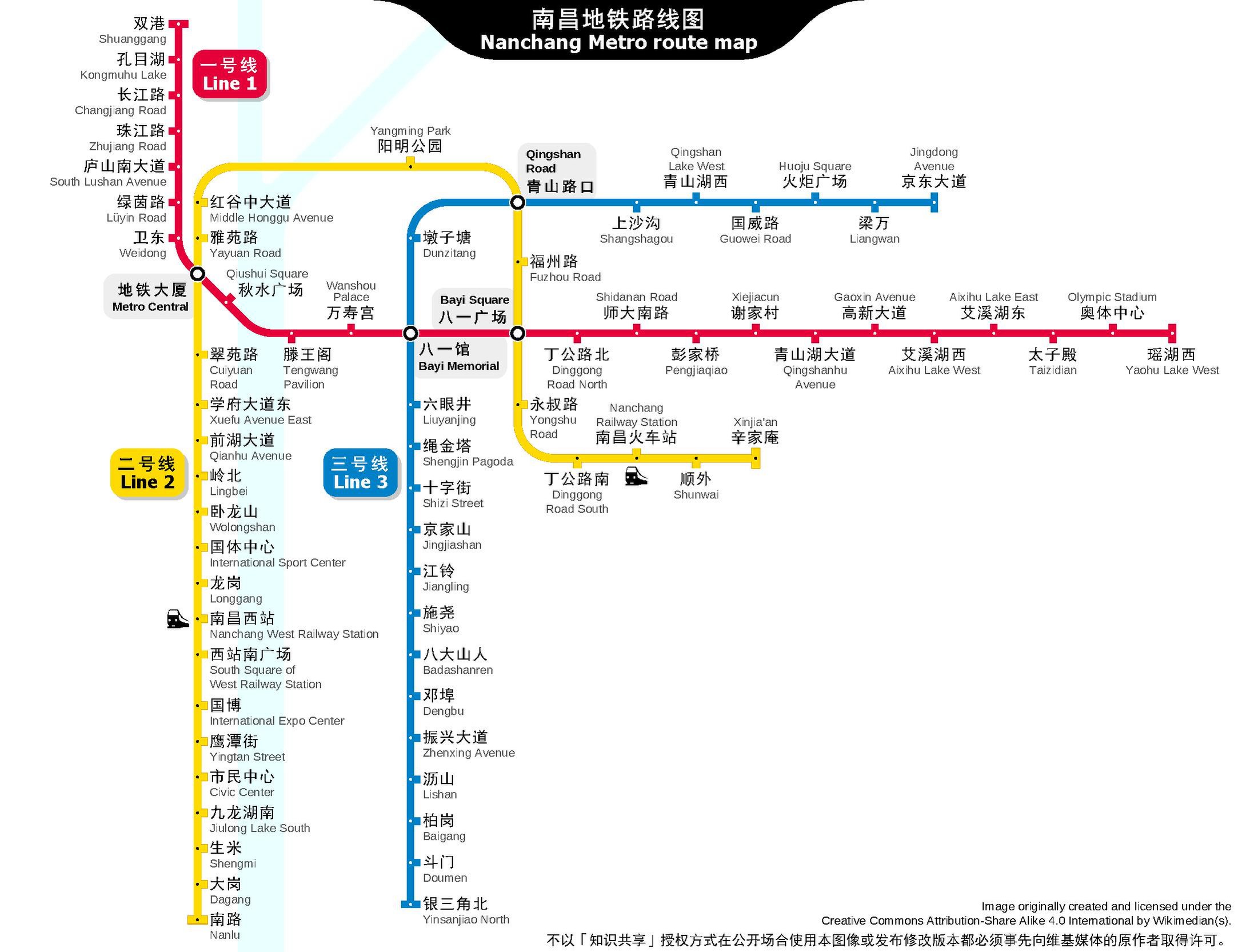
English: Nanchang Metro route map in PDF format.
中文:南昌地铁路线图,PDF格式。 |
|||
| Date | 12 December 2014, 01:50:20 (upload date) | |||
| Source | Own work | |||
| Author | Sameboat | |||
| Permission (Reusing this file) |
This file is licensed under the Creative Commons Attribution-Share Alike 4.0 International license.
|
|||
| Other versions |
|


File history
Click on a date/time to view the file as it appeared at that time.
| Date/Time | Thumbnail | Dimensions | User | Comment | |
|---|---|---|---|---|---|
| current | 01:12, 30 December 2020 |  | 2,166 × 1,666 (73 KB) | Sameboat (talk | contribs) | line 3 inaugurate |
| 00:51, 27 June 2020 |  | 2,166 × 1,666 (128 KB) | Sameboat (talk | contribs) | update line 2 | |
| 09:57, 2 July 2018 |  | 2,166 × 1,666 (73 KB) | Sameboat (talk | contribs) | minor | |
| 13:05, 20 August 2017 |  | 2,166 × 1,666 (73 KB) | Sameboat (talk | contribs) | 国博站 | |
| 00:57, 20 August 2017 | 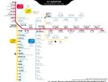 | 2,166 × 1,666 (73 KB) | Sameboat (talk | contribs) | Line 2 | |
| 05:00, 10 February 2017 | 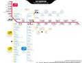 | 2,166 × 1,666 (79 KB) | Sameboat (talk | contribs) | Civil Centre -> Civic Center | |
| 03:09, 9 February 2017 |  | 2,166 × 1,666 (79 KB) | Sameboat (talk | contribs) | station names update | |
| 01:27, 11 August 2016 | 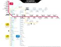 | 2,166 × 1,666 (70 KB) | Sameboat (talk | contribs) | Line 2 phase 2 and many other minor changes | |
| 10:11, 11 February 2016 | 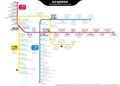 | 2,166 × 1,550 (65 KB) | Sameboat (talk | contribs) | Liantang | |
| 15:48, 5 February 2016 | 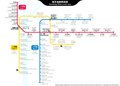 | 2,166 × 1,550 (64 KB) | Sameboat (talk | contribs) | Changnan |
You cannot overwrite this file.
File usage on Commons
The following 45 pages use this file:
- User:Chumwa/OgreBot/Potential transport maps/2016 August 11-20
- User:Chumwa/OgreBot/Potential transport maps/2016 February 1-9
- User:Chumwa/OgreBot/Potential transport maps/2016 February 10-19
- User:Chumwa/OgreBot/Potential transport maps/2016 January 11-20
- User:Chumwa/OgreBot/Potential transport maps/2017 August 11-20
- User:Chumwa/OgreBot/Potential transport maps/2017 February 1-9
- User:Chumwa/OgreBot/Potential transport maps/2017 February 10-18
- User:Chumwa/OgreBot/Potential transport maps/2018 July 1-10
- User:Chumwa/OgreBot/Public transport information/2015 March 11-20
- User:Chumwa/OgreBot/Public transport information/2015 September 11-20
- User:Chumwa/OgreBot/Public transport information/2016 August 11-20
- User:Chumwa/OgreBot/Public transport information/2016 February 1-9
- User:Chumwa/OgreBot/Public transport information/2016 February 10-19
- User:Chumwa/OgreBot/Public transport information/2016 January 1-10
- User:Chumwa/OgreBot/Public transport information/2016 January 11-20
- User:Chumwa/OgreBot/Public transport information/2017 August 11-20
- User:Chumwa/OgreBot/Public transport information/2017 February 1-9
- User:Chumwa/OgreBot/Public transport information/2017 February 10-18
- User:Chumwa/OgreBot/Public transport information/2018 July 1-10
- User:Chumwa/OgreBot/Public transport information/2020 December 21-31
- User:Chumwa/OgreBot/Public transport information/2020 June 21-30
- User:Chumwa/OgreBot/Transport Maps/2015 March 11-20
- User:Chumwa/OgreBot/Transport Maps/2015 September 11-20
- User:Chumwa/OgreBot/Transport Maps/2016 August 11-20
- User:Chumwa/OgreBot/Transport Maps/2016 February 1-9
- User:Chumwa/OgreBot/Transport Maps/2016 February 10-19
- User:Chumwa/OgreBot/Transport Maps/2016 January 1-10
- User:Chumwa/OgreBot/Transport Maps/2016 January 11-20
- User:Chumwa/OgreBot/Transport Maps/2017 August 11-20
- User:Chumwa/OgreBot/Transport Maps/2017 February 1-9
- User:Chumwa/OgreBot/Transport Maps/2017 February 10-18
- User:Chumwa/OgreBot/Transport Maps/2018 July 1-10
- User:Chumwa/OgreBot/Transport Maps/2020 December 21-31
- User:Chumwa/OgreBot/Transport Maps/2020 June 21-30
- User:Chumwa/OgreBot/Travel and communication maps/2016 August 11-20
- User:Chumwa/OgreBot/Travel and communication maps/2016 February 1-9
- User:Chumwa/OgreBot/Travel and communication maps/2016 February 10-19
- User:Chumwa/OgreBot/Travel and communication maps/2016 January 11-20
- User:Chumwa/OgreBot/Travel and communication maps/2017 August 11-20
- User:Chumwa/OgreBot/Travel and communication maps/2017 February 1-9
- User:Chumwa/OgreBot/Travel and communication maps/2017 February 10-18
- User:Chumwa/OgreBot/Travel and communication maps/2018 July 1-10
- User:Liesel/Rail transport/2014 December 11-20
- File:Nanchang Metro map sb zh-hans.svg
- Category:Line 3, Nanchang Metro
File usage on other wikis
The following other wikis use this file: