File:NPS yosemite-wawona-hiking-map.jpg
Jump to navigation
Jump to search
Size of this preview: 800 × 444 pixels. Other resolutions: 320 × 177 pixels | 640 × 355 pixels | 1,024 × 568 pixels | 1,280 × 710 pixels | 2,799 × 1,552 pixels.
Original file (2,799 × 1,552 pixels, file size: 695 KB, MIME type: image/jpeg)
Captions
Captions
Add a one-line explanation of what this file represents
Summary
[edit]
| Description |
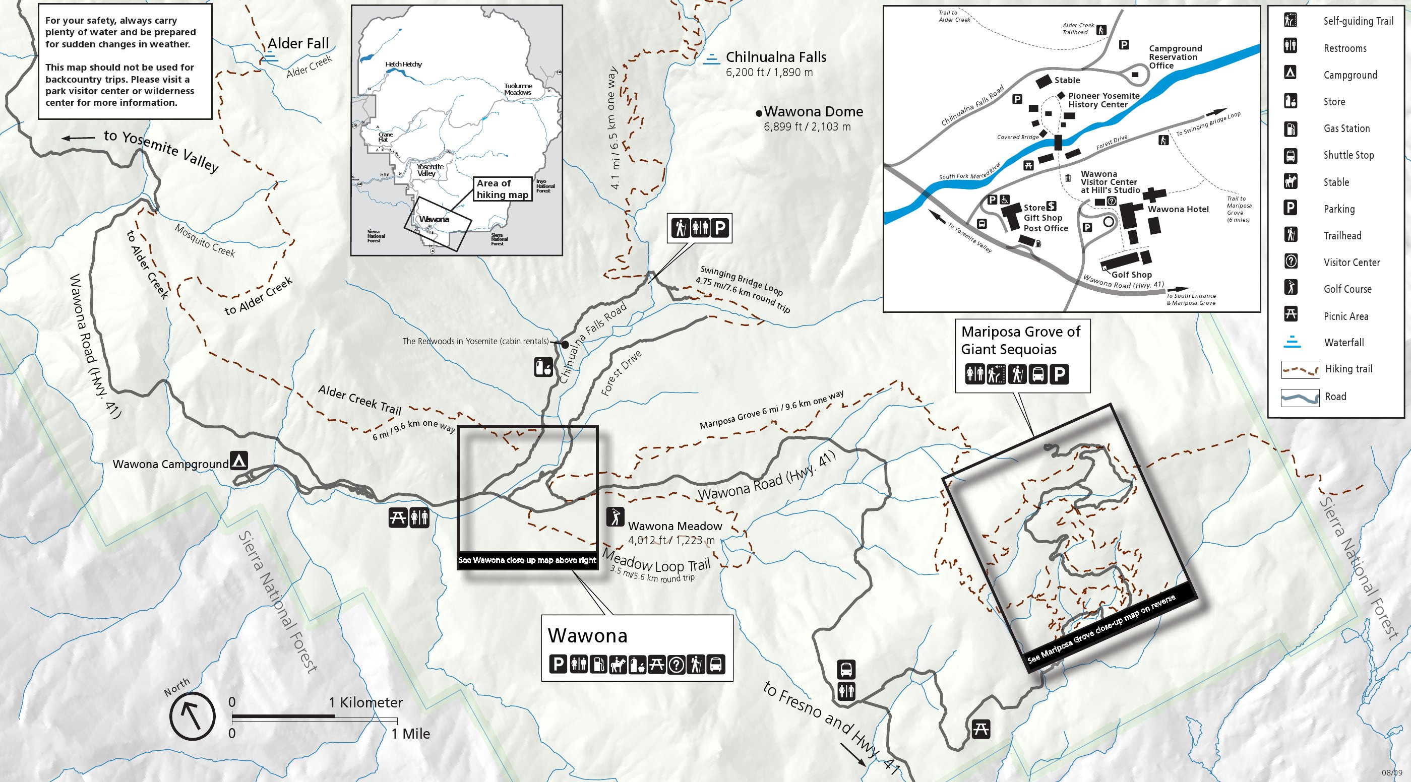
English: Wawona trail map, including the trails in the Wawona area such as Chilnualna Falls, Meadow Loop, and the Mariposa Grove. The map below zooms in on the grove with much more detail. |
| Date | |
| Source | U.S. National Park Service (http://npmaps.com/wp-content/uploads/yosemite-wawona-hiking-map.jpg) |
| Author | U.S. National Park Service, restoration/cleanup by Matt Holly |
Licensing
[edit]
| This image or media file contains material based on a work of a National Park Service employee, created as part of that person's official duties. As a work of the U.S. federal government, such work is in the public domain in the United States. See the NPS website and NPS copyright policy for more information. |
File history
Click on a date/time to view the file as it appeared at that time.
| Date/Time | Thumbnail | Dimensions | User | Comment | |
|---|---|---|---|---|---|
| current | 10:15, 17 May 2017 | | 2,799 × 1,552 (695 KB) | RKBot (talk | contribs) | =={{int:filedesc}}== {{Information |description= {{en|1=Wawona trail map, including the trails in the Wawona area such as Chilnualna Falls, Meadow Loop, and the Mariposa Grove. The map below zooms in on the grove with much more detail.}} |date= 2013-10... |
You cannot overwrite this file.
File usage on Commons
The following page uses this file: