File:NPS lake-clark-vegetation-map.jpg
Jump to navigation
Jump to search

Size of this preview: 483 × 599 pixels. Other resolutions: 193 × 240 pixels | 387 × 480 pixels | 619 × 768 pixels | 825 × 1,024 pixels | 1,651 × 2,048 pixels | 5,252 × 6,516 pixels.
Original file (5,252 × 6,516 pixels, file size: 9.39 MB, MIME type: image/jpeg)
Captions
Captions
Add a one-line explanation of what this file represents
Summary
[edit]
| Description |
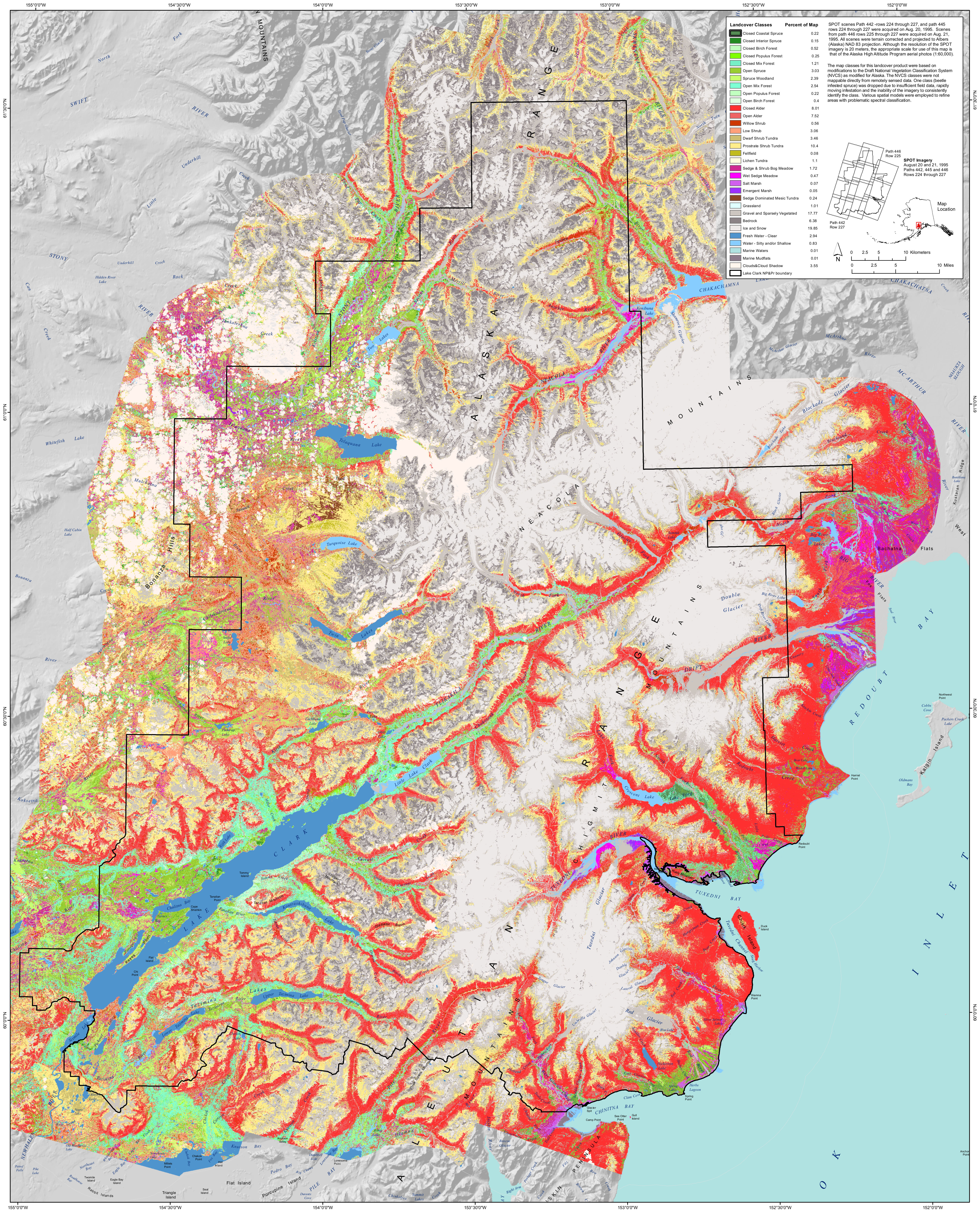
English: Vegetation map of Lake Clark, showing the variety of different types of forests in the park, along with rock, ice, marsh, tundra, and other land cover types in this diverse park. |
| Date | |
| Source | U.S. National Park Service (http://npmaps.com/wp-content/uploads/lake-clark-vegetation-map.jpg) |
| Author | U.S. National Park Service, restoration/cleanup by Matt Holly |
Licensing
[edit]
| This image or media file contains material based on a work of a National Park Service employee, created as part of that person's official duties. As a work of the U.S. federal government, such work is in the public domain in the United States. See the NPS website and NPS copyright policy for more information. |
File history
Click on a date/time to view the file as it appeared at that time.
| Date/Time | Thumbnail | Dimensions | User | Comment | |
|---|---|---|---|---|---|
| current | 00:40, 17 May 2017 | | 5,252 × 6,516 (9.39 MB) | RKBot (talk | contribs) | =={{int:filedesc}}== {{Information |description= {{en|1=Vegetation map of Lake Clark, showing the variety of different types of forests in the park, along with rock, ice, marsh, tundra, and other land cover types in this diverse park.}} |date= 2017-01-... |
You cannot overwrite this file.
File usage on Commons
The following 2 pages use this file: