File:NPS grand-canyon-north-rim-trail-map.pdf
Jump to navigation
Jump to search

Size of this JPG preview of this PDF file: 794 × 600 pixels. Other resolutions: 318 × 240 pixels | 635 × 480 pixels | 1,017 × 768 pixels | 1,280 × 967 pixels | 2,560 × 1,934 pixels | 3,375 × 2,550 pixels.
Original file (3,375 × 2,550 pixels, file size: 660 KB, MIME type: application/pdf)
Captions
Captions
Add a one-line explanation of what this file represents
Summary
[edit]| Description |
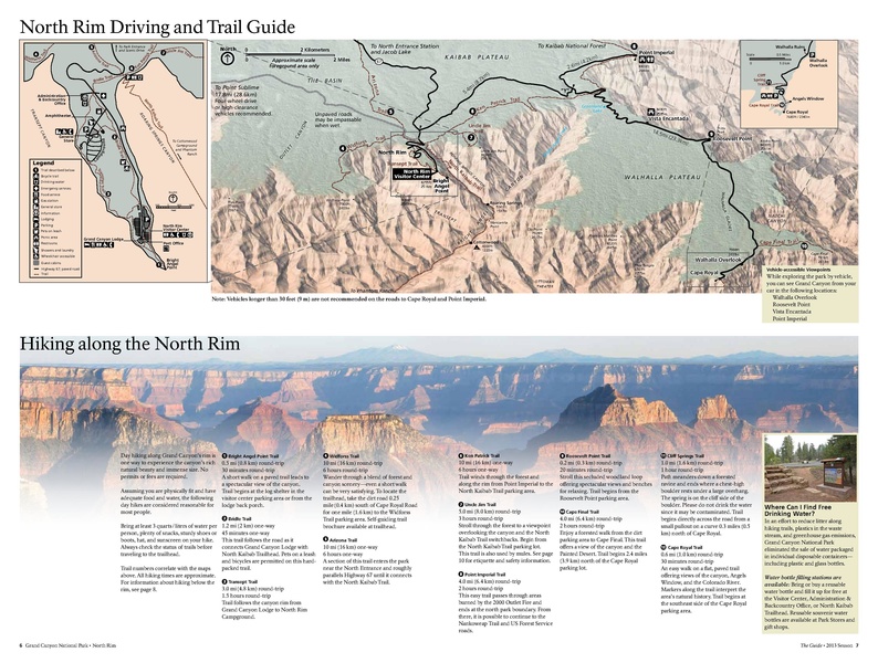
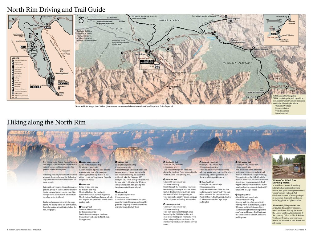
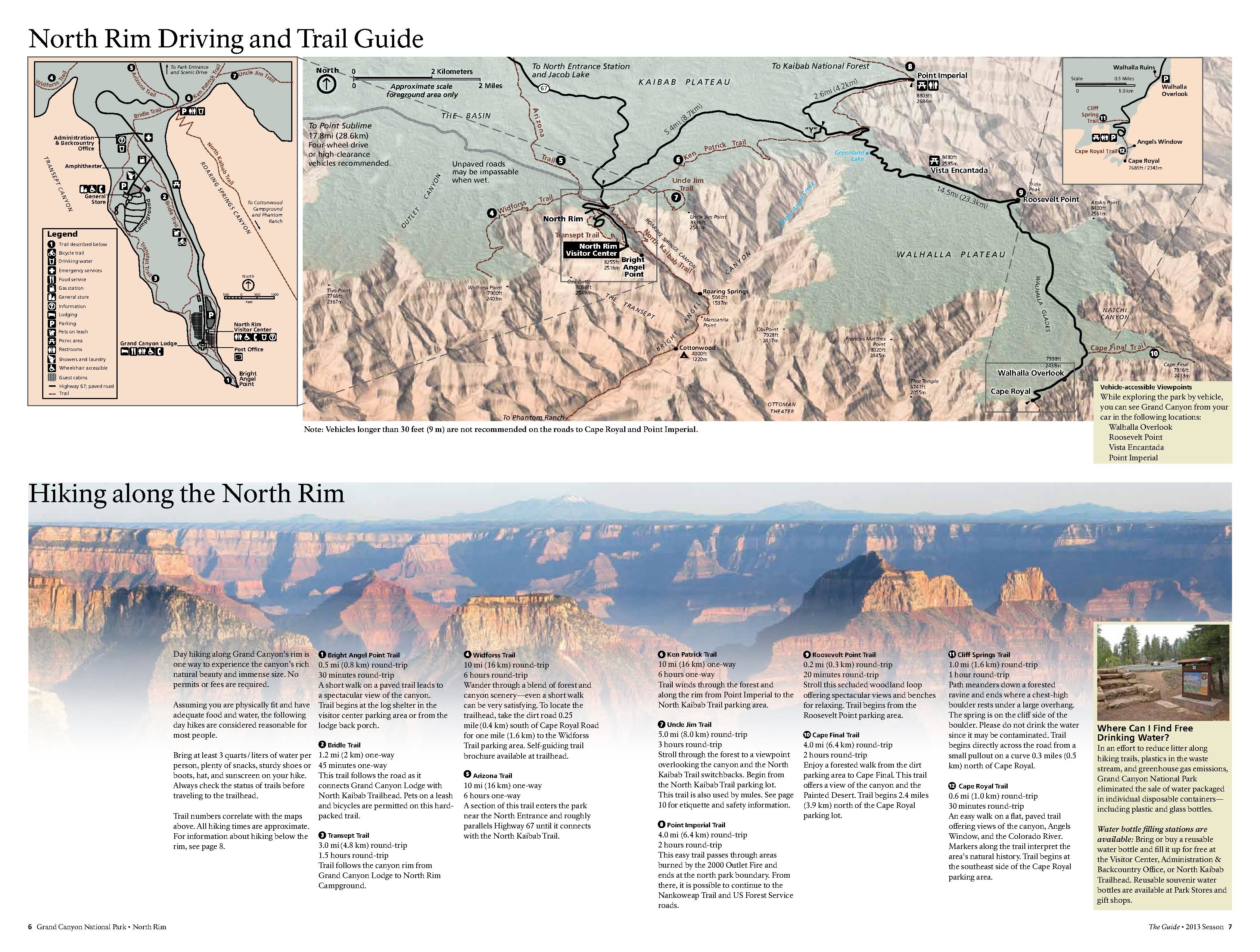
English: This Grand Canyon trails map of the North Rim also contains trail descriptions , mileages, and time estimates. |
| Date | |
| Source | U.S. National Park Service (http://npmaps.com/wp-content/uploads/grand-canyon-north-rim-trail-map.pdf) |
| Author | U.S. National Park Service, restoration/cleanup by Matt Holly |
| Other versions |
 |
Licensing
[edit]| This image or media file contains material based on a work of a National Park Service employee, created as part of that person's official duties. As a work of the U.S. federal government, such work is in the public domain in the United States. See the NPS website and NPS copyright policy for more information. |
File history
Click on a date/time to view the file as it appeared at that time.
| Date/Time | Thumbnail | Dimensions | User | Comment | |
|---|---|---|---|---|---|
| current | 23:12, 16 May 2017 |  | 3,375 × 2,550 (660 KB) | RKBot (talk | contribs) | =={{int:filedesc}}== {{Information |description= {{en|1=This Grand Canyon trails map of the North Rim also contains trail descriptions , mileages, and time estimates.}} |date= 2013-10-25 |source= U.S. National Park Service (http://npmaps.com/wp-content... |
You cannot overwrite this file.
File usage on Commons
The following 2 pages use this file:
Metadata
Categories:
- Maps of Grand Canyon National Park
- Hiking trails in Grand Canyon National Park
- Widforss Point
- Widforss Trail
- The Transept
- Transept Trail
- North Kaibab Trail
- Roaring Springs
- Roaring Springs Canyon
- Uncle Jim Point
- Uncle Jim Trail
- Obi Point
- Francois Matthes Point
- Ottoman Amphitheater
- Clear Creek Canyon closeup (upper canyon)
- Thor Temple
- Cape Royal
- Cape Royal Trail
- Cliff Spring Trail
- Walhalla Overlook
- Point Imperial (Grand Canyon)
- Vista Encantada
- Roosevelt Point
- Tritle Peak
- Bourke Point
- Cape Final Trail
- Woolsey Butte