File:NPS gateway-staten-island-bicycle-map.jpg
Jump to navigation
Jump to search

Size of this preview: 251 × 599 pixels. Other resolutions: 100 × 240 pixels | 201 × 480 pixels | 1,014 × 2,418 pixels.
Original file (1,014 × 2,418 pixels, file size: 813 KB, MIME type: image/jpeg)
Captions
Captions
Add a one-line explanation of what this file represents
Summary
[edit]
| Description |
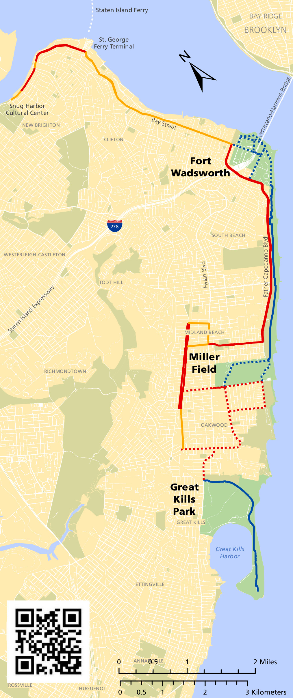
English: The Staten Island bicycle map shows the various bike trails that connect Fort Wadsworth, Miller Field, and Great Kills. The maps below zoom in on each of these locations in greater detail. |
| Date | |
| Source | U.S. National Park Service (http://npmaps.com/wp-content/uploads/gateway-staten-island-bicycle-map.jpg) |
| Author | U.S. National Park Service, restoration/cleanup by Matt Holly |
Licensing
[edit]
| This image or media file contains material based on a work of a National Park Service employee, created as part of that person's official duties. As a work of the U.S. federal government, such work is in the public domain in the United States. See the NPS website and NPS copyright policy for more information. |
File history
Click on a date/time to view the file as it appeared at that time.
| Date/Time | Thumbnail | Dimensions | User | Comment | |
|---|---|---|---|---|---|
| current | 21:31, 16 May 2017 | | 1,014 × 2,418 (813 KB) | RKBot (talk | contribs) | =={{int:filedesc}}== {{Information |description= {{en|1=The Staten Island bicycle map shows the various bike trails that connect Fort Wadsworth, Miller Field, and Great Kills. The maps below zoom in on each of these locations in greater detail.}} |date... |
You cannot overwrite this file.
File usage on Commons
The following page uses this file: