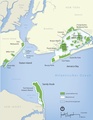
Category:Maps of Gateway National Recreation Area
Jump to navigation
Jump to search
English: Maps of Gateway National Recreation Area
Wikimedia category | |||||
| Upload media | |||||
| Instance of | |||||
|---|---|---|---|---|---|
| Category combines topics | |||||
| Gateway National Recreation Area | |||||
parks and beaches in New York City and New Jersey  | |||||
| Instance of | |||||
| Location |
| ||||
| Operator | |||||
| IUCN protected areas category | |||||
| Inception |
| ||||
| Area |
| ||||
| Elevation above sea level |
| ||||
| Visitors per year |
| ||||
| official website | |||||
 | |||||
Media in category "Maps of Gateway National Recreation Area"
The following 75 files are in this category, out of 75 total.
-
 Gateway National Recreation Area map de Ausschnitt.png 500 × 500; 86 KB
-
 Gateway National Recreation Area map de.pdf 1,275 × 1,650; 1.88 MB
-
 Gateway National Recreation Area map.pdf 1,275 × 1,650; 1.62 MB
-
 Jamaica-bay-unit.png 711 × 643; 327 KB
-
 JamaicaBay.jpeg 3,113 × 1,654; 783 KB
-
-
-

-
-

-
-
-

-

-
-
-
 Fort Wadworth NPS Map.jpg 1,161 × 1,629; 1.44 MB
-
 Gateway National Recreation Area Jamaica Bay Unit map.jpg 412 × 423; 49 KB
-
 Gateway National Recreation Area, New York-New Jersey LOC 2009584097.jpg 10,156 × 7,172; 7.5 MB
-
 Gateway National Recreation Area, New York-New Jersey LOC 2009584097.tif 10,156 × 7,172; 208.39 MB
-
 Gateway National Recreation Area, New York-New Jersey LOC 79694158.jpg 10,171 × 7,131; 7.47 MB
-
 Gateway National Recreation Area, New York-New Jersey LOC 79694158.tif 10,171 × 7,131; 207.51 MB
-
 Gateway National Recreation Area, New York-New Jersey LOC 79696381.jpg 10,161 × 7,134; 7.34 MB
-
 Gateway National Recreation Area, New York-New Jersey LOC 79696381.tif 10,161 × 7,134; 207.39 MB
-
 Gateway National Recreation Area, New York-New Jersey LOC 88693435.jpg 10,215 × 7,161; 7.33 MB
-
 Gateway National Recreation Area, New York-New Jersey LOC 88693435.tif 10,215 × 7,161; 209.28 MB
-
 Gateway National Recreation Area, New York-New Jersey LOC 90680227.jpg 10,185 × 7,160; 7.59 MB
-
 Gateway National Recreation Area, New York-New Jersey LOC 90680227.tif 10,185 × 7,160; 208.64 MB
-
 Gateway National Recreation Area, New York-New Jersey LOC 94684115.jpg 10,202 × 7,179; 8.86 MB
-
 Gateway National Recreation Area, New York-New Jersey LOC 94684115.tif 10,202 × 7,179; 209.54 MB
-
 Gateway-Gateway National Recreation Area, New York-New Jersey LOC 2002620653.jpg 10,176 × 4,810; 5.75 MB
-
 Gateway-Gateway National Recreation Area, New York-New Jersey LOC 2002620653.tif 10,176 × 4,810; 140.04 MB
-
 Gateway-Gateway National Recreation Area, New York-New Jersey LOC 2003623634.jpg 10,163 × 4,820; 5.78 MB
-
 Gateway-Gateway National Recreation Area, New York-New Jersey LOC 2003623634.tif 10,163 × 4,820; 140.15 MB
-
 Gateway-Gateway National Recreation Area, New York-New Jersey LOC 2005626516.jpg 10,196 × 4,822; 5.65 MB
-
 Gateway-Gateway National Recreation Area, New York-New Jersey LOC 2005626516.tif 10,196 × 4,822; 140.66 MB
-
 Gateway-Gateway National Recreation Area, New York-New Jersey LOC 2011587203.jpg 10,120 × 4,789; 5.61 MB
-
 Gateway-Gateway National Recreation Area, New York-New Jersey LOC 2011587203.tif 10,120 × 4,789; 138.66 MB
-
 New York City - Staten Island Community District 95 HLG.png 1,326 × 1,291; 87 KB
-
 NPS breezy-point-fishing-map.jpg 1,983 × 1,305; 307 KB
-
 NPS fire-island-dive-map.jpg 720 × 347; 143 KB
-
 NPS floyd-bennett-field-fishing-map.jpg 1,977 × 1,308; 379 KB
-
 NPS floyd-bennett-field-map.jpg 2,585 × 2,034; 542 KB
-
 NPS floyd-bennett-field-map.pdf 3,525 × 2,775; 174 KB
-
 NPS fort-hancock-map-1.gif 2,515 × 1,615; 446 KB
-
 NPS fort-hancock-walking-tour-map.jpg 1,615 × 2,945; 609 KB
-
 NPS fort-tilden-fishing-map.jpg 1,980 × 1,302; 359 KB
-
 NPS fort-wadsworth-map.jpg 2,114 × 3,296; 931 KB
-
 NPS frank-charles-park-fishing-map.jpg 1,979 × 1,298; 293 KB
-
 NPS gateway-fort-wadsworth-bicycle-map.jpg 2,080 × 2,412; 812 KB
-
 NPS gateway-fort-wadsworth-fishing-map.jpg 1,876 × 1,237; 431 KB
-
 NPS gateway-great-kills-fishing-map.jpg 1,881 × 1,235; 469 KB
-
 NPS gateway-miller-field-fishing-map.jpg 1,879 × 1,237; 154 KB
-
 NPS gateway-miller-field-great-kills-bicycle-map.jpg 804 × 2,418; 426 KB
-
 NPS gateway-national-recreation-area-map.jpg 2,255 × 1,960; 515 KB
-
 NPS gateway-national-recreation-area-map.pdf 1,166 × 1,012; 1,011 KB
-
 NPS gateway-staten-island-bicycle-map.jpg 1,014 × 2,418; 813 KB
-
 NPS Great Kills Park Map.jpg 1,600 × 1,200; 202 KB
-
 NPS jacob-riis-park-fishing-map.jpg 1,980 × 1,305; 316 KB
-
 NPS jamaica-bay-kayaking-map.jpg 2,464 × 1,472; 778 KB
-
 NPS jamaica-bay-map.jpg 2,649 × 2,965; 1.02 MB
-
 NPS jamaica-bay-map.pdf 3,612 × 4,043; 947 KB
-
 NPS jamaica-bay-salt-marsh-change-map.jpg 1,885 × 1,296; 519 KB
-
 NPS jamaica-bay-wildlife-refuge-map.jpg 1,275 × 1,989; 507 KB
-
 NPS sandy-hook-beach-fishing-map.jpg 1,560 × 1,872; 333 KB
-
 NPS sandy-hook-historic-building-map.jpg 1,962 × 2,972; 816 KB
-
 NPS sandy-hook-map.jpg 943 × 2,150; 170 KB
-
 NPS sandy-hook-map.pdf 2,829 × 6,450; 177 KB
-
 NPS sandy-hook-northern-tip-fishing-map.jpg 2,079 × 1,368; 239 KB
-
 NPS sandy-hook-shuttle-bus-map.gif 2,125 × 1,413; 296 KB
-
 NPS sandy-hook-south-fishing-map.jpg 1,556 × 1,940; 272 KB
-
 NPS sandy-hook-trail-map.jpg 1,495 × 1,832; 498 KB
-
 Spring Creek Park Map 1.png 2,495 × 1,591; 2.39 MB
-
 Spring Creek Park Map 2.png 2,495 × 1,591; 2.39 MB
-
 Spring Creek Park Map 3.png 2,495 × 1,591; 2.49 MB


.jpg)
.jpg)
.jpg)
.jpg)
.jpg)
.jpg)
.jpg)
_-_Kings_County_-_Brooklyn_-_ED_24-1_to_3802_-_NARA_-_24267303_(page_8).jpg)
_-_Kings_County_-_Brooklyn_-_ED_24-1_to_3802_-_NARA_-_24267303_(page_9).jpg)
_-_Queens_County_-_Queens_-_ED_41-1_to_2176_-_NARA_-_24519584_(page_12).jpg)
_-_Richmond_County_-_Richmond_-_ED_43-1_to_285_-_NARA_-_24519610_(page_4).jpg)


