File:NPS canyonlands-printable-map.pdf
Jump to navigation
Jump to search

Size of this JPG preview of this PDF file: 463 × 599 pixels. Other resolutions: 185 × 240 pixels | 371 × 480 pixels | 593 × 768 pixels | 791 × 1,024 pixels | 2,550 × 3,300 pixels.
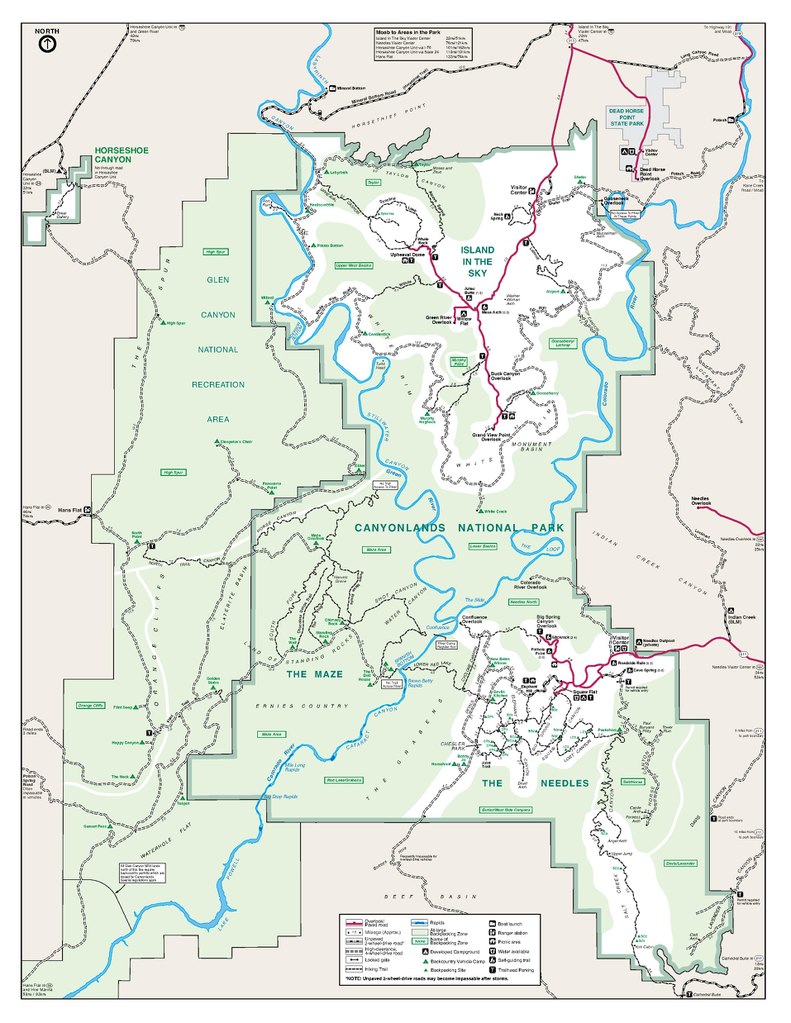
Original file (2,550 × 3,300 pixels, file size: 518 KB, MIME type: application/pdf)
Captions
Captions
Add a one-line explanation of what this file represents
Summary
[edit]| Description |
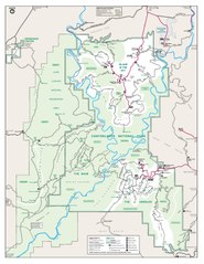
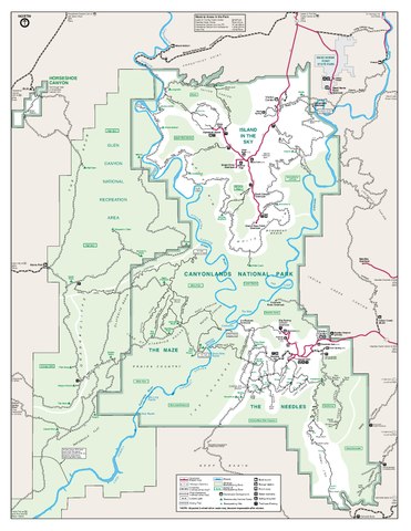
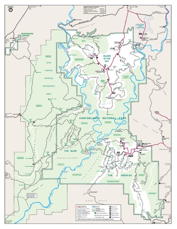
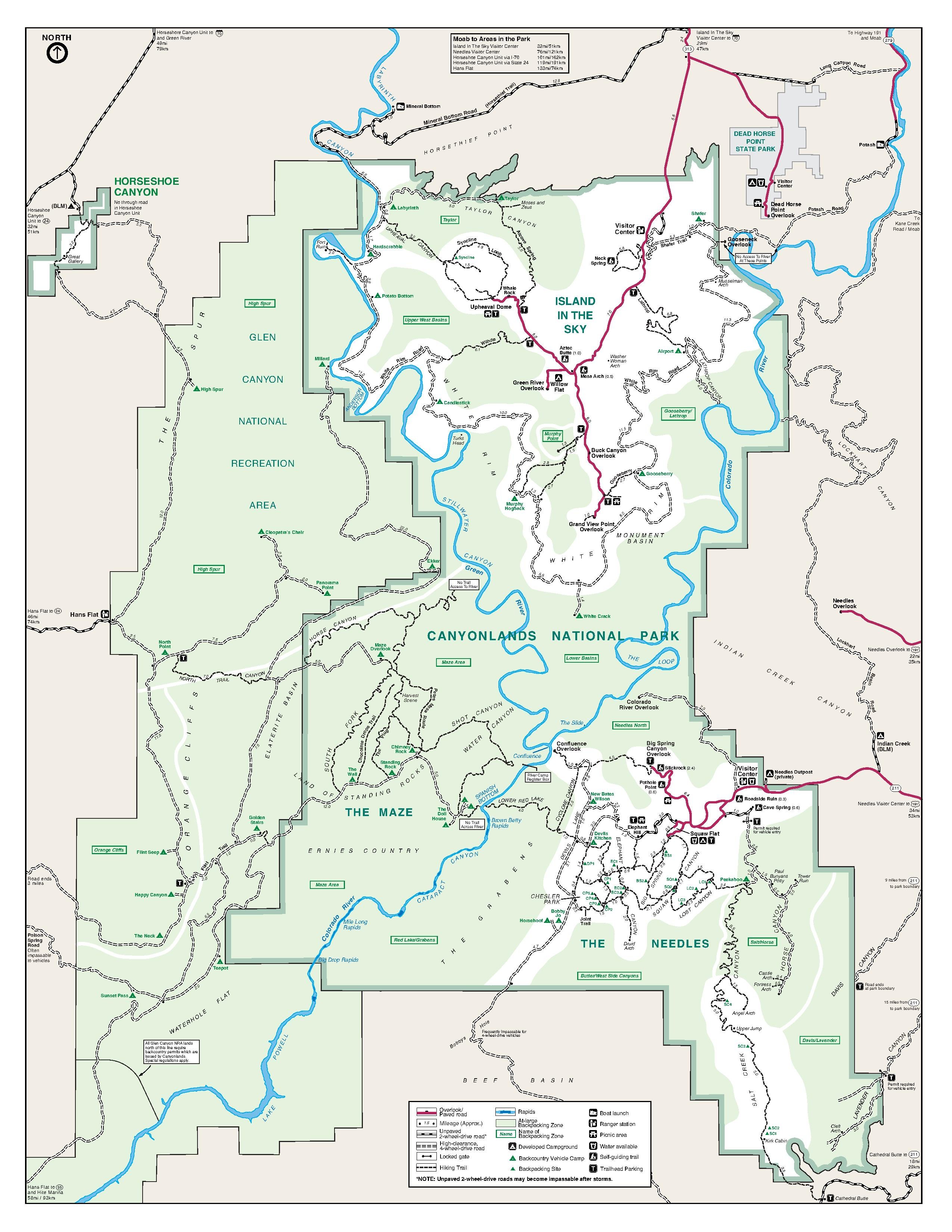
English: Full Canyonlands trail map, showing each of the three maps above combined onto a single large map. |
| Date | |
| Source | U.S. National Park Service (http://npmaps.com/wp-content/uploads/canyonlands-printable-map.pdf) |
| Author | U.S. National Park Service, restoration/cleanup by Matt Holly |
| Other versions |
 |
Licensing
[edit]| This image or media file contains material based on a work of a National Park Service employee, created as part of that person's official duties. As a work of the U.S. federal government, such work is in the public domain in the United States. See the NPS website and NPS copyright policy for more information. |
File history
Click on a date/time to view the file as it appeared at that time.
| Date/Time | Thumbnail | Dimensions | User | Comment | |
|---|---|---|---|---|---|
| current | 19:50, 16 May 2017 |  | 2,550 × 3,300 (518 KB) | RKBot (talk | contribs) | =={{int:filedesc}}== {{Information |description= {{en|1=Full Canyonlands trail map, showing each of the three maps above combined onto a single large map.}} |date= 2014-03-29 |source= U.S. National Park Service (http://npmaps.com/wp-content/uploads/can... |
You cannot overwrite this file.
File usage on Commons
The following page uses this file: