File:NPS bryce-canyon-geologic-map.jpg
Jump to navigation
Jump to search
Size of this preview: 482 × 599 pixels. Other resolutions: 193 × 240 pixels | 386 × 480 pixels | 618 × 768 pixels | 824 × 1,024 pixels | 1,648 × 2,048 pixels | 3,262 × 4,054 pixels.
Original file (3,262 × 4,054 pixels, file size: 2.17 MB, MIME type: image/jpeg)
Captions
Captions
Add a one-line explanation of what this file represents
Summary
[edit]
| Description |
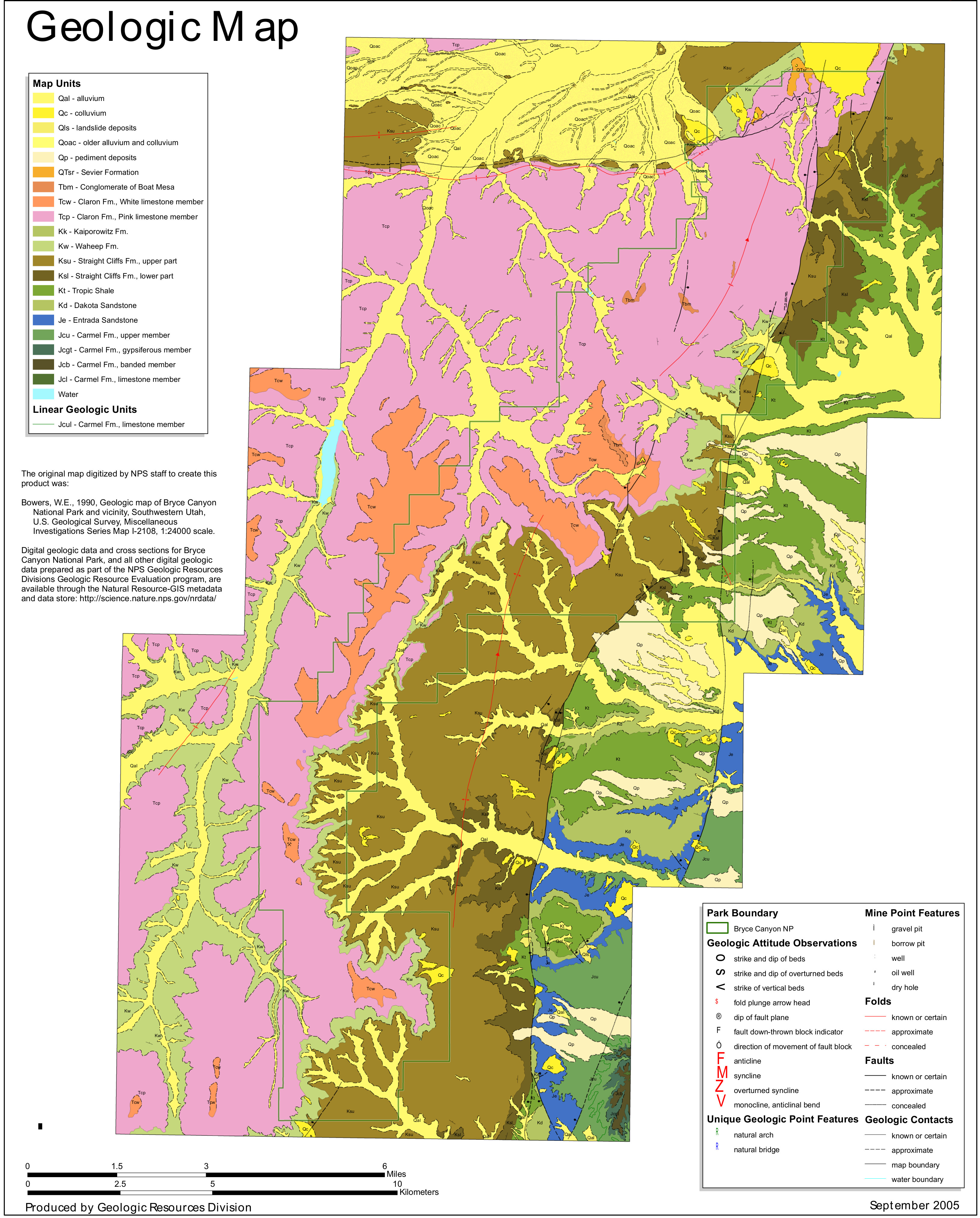
English: Bryce Canyon geologic map, showing a variety of rock formations in the national park including the Claron Formation, which forms the park’s famous red hoodoos. |
| Date | |
| Source | U.S. National Park Service (http://npmaps.com/wp-content/uploads/bryce-canyon-geologic-map.jpg) |
| Author | U.S. National Park Service, restoration/cleanup by Matt Holly |
Licensing
[edit]
| This image or media file contains material based on a work of a National Park Service employee, created as part of that person's official duties. As a work of the U.S. federal government, such work is in the public domain in the United States. See the NPS website and NPS copyright policy for more information. |
File history
Click on a date/time to view the file as it appeared at that time.
| Date/Time | Thumbnail | Dimensions | User | Comment | |
|---|---|---|---|---|---|
| current | 19:38, 16 May 2017 | | 3,262 × 4,054 (2.17 MB) | RKBot (talk | contribs) | =={{int:filedesc}}== {{Information |description= {{en|1=Bryce Canyon geologic map, showing a variety of rock formations in the national park including the Claron Formation, which forms the park’s famous red hoodoos.}} |date= 2017-01-08 |source= U.S.... |
You cannot overwrite this file.
File usage on Commons
The following page uses this file:
Categories:
- Geological maps of Bryce Canyon National Park
- Geological maps of Utah
- Geologic formations in Bryce Canyon National Park
- Quaternary alluvium in Utah
- Quaternary colluvium in Utah
- Quaternary landslide deposits in Utah
- Quaternary pediment deposits in the United States
- Sevier Formation (Utah)
- Conglomerate of Boat Mesa
- Claron Formation in Bryce Canyon National Park
- Claron Formation - maps
- White Limestone Member, Claron Formation
- Pink Limestone Member, Claron Formation
- Kaiparowits Formation
- Wahweap Formation - maps
- Straight Cliffs Formation - maps
- Tropic Shale - maps
- Dakota Sandstone in Utah
- Dakota Sandstone maps
- Entrada Sandstone in Utah
- Entrada Sandstone maps
- Carmel Formation in Utah
- Carmel Formation - maps
- Entrada Sandstone in Bryce Canyon National Park