File:NDL767595 新編国民地図.pdf


Original file (6,189 × 4,370 pixels, file size: 76.97 MB, MIME type: application/pdf, 54 pages)
Captions
Captions
Summary
[edit]| 新編国民地図
( |
|||||||||||||||||||||||||||
|---|---|---|---|---|---|---|---|---|---|---|---|---|---|---|---|---|---|---|---|---|---|---|---|---|---|---|---|
| Author |
原, 秀四郎, -1913 |
 | |||||||||||||||||||||||||
| Title |
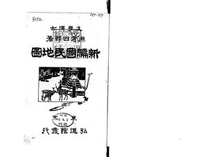
新編国民地図 |
||||||||||||||||||||||||||
| Edition | 2版 | ||||||||||||||||||||||||||
| Publisher |
弘道館 |
||||||||||||||||||||||||||
| Language | jpn | ||||||||||||||||||||||||||
| Publication date |
1910 明43.5 |
||||||||||||||||||||||||||
| Place of publication | JP | ||||||||||||||||||||||||||
| Source |
|
||||||||||||||||||||||||||
| Title Transcription | シンペン コクミン チズ | ||||||||||||||||||||||||||
| Subject: NDC | 290.38 | ||||||||||||||||||||||||||
| Call Number | 327-257 | ||||||||||||||||||||||||||
| Creator | 原秀四郎 著 | ||||||||||||||||||||||||||
| Source Identifier: JPNO | 40010966 | ||||||||||||||||||||||||||
| Material Type | Book | ||||||||||||||||||||||||||
| Source Identifier: NDLBibID | 000000428821 | ||||||||||||||||||||||||||
| Audience | 一般 | ||||||||||||||||||||||||||
| Publication Place | 東京 | ||||||||||||||||||||||||||
| Creator: NDLNAId | 00486477 | ||||||||||||||||||||||||||
| Description: digitize | 同一原本の別画像あり(2023-07-13現在) | ||||||||||||||||||||||||||
| Creator Transcription: NDLNA | ハラ, ヒデシロウ | ||||||||||||||||||||||||||
| Publisher Transcription | コウドウカン | ||||||||||||||||||||||||||
| Extent | 10p 地図25枚 ; 22cm | ||||||||||||||||||||||||||
| Contents | 目次
巻頭図書 (一) 地理学科中の地図学* (二) 本邦陸海図製作の現状* (三) 本邦地誌及び地図編成事業の沿革略* (四) 高低標示に特殊の方式を採用せる私見* (五) 本邦の歴史地図を読む方八則* 各種図書(半截形) 図集の題画 春日神社々頭 附録の題画 三種図式* 挿入図画第六 小夜中山附近図 三津浜附近図 讃岐国一部図 長門国小野村図 挿入図画第七 備中国一部図 高松附近及城趾図 棚倉附近図* 挿入図画第八 武蔵国一部図 下総国一部 武総国境附近図* 挿入写真版画甲 芝公園及日比谷公園* 挿入写真版画乙 芝公園及日比谷公園* 挿入写真版画丙 海図符号一斑* 挿入写真版画丁 駒込追分古画* 挿入写真版画戊 紀念写真* |
||||||||||||||||||||||||||

Licensing
[edit]This image is in the public domain because it is a mere mechanical scan or photocopy of a public domain original, or – from the available evidence – is so similar to such a scan or photocopy that no copyright protection can be expected to arise. The original itself is in the public domain for the following reason:
This tag is designed for use where there may be a need to assert that any enhancements (eg brightness, contrast, colour-matching, sharpening) are in themselves insufficiently creative to generate a new copyright. It can be used where it is unknown whether any enhancements have been made, as well as when the enhancements are clear but insufficient. For known raw unenhanced scans you can use an appropriate {{PD-old}} tag instead. For usage, see Commons:When to use the PD-scan tag.  |

File history
Click on a date/time to view the file as it appeared at that time.
| Date/Time | Thumbnail | Dimensions | User | Comment | |
|---|---|---|---|---|---|
| current | 14:43, 22 January 2024 |  | 6,189 × 4,370, 54 pages (76.97 MB) | Wmr-bot (talk | contribs) | 上載《767595.pdf》 |
You cannot overwrite this file.
File usage on Commons
The following page uses this file: