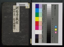
File:NDL1179016 測図学教程.pdf

Original file (8,256 × 6,052 pixels, file size: 140.65 MB, MIME type: application/pdf, 99 pages)
Captions
Captions
Summary
[edit]| 測図学教程
( |
|||||||||||||||||||||||||||
|---|---|---|---|---|---|---|---|---|---|---|---|---|---|---|---|---|---|---|---|---|---|---|---|---|---|---|---|
| Author |
教育総監部 |
||||||||||||||||||||||||||
| Title |
測図学教程 |
||||||||||||||||||||||||||
| Publisher |
前田干城堂 |
||||||||||||||||||||||||||
| Language | jpn | ||||||||||||||||||||||||||
| Publication date |
1928 昭和3 |
||||||||||||||||||||||||||
| Place of publication | JP | ||||||||||||||||||||||||||
| Source |
institution QS:P195,Q477675 |
||||||||||||||||||||||||||
| Creator InfoField | 教育総監部 編 | ||||||||||||||||||||||||||
| Publication Place InfoField | 東京 | ||||||||||||||||||||||||||
| Subject: NDC InfoField | 512 | ||||||||||||||||||||||||||
| Extent InfoField | 106p 図版11枚 ; 23cm | ||||||||||||||||||||||||||
| Material Type InfoField | Book | ||||||||||||||||||||||||||
| Source Identifier: JPNO InfoField | 47024180 | ||||||||||||||||||||||||||
| Date Digitized: W3CDTF InfoField | 2010-09-30 | ||||||||||||||||||||||||||
| Audience InfoField | 一般 | ||||||||||||||||||||||||||
| Title Transcription InfoField | ソクズガク キョウテイ | ||||||||||||||||||||||||||
| Publisher Transcription InfoField | マエダ カンジョウドウ | ||||||||||||||||||||||||||
| Source Identifier: NDLBibID InfoField | 000000777642 | ||||||||||||||||||||||||||
| Call Number InfoField | 588-84 | ||||||||||||||||||||||||||
| Creator: NDLNAId InfoField | 00261967 | ||||||||||||||||||||||||||
| Contents InfoField | 標題 第七 目算測圖(測圖ノ擴張) | ||||||||||||||||||||||||||
Licensing
[edit]This image is in the public domain because it is a mere mechanical scan or photocopy of a public domain original, or – from the available evidence – is so similar to such a scan or photocopy that no copyright protection can be expected to arise. The original itself is in the public domain for the following reason:
This tag is designed for use where there may be a need to assert that any enhancements (eg brightness, contrast, colour-matching, sharpening) are in themselves insufficiently creative to generate a new copyright. It can be used where it is unknown whether any enhancements have been made, as well as when the enhancements are clear but insufficient. For known raw unenhanced scans you can use an appropriate {{PD-old}} tag instead. For usage, see Commons:When to use the PD-scan tag. |
File history
Click on a date/time to view the file as it appeared at that time.
| Date/Time | Thumbnail | Dimensions | User | Comment | |
|---|---|---|---|---|---|
| current | 05:53, 9 December 2023 |  | 8,256 × 6,052, 99 pages (140.65 MB) | Wmr-bot (talk | contribs) | 上載《1179016.pdf》 |
You cannot overwrite this file.
File usage on Commons
The following page uses this file:
Metadata
This file contains additional information such as Exif metadata which may have been added by the digital camera, scanner, or software program used to create or digitize it. If the file has been modified from its original state, some details such as the timestamp may not fully reflect those of the original file. The timestamp is only as accurate as the clock in the camera, and it may be completely wrong.
| Short title | |
|---|---|
| Author | |
| Keywords | https://commons.wikimedia.org/wiki/Commons:Library_back_up_project |
| Conversion program | PyPDF2 |
| Encrypted | yes (print:yes copy:no change:no addNotes:no algorithm:AES-256) |
| Page size | 3963 x 2905.5 pts |
| Version of PDF format | 1.7 |


