File:ND-382-MZG-MET - Hohle Eiche.jpg
Original file (3,512 × 5,268 pixels, file size: 16.64 MB, MIME type: image/jpeg)
Captions
Summary
[edit]DescriptionND-382-MZG-MET - Hohle Eiche.jpg |
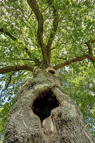
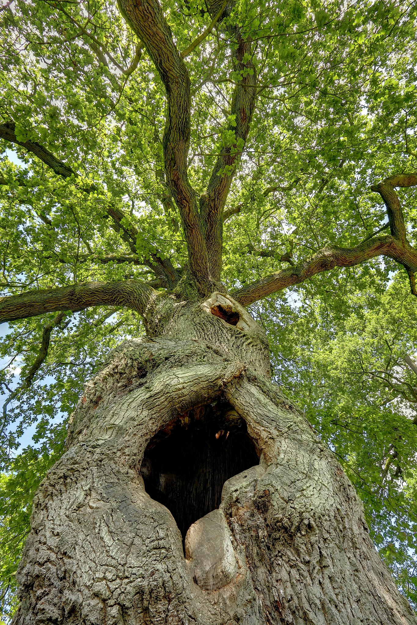
Deutsch: Eines der Naturdenkmale "6 Alteichen (davon 2 Zwillingseichen)" bei Sankt Gangolf. |
Date | |
Source | Own work |
Author | Pascal Dihé |
Camera location | 49° 29′ 05.46″ N, 6° 35′ 09.4″ E | View this and other nearby images on: OpenStreetMap | 49.484851; 6.585944 |
---|
This is a picture of the protected area listed at WDPA under the ID 390355
|
Licensing
[edit]- You are free:
- to share – to copy, distribute and transmit the work
- to remix – to adapt the work
- Under the following conditions:
- attribution – You must give appropriate credit, provide a link to the license, and indicate if changes were made. You may do so in any reasonable manner, but not in any way that suggests the licensor endorses you or your use.
- share alike – If you remix, transform, or build upon the material, you must distribute your contributions under the same or compatible license as the original.
This image was uploaded as part of Wiki Loves Earth 2018.
aragonés | العربية | asturianu | azərbaycanca | беларуская (тарашкевіца) | български | বাংলা | brezhoneg | català | čeština | Cymraeg | Deutsch | Ελληνικά | English | español | eesti | euskara | فارسی | français | galego | עברית | hrvatski | հայերեն | Bahasa Indonesia | italiano | 日本語 | ქართული | 한국어 | latviešu | македонски | മലയാളം | मराठी | Bahasa Melayu | norsk bokmål | नेपाली | Nederlands | norsk | polski | português | português do Brasil | русский | sicilianu | shqip | slovenščina | српски / srpski | svenska | ไทย | Türkçe | українська | اردو | 中文 | 中文(台灣) | +/− |
File history
Click on a date/time to view the file as it appeared at that time.
Date/Time | Thumbnail | Dimensions | User | Comment | |
---|---|---|---|---|---|
current | 19:51, 31 May 2018 | 3,512 × 5,268 (16.64 MB) | Pascal Dihé (talk | contribs) | User created page with UploadWizard |
You cannot overwrite this file.
File usage on Commons
There are no pages that use this file.
File usage on other wikis
The following other wikis use this file:
- Usage on vi.wikipedia.org
Metadata
This file contains additional information such as Exif metadata which may have been added by the digital camera, scanner, or software program used to create or digitize it. If the file has been modified from its original state, some details such as the timestamp may not fully reflect those of the original file. The timestamp is only as accurate as the clock in the camera, and it may be completely wrong.
Camera manufacturer | Canon |
---|---|
Camera model | Canon EOS 7D |
Author | Pascal Dihe |
Copyright holder |
|
Exposure time | 1/25 sec (0.04) |
F-number | f/10 |
ISO speed rating | 100 |
Date and time of data generation | 14:18, 4 September 2010 |
Lens focal length | 10 mm |
Latitude | 49° 29′ 5.47″ N |
Longitude | 6° 35′ 9.4″ E |
Altitude | 209 meters above sea level |
Credit/Provider | CC BY-SA 4.0, Pascal Dihe, https://www.dihe.eu |
Source | https://www.dihe.eu |
City shown | Mettlach |
JPEG file comment | |
File change date and time | 14:18, 4 September 2010 |
Exposure Program | Aperture priority |
Exif version | 2.21 |
Date and time of digitizing | 14:18, 4 September 2010 |
APEX shutter speed | 4.6438561438561 |
APEX aperture | 6.6148570484217 |
APEX exposure bias | 0 |
Metering mode | Pattern |
Flash | Flash did not fire, compulsory flash suppression |
DateTime subseconds | 56 |
DateTimeOriginal subseconds | 56 |
DateTimeDigitized subseconds | 56 |
Supported Flashpix version | 1 |
Color space | sRGB |
Custom image processing | Normal process |
Exposure mode | Auto bracket |
White balance | Manual white balance |
Scene capture type | Standard |
GPS time (atomic clock) | 12:18 |
Geodetic survey data used | WGS-84 |
GPS date | 4 September 2010 |
GPS tag version | 0.0.2.2 |
Supported Flashpix version | 1 |
Keywords |
|
Original transmission location code | E7D_6166_fused.jpg |
Code for country shown | DEU |
Sublocation of city shown | Ponten |
Country shown | Deutschland |
Province or state shown | Saarland |
Special instructions | CC BY-SA 4.0, Pascal Dihé, https://www.dihe.eu |
Contact information | Pascal Dihé <pascal@dihe.eu> |
Writer | Pascal Dihé <pascal@dihe.eu> |
IIM version | 4 |
Structured data
Items portrayed in this file
depicts
4 September 2010
49°29'5.464"N, 6°35'9.398"E
0.04 second
10
10 millimetre
100
image/jpeg
- Files with coordinates missing SDC location of creation (49° N, 6° E)
- Protected areas with known WDPA-ID
- CC-BY-SA-4.0
- Self-published work
- Images from Wiki Loves Earth 2018
- Images from Wiki Loves Earth 2018 in Germany
- Images from Wiki Loves Earth missing SDC location of creation
- Images from Wiki Loves Earth 2018, DE-SL
- Uploaded via Campaign:wle-de-sl
- Germany photographs taken on 2010-09-04