File:NASA Worldwind, USGS imagery map, Tule Island, California.png
Jump to navigation
Jump to search

Size of this preview: 600 × 600 pixels. Other resolutions: 240 × 240 pixels | 611 × 611 pixels.
Original file (611 × 611 pixels, file size: 447 KB, MIME type: image/png)
Captions
Captions
Add a one-line explanation of what this file represents
Summary
[edit]
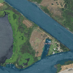
| Description | USGS aerial imagery of w:Tule Island, with w:Headreach Island to its northwest and McDonald Island to its southeast. | |||
| Source | NASA tool at worldwind.earth, USGS Topo Imagery map layer | |||
| Author | Self | |||
| Permission (Reusing this file) |
|
File history
Click on a date/time to view the file as it appeared at that time.
| Date/Time | Thumbnail | Dimensions | User | Comment | |
|---|---|---|---|---|---|
| current | 00:15, 22 February 2021 | | 611 × 611 (447 KB) | JPxG (talk | contribs) | {{Information |Description=USGS aerial imagery of w:Tule Island, with w:Headreach Island to its northwest and McDonald Island to its southeast. |Source=NASA tool at worldwind.earth, USGS Topo Imagery map layer |Date= |Author= |Permission={{PD-USGov-USGS}} |other_versions= }} Category:Islands of California Category:Sacramento–San Joaquin River Delta Category:Aerial photographs of river deltas Category:Aerial photographs of California |
You cannot overwrite this file.
File usage on Commons
There are no pages that use this file.
File usage on other wikis
The following other wikis use this file:
- Usage on bn.wikipedia.org
- Usage on en.wikipedia.org