Category:Satellite pictures of Sacramento–San Joaquin River Delta
Jump to navigation
Jump to search
Media in category "Satellite pictures of Sacramento–San Joaquin River Delta"
The following 54 files are in this category, out of 54 total.
-
 NASA Worldwind, USGS imagery map, Acker Island, California.png 899 × 901; 756 KB
-
 NASA Worldwind, USGS imagery map, Atherton Island, California.png 500 × 200; 146 KB
-
 NASA Worldwind, USGS imagery map, Atlas Tract, California.png 1,600 × 1,600; 2.04 MB
-
 NASA Worldwind, USGS imagery map, Bradmoor Island, California.png 1,500 × 1,500; 3.21 MB
-
 NASA Worldwind, USGS imagery map, Brannan Island, California.png 1,300 × 1,300; 2.2 MB
-
 NASA Worldwind, USGS imagery map, Chain Island, California.png 600 × 600; 420 KB
-
 NASA Worldwind, USGS imagery map, Deadman Island, California.png 300 × 300; 112 KB
-
 NASA Worldwind, USGS imagery map, Empire Tract, California.png 1,213 × 1,923; 2.88 MB
-
 NASA Worldwind, USGS imagery map, Eucalyptus Island, California.png 475 × 300; 170 KB
-
 NASA Worldwind, USGS imagery map, French Island, California.png 600 × 600; 356 KB
-
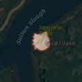 NASA Worldwind, USGS imagery map, Goat Island, California.png 200 × 200; 60 KB
-
 NASA Worldwind, USGS imagery map, Grizzly Island, California.png 2,600 × 1,800; 6.17 MB
-
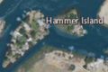 NASA Worldwind, USGS imagery map, Hammer Island, California.png 450 × 300; 153 KB
-
 NASA Worldwind, USGS imagery map, Hammond Island, California.png 3,400 × 1,700; 7.53 MB
-
 NASA Worldwind, USGS imagery map, Hastings Tract, California.png 2,672 × 1,668; 5.37 MB
-
 NASA Worldwind, USGS imagery map, Headreach Island, California.png 500 × 400; 239 KB
-
 NASA Worldwind, USGS imagery map, Hog Island (San Joaquin County), California.png 1,375 × 1,375; 1.69 MB
-
 NASA Worldwind, USGS imagery map, Holland Tract, California.png 1,673 × 1,907; 4.31 MB
-
 NASA Worldwind, USGS imagery map, Ida Island, California.png 900 × 500; 619 KB
-
 NASA Worldwind, USGS imagery map, Joice Island, California.png 1,500 × 1,500; 2.51 MB
-
 NASA Worldwind, USGS imagery map, Kimball Island, California.png 1,600 × 1,200; 1.86 MB
-
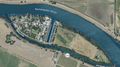
 NASA Worldwind, USGS imagery map, Kings Island, California.png 225 × 225; 93 KB
-
 NASA Worldwind, USGS imagery map, Liberty Island, California.png 550 × 1,800; 1.25 MB
-
 NASA Worldwind, USGS imagery map, Little Hastings Tract, California.png 1,000 × 1,000; 1.24 MB
-
 NASA Worldwind, USGS imagery map, Little Holland Tract, California.png 2,001 × 2,000; 3.82 MB
-
 NASA Worldwind, USGS imagery map, Little Venice Island, California.png 1,000 × 1,000; 916 KB
-
 NASA Worldwind, USGS imagery map, Long Island, California.png 650 × 350; 310 KB
-
 NASA Worldwind, USGS imagery map, Mallard Island, California.png 300 × 150; 71 KB
-

-
 NASA Worldwind, USGS imagery map, Montezuma Island, California.png 600 × 600; 428 KB
-
 NASA Worldwind, USGS imagery map, Moore Tract, California.png 2,090 × 2,090; 4.93 MB
-
 NASA Worldwind, USGS imagery map, Orwood Tract, California.png 1,729 × 1,729; 3.34 MB
-
 NASA Worldwind, USGS imagery map, Palm Tract, California.png 1,729 × 1,729; 3.38 MB
-
 NASA Worldwind, USGS imagery map, Randall Island, California.png 1,800 × 1,800; 4.36 MB
-
 NASA Worldwind, USGS imagery map, Rhode Island, California.png 550 × 550; 342 KB
-
 NASA Worldwind, USGS imagery map, Rindge Tract, California.png 2,359 × 1,778; 5.09 MB
-
 NASA Worldwind, USGS imagery map, Rio Blanco Tract, California.png 2,507 × 1,787; 4.43 MB
-
 NASA Worldwind, USGS imagery map, Rough and Ready Island, California.png 2,262 × 1,748; 5.51 MB
-
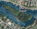 NASA Worldwind, USGS imagery map, Shenkel Island, California.png 250 × 200; 96 KB
-
 NASA Worldwind, USGS imagery map, Shima Tract, California.png 1,759 × 1,758; 3.2 MB
-
 NASA Worldwind, USGS imagery map, Shin Kee Tract, California.png 1,991 × 1,630; 3.78 MB
-
 NASA Worldwind, USGS imagery map, Spinner Island, California.png 800 × 800; 816 KB
-
 NASA Worldwind, USGS imagery map, Spud Island, California.png 1,180 × 1,179; 1.19 MB
-
 NASA Worldwind, USGS imagery map, Stewart Tract, California.png 2,000 × 1,222; 2.66 MB
-
 NASA Worldwind, USGS imagery map, Terminous Tract, California.png 1,800 × 1,800; 3.18 MB
-
 NASA Worldwind, USGS imagery map, Terminous, California.png 1,800 × 1,800; 3.19 MB
-
 NASA Worldwind, USGS imagery map, Tinsley Island, California.png 650 × 650; 506 KB
-
 NASA Worldwind, USGS imagery map, Tule Island, California.png 611 × 611; 447 KB
-
 NASA Worldwind, USGS imagery map, Vulcan Island, California.png 600 × 300; 267 KB
-
 NASA Worldwind, USGS imagery map, Ward Island, California.png 647 × 645; 431 KB
-
 NASA Worldwind, USGS imagery map, Webb Tract, California.png 1,956 × 1,671; 4.07 MB
-
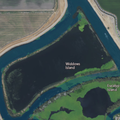 NASA Worldwind, USGS imagery map, Widdows Island, California.png 542 × 542; 292 KB
-
 NASA Worldwind, USGS imagery map, Wright-Elmwood Tract, California.png 1,790 × 1,936; 3.55 MB
-
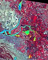 Sacramento-San Joaquin River Delta, CA (ASTER).jpg 3,101 × 3,836; 2.15 MB


,_California.png)


.jpg)