File:Myrtenbrücke an der Straße über den Semmering (1845).jpg

Original file (1,796 × 2,672 pixels, file size: 1.66 MB, MIME type: image/jpeg)
Captions
Captions
Summary
[edit].jpg&action=edit§ion=1)
| Description |
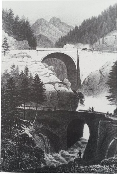
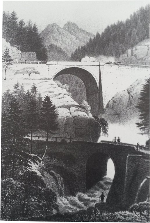
Deutsch: Die 19,7 m hohe und 22,8 m breite Bogenbrücke über den Myrthengraben für die zwischen 1839-1841 gebaute Trasse der Semmeringstraße. Ausgeführt wurde der Bau von der Fa. Tallachini. Zwei Wegtechniken werden gegenübergestellt: die alte Steinbrücke für die e. Abstieg nach der bereits beim Bärensattel erreichten Höhe und ein anschließend besonders steiler Wiederanstieg nötig war und die neue, hoch in den Himmel ragende Brücke, die einen gleichmäßigen Anstieg erlaubte. |
| Date | |
| Source | Kolorierte Tonlithografie "nach der Natur auf Stein gez. v. Rothmüller, gedr. bei J. Rauh, Wien , NÖ Landesbibliothek, Topogr. Sammlung (6.941). |
| Author | Anton Rothmüller |
Licensing
[edit].jpg&action=edit§ion=2)
|
This work is in the public domain in its country of origin and other countries and areas where the copyright term is the author's life plus 70 years or fewer.
| |
| This file has been identified as being free of known restrictions under copyright law, including all related and neighboring rights. | |
File history
Click on a date/time to view the file as it appeared at that time.
| Date/Time | Thumbnail | Dimensions | User | Comment | |
|---|---|---|---|---|---|
| current | 16:30, 1 May 2020 | | 1,796 × 2,672 (1.66 MB) | Veleius (talk | contribs) | {{Information |description ={{de|1=Die 19,7 m hohe und 22,8 m breite Bogenbrücke über den Myrthengraben für die zwischen 1839-1841 gebaute Trasse der Semmeringstraße. Ausgeführt wurde der Bau von der Fa. Tallachini. Zwei Wegtechniken werden gegenübergestellt: die alte Steinbrücke für die e. Abstieg nach der bereits beim Bärensattel erreichten Höhe und ein anschließend besonders steiler Wiederanstieg nötig war und die neue, hoch in den Himmel ragende Brücke, die einen gleichmäßigen Anstieg e... |
You cannot overwrite this file.
File usage on Commons
There are no pages that use this file.
File usage on other wikis
The following other wikis use this file:
- Usage on de.wikipedia.org
.jpg&oldid=607998740)