File:Moreno-Olascoaga.1886.jpg

Original file (4,993 × 2,811 pixels, file size: 1.96 MB, MIME type: image/jpeg)
Captions
Captions
| Description |
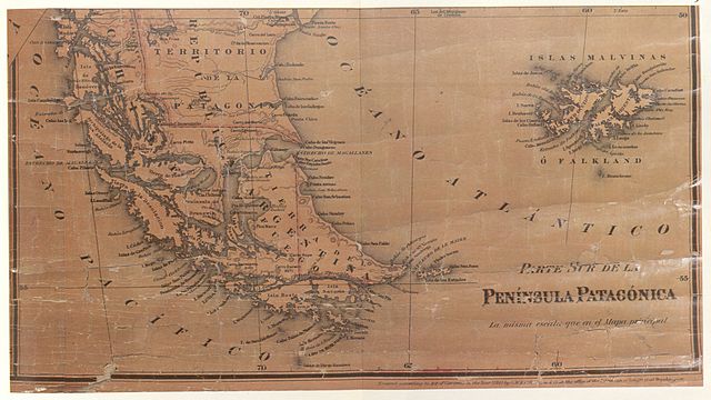
General Map of the Argentina Republic and neighbouring countries-1886. The map shown here states that it was "made according to the latest official data" and "in the light of the latest plans and sketches" made by Francisco P. Moreno, Argentine expert on the Commission for marking out the frontier with Chile, and by Lieutenant-Colonel Jose Olascoaga, "Head of the Military Typographic Office". As may be observed, the international boundary is traced along the centre of the Beagle Channel, showing Picton, Nueva and Lennox and all the other islands and islets extending southwards as far as Cape Horn as being under Chilean sovereingty. |
||||
| Date | |||||
| Source | El Conflicto del Beagle, edited by the chilean Foreign Affairs Office, 1978, Switzerland. | ||||
| Author | Jose Olascoaga and Francisco P. Moreno | ||||
| Permission (Reusing this file) |
|
||||
File history
Click on a date/time to view the file as it appeared at that time.
| Date/Time | Thumbnail | Dimensions | User | Comment | |
|---|---|---|---|---|---|
| current | 00:49, 6 November 2007 | | 4,993 × 2,811 (1.96 MB) | Keysanger (talk | contribs) | {{Information |Description=General Map of the Argentina Republic and neighbouring countries-1886. The map shown here states that it was "made according to the latest official data" and "in the light of the latest plans and sketches" made by Francisco P. M |
You cannot overwrite this file.
File usage on Commons
There are no pages that use this file.
File usage on other wikis
The following other wikis use this file:
- Usage on de.wikipedia.org
- Usage on en.wikipedia.org
- Usage on es.wikipedia.org
- Usage on fr.wikipedia.org