File:Moldova location map Topographic.png
Jump to navigation
Jump to search

Size of this preview: 490 × 600 pixels. Other resolutions: 196 × 240 pixels | 626 × 766 pixels.
Original file (626 × 766 pixels, file size: 1.28 MB, MIME type: image/png)
Captions
Captions
Add a one-line explanation of what this file represents
Summary
[edit]
| Description |
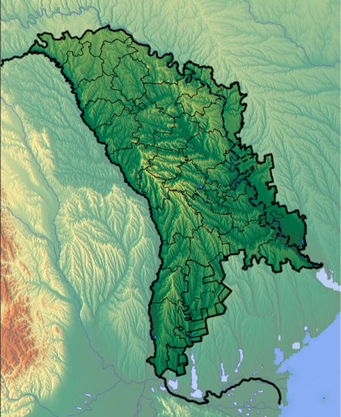
Deutsch: Positionskarte von Moldawien
Quadratische Plattkarte, N-S-Streckung 140 %. Geographische Begrenzung der Karte:
English: Location map of Moldova
Equirectangular projection, N/S stretching 140 %. Geographic limits of the map:
|
| Date | |
| Source | Own work (background : http://www.maps-for-free.com) |
| Author | Dr Brains |
Licensing
[edit]
I, the copyright holder of this work, hereby publish it under the following licenses:

|
Permission is granted to copy, distribute and/or modify this document under the terms of the GNU Free Documentation License, Version 1.2 only as published by the Free Software Foundation; with no Invariant Sections, no Front-Cover Texts, and no Back-Cover Texts. A copy of the license is included in the section entitled GNU Free Documentation License. | 1.2 only |
|
|
Permission is granted to copy, distribute and/or modify this document under the terms of the GNU Free Documentation License, Version 1.3 or any later version published by the Free Software Foundation; with no Invariant Sections, no Front-Cover Texts, and no Back-Cover Texts. A copy of the license is included in the section entitled GNU Free Documentation License.
|
If this file is eligible for relicensing, it may also be used under the Creative Commons Attribution-ShareAlike 3.0 license. The relicensing status of this image needs to be manually reviewed by an experienced user. You can help.
|
You may select the license of your choice.
File history
Click on a date/time to view the file as it appeared at that time.
| Date/Time | Thumbnail | Dimensions | User | Comment | |
|---|---|---|---|---|---|
| current | 09:43, 17 November 2012 | | 626 × 766 (1.28 MB) | Spiridon Ion Cepleanu (talk | contribs) | Location map of Moldova from Dr.Brains, with the Transnistrian "rayons" also. |
| 18:10, 25 June 2012 |  | 782 × 959 (1.49 MB) | Dr Brains (talk | contribs) |
You cannot overwrite this file.
File usage on Commons
The following 2 pages use this file:
File usage on other wikis
The following other wikis use this file:
- Usage on fr.wikipedia.org