File:Michigan Macomb county Lake St Clair Anchor Bay Selfridge AFB IMG 1817.JPG
Jump to navigation
Jump to search
Size of this preview: 800 × 472 pixels. Other resolutions: 320 × 189 pixels | 640 × 378 pixels | 1,024 × 604 pixels | 1,280 × 755 pixels | 2,560 × 1,510 pixels | 4,530 × 2,672 pixels.
Original file (4,530 × 2,672 pixels, file size: 7.62 MB, MIME type: image/jpeg)
Captions
Captions
Add a one-line explanation of what this file represents
Summary
[edit]
| Description |
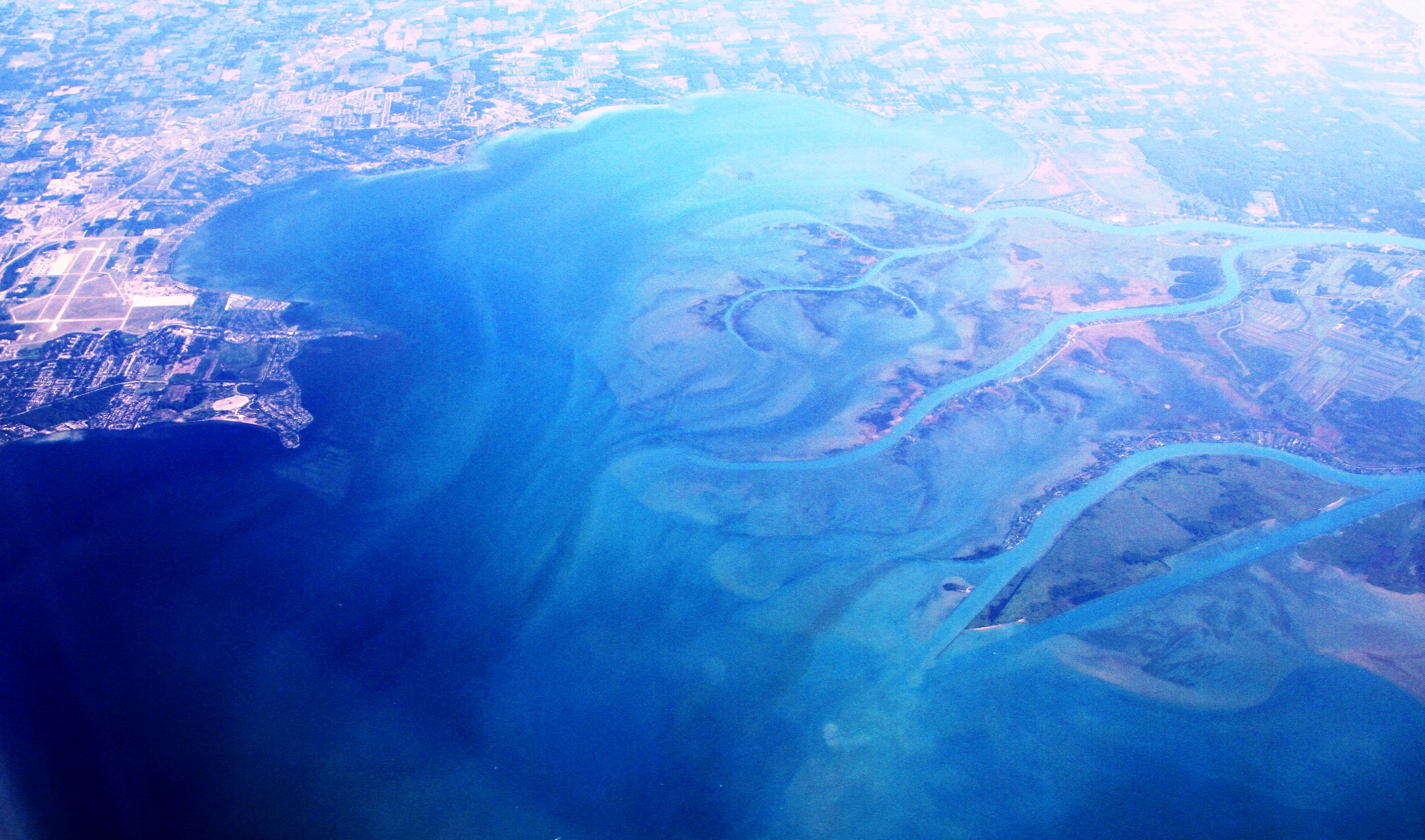
English: Aerial view from the south towards north, over Macomb County, southeastern Michigan. This county surrounds Detroit city in the north and northeast of the metropolitan area. The Anchor Bay is a part of Lake St Clair, by the estuary of the St Lawrence River which borders the United States and Canada. |
| Date | |
| Source | Own work |
| Author | Bjoertvedt |
Licensing
[edit]
I, the copyright holder of this work, hereby publish it under the following license:
This file is licensed under the Creative Commons Attribution-Share Alike 3.0 Unported license.
- You are free:
- to share – to copy, distribute and transmit the work
- to remix – to adapt the work
- Under the following conditions:
- attribution – You must give appropriate credit, provide a link to the license, and indicate if changes were made. You may do so in any reasonable manner, but not in any way that suggests the licensor endorses you or your use.
- share alike – If you remix, transform, or build upon the material, you must distribute your contributions under the same or compatible license as the original.
File history
Click on a date/time to view the file as it appeared at that time.
| Date/Time | Thumbnail | Dimensions | User | Comment | |
|---|---|---|---|---|---|
| current | 14:49, 27 January 2013 | | 4,530 × 2,672 (7.62 MB) | Bjoertvedt (talk | contribs) | User created page with UploadWizard |
You cannot overwrite this file.
File usage on Commons
There are no pages that use this file.
File usage on other wikis
The following other wikis use this file:
- Usage on en.wikipedia.org