File:Meyer‘s Zeitungsatlas 048 – Rheinprovinz Jülich-Cleve-Berg (Main map).jpg

Original file (2,254 × 3,703 pixels, file size: 4.62 MB, MIME type: image/jpeg)
Captions
Captions
Summary
[edit]| Title |
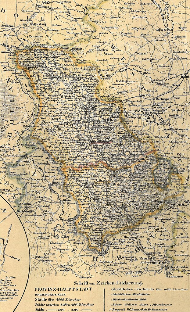
Meyer‘s Zeitungsatlas 048 – Rheinprovinz Jülich-Cleve-Berg |
| Date | |
| Source | Eigener Scan aus privat gebundenem Exemplar von Meyer‘s Zeitungsatlas |
| Creator |
Gezeichnet von Art. Pr. Ltn. Renner |
| Geotemporal data | |
| Map location | Provinz Jülich-Kleve-Berg |
| Map type | thematic map |
| Georeferencing | If inappropriate please set warp_status = skip to hide. |
| Bibliographic data | |
| Part of the series | Meyer‘s Zeitungsatlas |
| Language | German |
| Place of publication | Hildburghausen |
| Publisher |
Stahlstich (Direktion v. Kleinknecht) aus der Schweinfurter Geograph. Gravieranstalt des Bibliographischen Instituts zu Hildburghausen, Amsterdam und New York |
| Archival data | |
| Dimensions | height: 26.1 cm (10.2 in); width: 30.9 cm (12.1 in) |
| Medium | steel engraving print on paper |
| Inscriptions | |
| Notes | Zusatzkarten: Düsseldorf; Bonn; Krefeld [und Umgegend]; Barmen [und Umgegend]; Cöln. Statistische Notizen |
| Scan resolution | 600 dpi |
| Other versions | |

.jpg&action=edit§ion=1)
Licensing
[edit].jpg&action=edit§ion=2)
|
This work is in the public domain in its country of origin and other countries and areas where the copyright term is the author's life plus 70 years or fewer.
| |
| This file has been identified as being free of known restrictions under copyright law, including all related and neighboring rights. | |
File history
Click on a date/time to view the file as it appeared at that time.
| Date/Time | Thumbnail | Dimensions | User | Comment | |
|---|---|---|---|---|---|
| current | 22:52, 10 December 2023 | | 2,254 × 3,703 (4.62 MB) | Enyavar (talk | contribs) | File:Meyer‘s Zeitungsatlas 048 – Rheinprovinz Jülich-Cleve-Berg.jpg cropped 62 % horizontally, 25 % vertically using CropTool with precise mode. |
You cannot overwrite this file.
File usage on Commons
The following page uses this file:
.jpg&oldid=849290369)