File:Mesa Rock LIDAR.jpg
Jump to navigation
Jump to search

Size of this preview: 667 × 600 pixels. Other resolutions: 267 × 240 pixels | 534 × 480 pixels | 965 × 868 pixels.
Original file (965 × 868 pixels, file size: 242 KB, MIME type: image/jpeg)
Captions
Captions
Add a one-line explanation of what this file represents
Summary
[edit]
| Description |
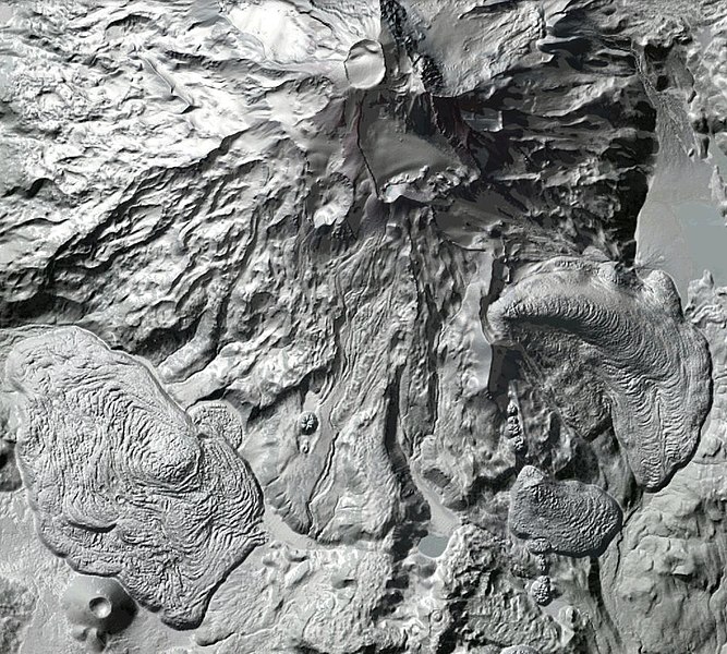
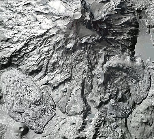
Français : Capture Lidar du versant sud de South Sister, dans la chaîne des Three Sisters, montrant aussi Mesa Rock en bas à gauche. |
| Date | |
| Source | Dogami Lidar Data viewer |
| Author | Agency : DOGAMI through OLC. Company : Watershed Sciences. point of contact : Ian Madin, DOGAMI (ian.madin at dogami.state.or.us) |
Licensing
[edit]
This file is in the public domain because : according to DOGAMI Lidar Data Distribution Policy (and http://www.blm.gov/or/gis/lidar.php), DOGAMI is the primary state agency for lidar data collection, archiving, and distribution for Oregon. DOGAMI distributes lidar products that are in the public domain, meaning that there are no restrictions on use or redistribution.
|
File history
Click on a date/time to view the file as it appeared at that time.
| Date/Time | Thumbnail | Dimensions | User | Comment | |
|---|---|---|---|---|---|
| current | 16:11, 30 April 2013 | | 965 × 868 (242 KB) | Bourrichon (talk | contribs) | User created page with UploadWizard |
You cannot overwrite this file.
File usage on Commons
The following page uses this file:
File usage on other wikis
The following other wikis use this file:
- Usage on fr.wikipedia.org
- Usage on pt.wikipedia.org
Categories:
- LIDAR images of volcanoes
- Satellite pictures of the Three Sisters (volcanoes)
- Satellite pictures of Oregon
- South Sister (volcano)
- Volcanology of Oregon
- Volcanism of the Three Sisters (volcanoes)
- Lava fields in Oregon
- Rock Mesa (Oregon)
- LIDAR images of lava fields
- April 2013 in Oregon
- Lava flows of South Sister Volcano
- Maps of lava fields
- Maps of lava flows
- 2013 in volcanology