Category:LIDAR images of volcanoes
Jump to navigation
Jump to search
Media in category "LIDAR images of volcanoes"
The following 15 files are in this category, out of 15 total.
-
Airborne Lidar Bathymetric Technology.jpg 850 × 496; 114 KB
-
Calbuco Ash Over Buenos Aires 04-24-2015.jpg 2,016 × 708; 831 KB
-
Lidar 3D model MT St. Helens.jpg 4,238 × 6,320; 13.57 MB
-
Mesa Rock LIDAR.jpg 965 × 868; 242 KB
-
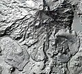
Middle Sister LIDAR.jpg 953 × 1,401; 173 KB
-
Mount Baker Kulshan Glaciers 01 Lidar (52593993526).jpg 10,800 × 10,800; 58.25 MB
-
Mount Baker Kulshan Glaciers 02 Photo Lidar blend (52594511553).jpg 10,800 × 10,800; 61.01 MB
-
Mount Baker Kulshan Glaciers 03 Photo (52594511333).jpg 10,800 × 10,800; 67.08 MB
-
Mount Rainier glaciers 01 lidar hillshade color (51149831236).jpg 6,000 × 6,000; 31.25 MB
-
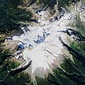
Mount Rainier glaciers 02 photo lidar hillshade blend (51150062838).jpg 6,000 × 6,000; 35.66 MB
-
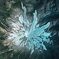
Mount Rainier glaciers 03 aerial photo (51150613674).jpg 6,000 × 6,000; 41.36 MB
-
Mount St Helens 40th Anniversary image (51150069168).jpg 8,100 × 11,700; 82.23 MB
-
Mount St. Helens A Mountain Reborn background image (52067073951).jpg 10,800 × 7,200; 66.88 MB
-
MountShasta2016orthophoto-LIDARslope50.tif 1,916 × 1,023; 7.48 MB
-
Sparks Lake LIDAR.jpg 691 × 800; 131 KB


