File:Mayotte topographic map-de.svg
Jump to navigation
Jump to search

Size of this PNG preview of this SVG file: 477 × 599 pixels. Other resolutions: 191 × 240 pixels | 382 × 480 pixels | 612 × 768 pixels | 815 × 1,024 pixels | 1,631 × 2,048 pixels | 1,033 × 1,297 pixels.
Original file (SVG file, nominally 1,033 × 1,297 pixels, file size: 852 KB)
Captions
Captions
Add a one-line explanation of what this file represents
Summary
[edit]| Description |
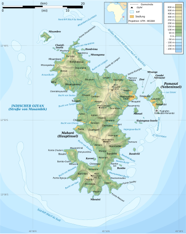
Français : Carte topographique de Mayotte en allemand. Utiliser la version PNG dans les articles pour un rendu plus rapide.
Deutsch: Topografische Karte von Mayotte.
|
||
| Date | |||
| Source |
Own work. Sources of data:
|
||
| Author |
|
||
| Permission (Reusing this file) |
I, the copyright holder of this work, hereby publish it under the following licenses:
This file is licensed under the Creative Commons Attribution-Share Alike 4.0 International, 3.0 Unported, 2.5 Generic, 2.0 Generic and 1.0 Generic license.
You may select the license of your choice. |
||
| Other versions |
[]
|


English: This map has been created by Rémi Kaupp (User:Korrigan) and released under the license(s) stated below. You are free to use it for any purpose as long as you credit me and follow the terms of the license. You may need to credit the sources of data of the map (please check). Example:
Français : Cette carte a été créée par Rémi Kaupp (User:Korrigan) et placée sous la ou les licence(s) ci-dessous. Vous êtes libre de la réutiliser, tant que vous me citez en tant qu'auteur et suivez les instructions de la licence. Certaines sources de données de la carte doivent peut-être être créditées, veuillez vérifier. Exemple :
|
 |
File history
Click on a date/time to view the file as it appeared at that time.
| Date/Time | Thumbnail | Dimensions | User | Comment | |
|---|---|---|---|---|---|
| current | 15:58, 20 August 2016 | | 1,033 × 1,297 (852 KB) | Furfur (talk | contribs) | == {{int:filedesc}} == {{Information |Description={{en|1=Topographic map of Mayotte in German. Use the PNG version in articles for faster loading.}} {{fr|1=Carte topographique de Mayotte en allemand. Utilise... |
You cannot overwrite this file.
File usage on Commons
The following page uses this file: