File:Marwood - Farm Barn (geograph 7808416).jpg
Jump to navigation
Jump to search
Size of this preview: 800 × 533 pixels. Other resolutions: 320 × 213 pixels | 640 × 427 pixels | 1,024 × 683 pixels | 1,280 × 853 pixels | 2,560 × 1,707 pixels | 6,400 × 4,267 pixels.
Original file (6,400 × 4,267 pixels, file size: 6.72 MB, MIME type: image/jpeg)
Captions
Captions
Add a one-line explanation of what this file represents
Summary
[edit].jpg&action=edit§ion=1)
| Description |
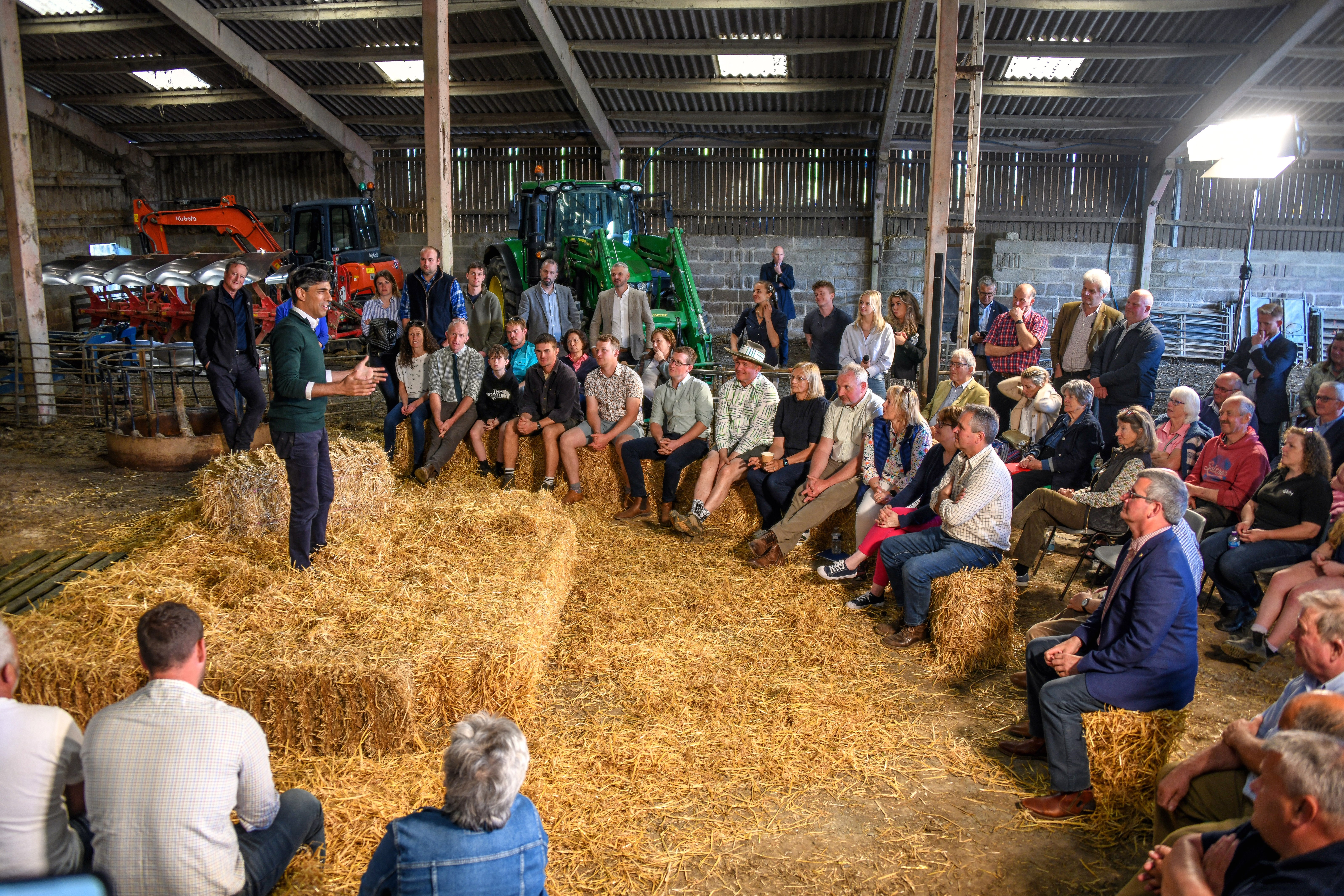
English: Standing on straw, the Prime Minister Rishi Sunak sets out his plan for farming if he continues to be in power after the July 4th general election. |
| Date | |
| Source | From geograph.org.uk |
| Author | Lewis Clarke |
| Permission (Reusing this file) |
Creative Commons Attribution Share-alike license 2.0 |
| Attribution (required by the license) | Lewis Clarke / Marwood : Farm Barn / |
| Camera location | | View this and other nearby images on: OpenStreetMap |
|---|
.jpg¶ms=051.116216_N_-004.068871_E_globe:Earth_type:camera_source:geograph-osgb36(SS55293725)_heading:67.00&language=en)
| Object location | | View this and other nearby images on: OpenStreetMap |
|---|
.jpg¶ms=051.116310_N_-004.068590_E_globe:Earth_class:object_type:object_source:geograph-osgb36(SS55313726)_heading:67.00&language=en)
Licensing
[edit].jpg&action=edit§ion=2)

|
This image was taken from the Geograph project collection. See this photograph's page on the Geograph website for the photographer's contact details. The copyright on this image is owned by Lewis Clarke and is licensed for reuse under the Creative Commons Attribution-ShareAlike 2.0 license.
|
This file is licensed under the Creative Commons Attribution-Share Alike 2.0 Generic license.
Attribution: Lewis Clarke
- You are free:
- to share – to copy, distribute and transmit the work
- to remix – to adapt the work
- Under the following conditions:
- attribution – You must give appropriate credit, provide a link to the license, and indicate if changes were made. You may do so in any reasonable manner, but not in any way that suggests the licensor endorses you or your use.
- share alike – If you remix, transform, or build upon the material, you must distribute your contributions under the same or compatible license as the original.
File history
Click on a date/time to view the file as it appeared at that time.
| Date/Time | Thumbnail | Dimensions | User | Comment | |
|---|---|---|---|---|---|
| current | 17:07, 3 July 2024 | | 6,400 × 4,267 (6.72 MB) | Hullian111-Flickr2Commons (talk | contribs) | == {{int:filedesc}} == {{Information |Description={{en|1=Standing on straw, the Prime Minister Rishi Sunak sets out his plan for farming if he continues to be in power after the July 4th general election.}} |Source=From [https://www.geograph.org.uk/photo/7808416 geograph.org.uk] |Date=2024-06-18 |Author=[https://www.geograph.org.uk/profile/11775 Lewis Clarke] |Permission=Creative Commons Attribution Share-alike license 2.0 |Other fields={{Credit line |Author=Lewis Clarke |License=[https://c... |
You cannot overwrite this file.
File usage on Commons
There are no pages that use this file.
.jpg&oldid=891814522)