Category:Marwood, Devon
Jump to navigation
Jump to search
English: Marwood is a village in North Devon 3.5 miles north of Barnstaple. The village contains ornamental gardens open to the public, known as Marwood Hill Gardens. These were developed by Dr Jimmy Smart, who died in 2002.
Roy Lancaster (broadcaster and well-known horticulturist) has referred to Marwood Hill as one of the most acclaimed gardens in Devon, saying that it is a delight at any time, but particularly during Spring [reference: The Garden, February 2014 issue, pp. 34-39].
village and civil parish in Devon, UK  | |||||
| Upload media | |||||
| Instance of | |||||
|---|---|---|---|---|---|
| Location | North Devon, Devon, South West England, England | ||||
 | |||||
Subcategories
This category has only the following subcategory.
S
Media in category "Marwood, Devon"
The following 200 files are in this category, out of 460 total.
(previous page) (next page)-
 'Byways' Guineaford - geograph.org.uk - 5953099.jpg 1,024 × 768; 146 KB
-
 'Little Foxbury', Kingsheanton - geograph.org.uk - 5953093.jpg 1,024 × 768; 122 KB
-
 'Long House' - geograph.org.uk - 6086091.jpg 1,024 × 759; 178 KB
-

-

-

-

-
 A bridge over a stream near Rookbear Lane - geograph.org.uk - 2236700.jpg 1,024 × 680; 331 KB
-

-

-

-
 A bridge over Bradiford Water at Broomhill Hotel - geograph.org.uk - 2237483.jpg 1,024 × 680; 242 KB
-
 A bridge over Bradiford Water at Broomhill Hotel - geograph.org.uk - 2237487.jpg 1,024 × 680; 246 KB
-

-

-

-

-

-

-

-

-

-
 A bridge over Colam Stream at Muddiford - geograph.org.uk - 2237519.jpg 1,024 × 680; 243 KB
-
 A bridge over Colam Stream at Muddiford - geograph.org.uk - 2237521.jpg 1,024 × 683; 225 KB
-

-
 A bridge over Colam Stream in Bittadon Ball Wood - geograph.org.uk - 2239941.jpg 1,024 × 680; 258 KB
-

-
 A bridge over Colam Stream in Milltown - geograph.org.uk - 2240241.jpg 1,024 × 676; 222 KB
-
 A bridge over Colam Stream in Milltown - geograph.org.uk - 2240245.jpg 1,024 × 680; 212 KB
-

-

-

-

-

-

-

-
 A bridge over Colam Stream on Whiddon Lane - geograph.org.uk - 2240281.jpg 1,024 × 680; 266 KB
-
 A bridge over Colam Stream on Whiddon Lane - geograph.org.uk - 2240286.jpg 1,024 × 680; 275 KB
-

-

-

-

-
 A brook approaching Colam Stream - geograph.org.uk - 2239940.jpg 1,024 × 680; 271 KB
-
 A cattle shed on Kennacott Farm - geograph.org.uk - 4003431.jpg 6,000 × 4,000; 4.14 MB
-
 A cattle shed on Kennacott Farm - geograph.org.uk - 4003432.jpg 6,000 × 4,000; 4.73 MB
-
 A cloudy day on Swindon down - geograph.org.uk - 5398399.jpg 5,790 × 3,860; 5.34 MB
-
 A convoy vehicle leads traffic through works on the B3230 - geograph.org.uk - 5268436.jpg 4,000 × 3,000; 5.37 MB
-
 A cottage near Patsford farm - geograph.org.uk - 2266015.jpg 1,024 × 683; 164 KB
-
 A Dalek in a garden in Muddiford - geograph.org.uk - 4812478.jpg 4,000 × 3,000; 5.15 MB
-

-
 A gentle warning - geograph.org.uk - 2383983.jpg 640 × 480; 58 KB
-

-

-

-
 A particularly sharp bend on the B3230 - geograph.org.uk - 1743949.jpg 1,024 × 768; 247 KB
-

-
 A sluice gate next to a weir on Bradiford Water - geograph.org.uk - 2237412.jpg 1,024 × 680; 295 KB
-

-

-

-

-

-

-

-

-
 A wind turbine at the Fullabrook Wind Farm - geograph.org.uk - 3830716.jpg 3,648 × 2,736; 3.97 MB
-
 About to descend - geograph.org.uk - 2383988.jpg 640 × 480; 55 KB
-

-
 Access to a field on Metcombe Down - geograph.org.uk - 2383030.jpg 640 × 480; 82 KB
-
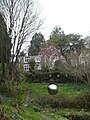
 Across the Lake at Marwood Hill Gardens - geograph.org.uk - 723734.jpg 640 × 480; 118 KB
-
 All 22 turbines completed on Fullabrook Wind Farm - geograph.org.uk - 2515120.jpg 4,272 × 1,191; 2.48 MB
-
 Allotment by the river - geograph.org.uk - 623365.jpg 640 × 480; 123 KB
-

-

-
 An unstable edge on the B3230 - geograph.org.uk - 4119703.jpg 3,577 × 2,643; 4.5 MB
-

-
 Approaching Bittadon on the B3230 - geograph.org.uk - 1743934.jpg 1,024 × 768; 220 KB
-
 Approaching Milltown from Muddiford on the B3230 - geograph.org.uk - 1743968.jpg 1,024 × 768; 178 KB
-

-
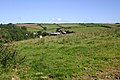
 Arable farmland on Whitefield Down - geograph.org.uk - 5150539.jpg 1,024 × 768; 300 KB
-
 Autumn Colours - panoramio (3).jpg 3,054 × 1,908; 4.06 MB
-
 B3230 near Little Silver - geograph.org.uk - 5953110.jpg 1,024 × 768; 288 KB
-
 Bare trees on Blakewell Lane - geograph.org.uk - 6086599.jpg 1,024 × 779; 250 KB
-
 Blakewell Fisheries - geograph.org.uk - 2223609.jpg 1,024 × 680; 302 KB
-
 Blakewell Fisheries - geograph.org.uk - 2224827.jpg 1,024 × 680; 230 KB
-
 Blakewell Fisheries - geograph.org.uk - 6086905.jpg 1,024 × 813; 242 KB
-
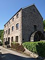 Blakewell Mill - geograph.org.uk - 1346605.jpg 480 × 640; 96 KB
-
 Bradiford Water - geograph.org.uk - 6086592.jpg 1,024 × 768; 229 KB
-
 Bradiford Water and sculpture at Broomhill Art Hotel - geograph.org.uk - 6109051.jpg 1,600 × 1,200; 1.09 MB
-
 Bradiford Water in grounds of Broomhill Art Hotel - geograph.org.uk - 6109047.jpg 1,200 × 1,600; 1.03 MB
-
 Bradiford Water just downstream from Muddiford - geograph.org.uk - 2237406.jpg 1,024 × 680; 287 KB
-
 Bridleway to Blakewell - geograph.org.uk - 1346642.jpg 640 × 480; 121 KB
-
 Bridleway to Prixford - geograph.org.uk - 6086100.jpg 1,024 × 768; 232 KB
-
 Broomhill Art Hotel - geograph.org.uk - 6109042.jpg 1,600 × 1,200; 1,014 KB
-
 Broomhill Art Hotel - geograph.org.uk - 6109072.jpg 1,200 × 1,600; 1.1 MB
-
-
 Bungalow at Whitehall Cross - geograph.org.uk - 6086089.jpg 1,024 × 801; 178 KB
-
 Car park at Broomhill Art Hotel - geograph.org.uk - 6109077.jpg 1,600 × 1,200; 1.08 MB
-
 Car park for Marwood Hill Gardens - geograph.org.uk - 3441817.jpg 768 × 1,024; 273 KB
-
 Cattle feeding at Lower Metcombe Farm - geograph.org.uk - 2266019.jpg 1,024 × 683; 186 KB
-
 Chapel at Muddiford - geograph.org.uk - 523169.jpg 640 × 425; 131 KB
-
 Chapel Farm, Marwood - geograph.org.uk - 4003430.jpg 6,000 × 4,000; 4.93 MB
-
 Church Farm, Bittadon - geograph.org.uk - 4003429.jpg 6,000 × 4,000; 4.53 MB
-
 Colam House - geograph.org.uk - 5150641.jpg 1,024 × 768; 191 KB
-
 Collacott Bridge on Colam Stream - geograph.org.uk - 2207607.jpg 1,024 × 680; 295 KB
-

-

-
 Collacott Farm, near Bittadon - geograph.org.uk - 1893814.jpg 1,024 × 768; 125 KB
-
 Cottage, Lower Blakewell - geograph.org.uk - 6086594.jpg 1,024 × 736; 86 KB
-
 Cottages on the B3230 - geograph.org.uk - 5839275.jpg 1,024 × 805; 133 KB
-
 Cottages, Kingsheanton - geograph.org.uk - 5953094.jpg 1,024 × 768; 150 KB
-
 Cottages, Prixford - geograph.org.uk - 5953063.jpg 1,024 × 768; 128 KB
-
 Crop protection, near Kingsheanton - geograph.org.uk - 5953098.jpg 1,024 × 784; 243 KB
-
 Crossroads at Guineaford - geograph.org.uk - 5953101.jpg 1,024 × 768; 225 KB
-
 Deer grazing. - geograph.org.uk - 1202771.jpg 640 × 480; 134 KB
-
 Disused Quarry by B3230 - geograph.org.uk - 523194.jpg 640 × 425; 132 KB
-
 Don't mess with this guy^ - geograph.org.uk - 4497773.jpg 640 × 480; 133 KB
-
 Driveway, 'Binalong' - geograph.org.uk - 5953107.jpg 1,024 × 768; 252 KB
-
 East end of Reed's Lane - geograph.org.uk - 5150532.jpg 1,024 × 805; 238 KB
-
 Entering Muddiford on the B3230 - geograph.org.uk - 1743981.jpg 1,024 × 768; 228 KB
-
 Entrance, Springfield Nursery - geograph.org.uk - 6086102.jpg 1,024 × 794; 193 KB
-
 Farm buildings above Higher Muddiford - geograph.org.uk - 820272.jpg 640 × 425; 67 KB
-
 Farm buildings in Middle Marwood - geograph.org.uk - 3441848.jpg 1,024 × 682; 125 KB
-
 Farm buildings near No Man's Land - geograph.org.uk - 4003454.jpg 6,000 × 4,000; 5.47 MB
-
 Farm track on Metcombe Down - geograph.org.uk - 6086040.jpg 1,024 × 786; 167 KB
-
 Farmland above Prixford - geograph.org.uk - 5953092.jpg 1,024 × 784; 196 KB
-
 Farmland near Middle Marwood - geograph.org.uk - 93136.jpg 640 × 480; 53 KB
-
 Farmland near Springfield Cross - geograph.org.uk - 93163.jpg 640 × 480; 48 KB
-
 Farmland on Whitefield Down - geograph.org.uk - 5150559.jpg 1,024 × 768; 174 KB
-
 Ferns at Marwood Hill Gardens - geograph.org.uk - 723736.jpg 640 × 480; 122 KB
-
 Field of stubble on Swindon Down - geograph.org.uk - 5839256.jpg 1,024 × 768; 233 KB
-
 Fields West of Hewish Down - geograph.org.uk - 722178.jpg 640 × 425; 81 KB
-

-
 Footpath at Higher Muddiford - geograph.org.uk - 523184.jpg 640 × 425; 122 KB
-
 Footpaths crossing Whiddon Lane - geograph.org.uk - 6109127.jpg 1,600 × 1,201; 748 KB
-
 Fullabrook Down - geograph.org.uk - 2175793.jpg 1,024 × 680; 195 KB
-

-
 Fullabrook Wind Farm - geograph.org.uk - 5950506.jpg 1,024 × 746; 168 KB
-

-
 Fullabrook Wind Farm nears completion - geograph.org.uk - 2488304.jpg 4,274 × 1,233; 2.21 MB
-

-

-
 Fullabrook Wind Farm, Bideford Bay and Hartland - geograph.org.uk - 2487917.jpg 3,228 × 2,155; 2.45 MB
-
 GarlandArms.png 811 × 935; 65 KB
-
 Gipsy Corner - geograph.org.uk - 5839254.jpg 1,024 × 778; 205 KB
-
 Gipsy Corner and wind turbine on Swindon Down - geograph.org.uk - 3441841.jpg 1,024 × 682; 115 KB
-
 Greenhill - geograph.org.uk - 774585.jpg 640 × 480; 120 KB
-
 Guineaford - geograph.org.uk - 93150.jpg 640 × 480; 56 KB
-
 Guineaford cross road - geograph.org.uk - 741828.jpg 640 × 480; 77 KB
-
 Gypsy Corner - geograph.org.uk - 766843.jpg 640 × 428; 34 KB
-
 Hartnoll Barton, near Bittadon - geograph.org.uk - 1893823.jpg 1,024 × 768; 143 KB
-
 Hartnoll Wood, Bittadon - geograph.org.uk - 690642.jpg 448 × 640; 184 KB
-

-
 Hewish Barton, Bittadon - geograph.org.uk - 731544.jpg 640 × 363; 50 KB
-
 Hewish Down - geograph.org.uk - 514401.jpg 640 × 426; 93 KB
-
 Higher Muddiford - geograph.org.uk - 812998.jpg 640 × 480; 67 KB
-
 Hillside at Higher Blakewell - geograph.org.uk - 1348950.jpg 640 × 480; 107 KB
-
 Home Farm, Kingsheanton - geograph.org.uk - 4003428.jpg 6,000 × 4,000; 4.41 MB
-
 Home Park Farm, Kingsheanton - geograph.org.uk - 4003425.jpg 6,000 × 4,000; 4.44 MB
-
 Honeywell private road - geograph.org.uk - 522512.jpg 640 × 425; 86 KB
-
 Houses at Milltown - geograph.org.uk - 727486.jpg 640 × 424; 104 KB
-
 Houses in Prixford - geograph.org.uk - 3441812.jpg 1,024 × 1,021; 307 KB
-
 Huish Farm, Kingsheanton - geograph.org.uk - 4003423.jpg 6,000 × 4,000; 4.24 MB
-
 Hydraulic Ram near Patsford - geograph.org.uk - 778555.jpg 640 × 480; 106 KB
-

-

-

-

-
 Kennacott Farm - geograph.org.uk - 4003433.jpg 6,000 × 4,000; 5.42 MB
-
 Kennacott Farm - geograph.org.uk - 4003435.jpg 4,000 × 6,000; 4.58 MB
-
 King Bridge on Bradiford Water - geograph.org.uk - 2237474.jpg 1,024 × 680; 253 KB
-
 King Bridge on Bradiford Water - geograph.org.uk - 2237476.jpg 1,024 × 680; 236 KB
-

-
 Kingsheanton main street - geograph.org.uk - 2384057.jpg 640 × 480; 60 KB
-
 Kingsheanton near Guineaford - geograph.org.uk - 761832.jpg 640 × 480; 98 KB
-

-
 Lane entering Middle Marwood - geograph.org.uk - 2701482.jpg 640 × 480; 92 KB
-
 Lane to Springfield Cross - geograph.org.uk - 6086098.jpg 1,024 × 768; 225 KB
-
 Lane, Lower Blakewell - geograph.org.uk - 6086597.jpg 1,024 × 768; 304 KB
-
 Leaving Milltown on the B3230 - geograph.org.uk - 1743959.jpg 1,024 × 768; 208 KB
-
 Leaving Muddiford on the B3230 - geograph.org.uk - 1743973.jpg 1,024 × 768; 144 KB
-
 Little Silver - geograph.org.uk - 5953105.jpg 1,024 × 768; 186 KB
-

-
 Looking down to Patsford farm - geograph.org.uk - 523636.jpg 640 × 425; 98 KB
-

-

-

-
 Lower Blakewell - geograph.org.uk - 623084.jpg 640 × 480; 82 KB
-
 Lower Metcombe Farm - geograph.org.uk - 2266017.jpg 1,024 × 683; 122 KB
-
 Magnolia blossom in Marwood Hill Gardens (geograph 3441829).jpg 768 × 1,024; 259 KB
-
 Marwood - Farm Barn (geograph 7808416).jpg 6,400 × 4,267; 6.72 MB
-
 Marwood Hill Gardens - geograph.org.uk - 31240.jpg 640 × 415; 66 KB
-
 Marwood Hill Gardens - geograph.org.uk - 723730.jpg 640 × 480; 92 KB
-
 Marwood Hill gardens - geograph.org.uk - 99309.jpg 640 × 480; 150 KB
-
 Marwood Hill Gardens and Marwood Church (geograph 4916172).jpg 640 × 480; 135 KB
-
 Marwood Hill Gardens and Marwood Church tower (geograph 4916169).jpg 640 × 480; 123 KB
-
 Marwood Hill Gardens; one of the lakes (geograph 3441821).jpg 1,024 × 768; 311 KB
-
 Marwood Methodist Church - geograph.org.uk - 766855.jpg 640 × 480; 104 KB
-
 Marwood, bridleway near Kingsheanton - geograph.org.uk - 514224.jpg 640 × 427; 280 KB
-
 Marwood, farm at Kingsheanton - geograph.org.uk - 514220.jpg 640 × 427; 166 KB


.jpg)


_-_geograph.org.uk_-_4566533.jpg)
_-_geograph.org.uk_-_4566522.jpg)
_-_geograph.org.uk_-_4566544.jpg)
_-_geograph.org.uk_-_4566529.jpg)


.jpg)
.jpg)


.jpg)
.jpg)
.jpg)


