File:Maps of Paris by Braun & Hogenberg - Bukowskis.jpg
Jump to navigation
Jump to search
Size of this preview: 759 × 600 pixels. Other resolutions: 304 × 240 pixels | 607 × 480 pixels | 972 × 768 pixels | 1,280 × 1,012 pixels | 2,560 × 2,023 pixels | 4,235 × 3,347 pixels.
Original file (4,235 × 3,347 pixels, file size: 8.99 MB, MIME type: image/jpeg)
Captions
Captions
Add a one-line explanation of what this file represents
Summary
[edit]
| Title |
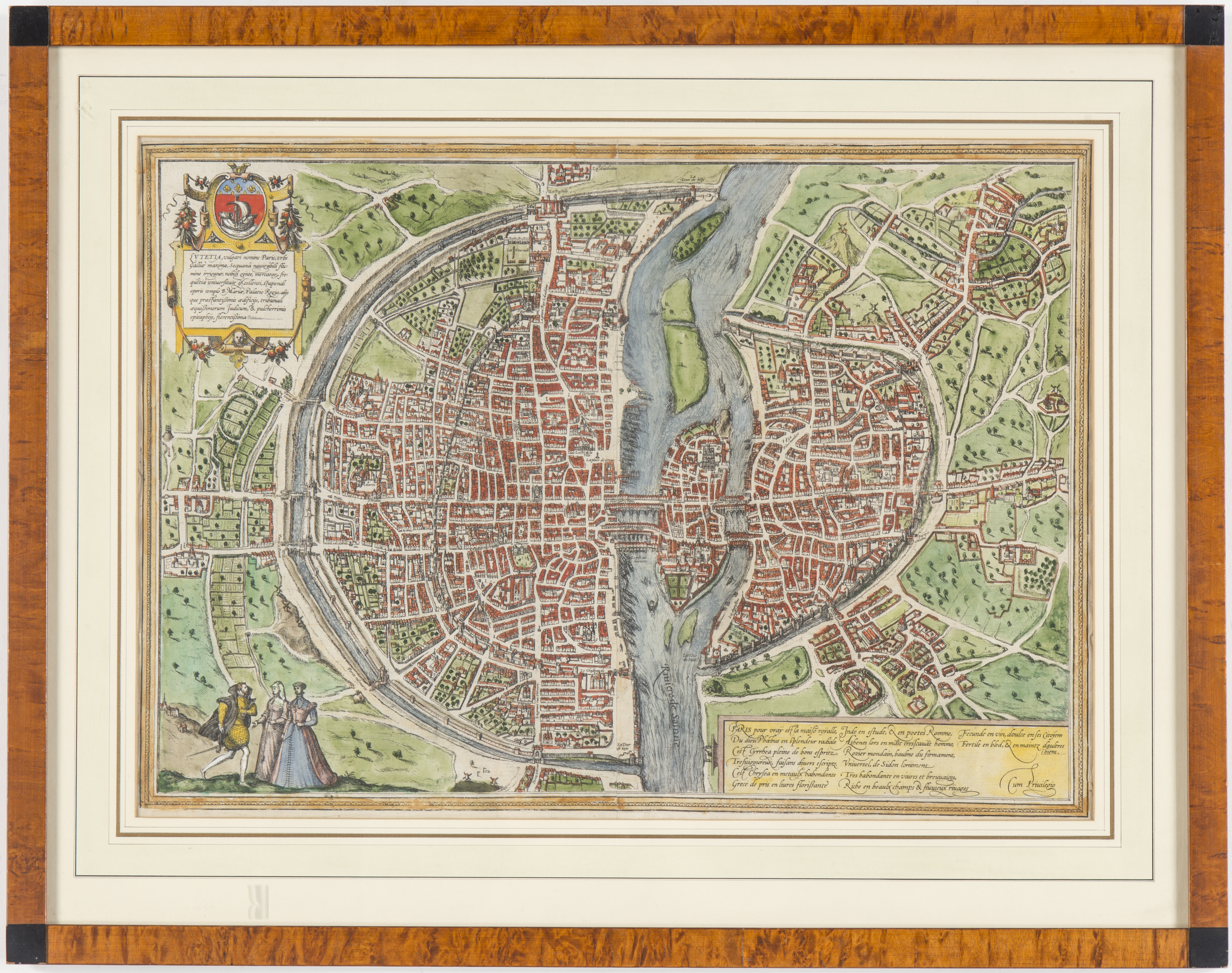
Paris, Braun et Hogenberg |
| Description |
English: The Braun map of Paris depicts the city with a bird's-eye view to the east as it appeared around 1530. The map includes the city wall of Philippe Auguste, and shows gates in the section of the wall on the Right Bank, which would be pulled down after 1530. It was first published in Cologne in 1572 as the sixth plate (unnumbered) in Civitates Orbis Terrarum, Liber primus by Georg Braun, Simon Van der Novel, and Franz Hogenberg. |
| Date | circa 1530 |
| Source | Paris, Braun et Hogenberg - Bukowskis |
| Creator |
Georg Braun, Simon Van der Novel, and Franz Hogenberg |
| Geotemporal data | |
| Map location | Paris |
| Georeferencing | If inappropriate please set warp_status = skip to hide. |
| Archival data | |
| Dimensions | 34 x 47.5 cm. |
| Medium | Partially colored |
Licensing
[edit]
|
This work is in the public domain in its country of origin and other countries and areas where the copyright term is the author's life plus 100 years or fewer. | |
| This file has been identified as being free of known restrictions under copyright law, including all related and neighboring rights. | |
File history
Click on a date/time to view the file as it appeared at that time.
| Date/Time | Thumbnail | Dimensions | User | Comment | |
|---|---|---|---|---|---|
| current | 16:29, 2 August 2021 | | 4,235 × 3,347 (8.99 MB) | Remitamine (talk | contribs) | Higher resolution version |
| 15:17, 3 October 2017 |  | 2,420 × 1,760 (5.14 MB) | Paris 16 (talk | contribs) | User created page with UploadWizard |
You cannot overwrite this file.
File usage on Commons
The following page uses this file: