File:Mappa baia di Alassio.svg
Jump to navigation
Jump to search

Size of this PNG preview of this SVG file: 521 × 599 pixels. Other resolutions: 209 × 240 pixels | 417 × 480 pixels | 667 × 768 pixels | 890 × 1,024 pixels | 1,780 × 2,048 pixels | 664 × 764 pixels.
Original file (SVG file, nominally 664 × 764 pixels, file size: 82 KB)
Captions
Captions
Add a one-line explanation of what this file represents
Summary
[edit]
| Description |
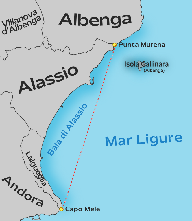
Italiano: Mappa di localizzazione della baia di Alassio |
|||
| Date | ||||
| Source | Own work. Borders from OpenStreetMap. | |||
| Author |
This vector image includes elements that have been taken or adapted from this file: This vector image includes elements that have been taken or adapted from this file: |
|||
| Permission (Reusing this file) |
I, the copyright holder of this work, hereby publish it under the following license:
|
.svg)
.svg)
File history
Click on a date/time to view the file as it appeared at that time.
| Date/Time | Thumbnail | Dimensions | User | Comment | |
|---|---|---|---|---|---|
| current | 12:26, 17 March 2024 | | 664 × 764 (82 KB) | Arrow303 (talk | contribs) | fix as per it:Speciale:LinkPermanente/138363707#Capo Mele |
| 22:58, 16 March 2024 |  | 664 × 764 (79 KB) | Ashoppio (talk | contribs) | fix | |
| 22:16, 16 March 2024 |  | 664 × 764 (78 KB) | Ashoppio (talk | contribs) | updated | |
| 21:34, 16 March 2024 |  | 664 × 764 (277 KB) | Arrow303 (talk | contribs) | font size | |
| 21:33, 16 March 2024 |  | 664 × 764 (277 KB) | Arrow303 (talk | contribs) | {{Information |Description={{it|Mappa di localizzazione della baia di Alassio}} |Source={{own}}. Borders from OpenStreetMap. |Date=2024-03-16 |Author= *'''OpenStreetMap data:''' OpenStreetMap contributors *{{author|derivative|{{u|Arrow303}}}} {{attrib|Map_of_comune_of_Alassio_(province_of_Savona,_region_Liguria,_Italy).svg|U=Vonvikken}} {{attrib|Map_of_comune_of_Diano_Marina_(province_of_Imperia,_region_Liguria,_Italy).svg|U=Vonvikken}} |Permission={{self|ODbL OpenStreetMap}}... |
You cannot overwrite this file.
File usage on Commons
The following 4 pages use this file:
File usage on other wikis
The following other wikis use this file:
- Usage on it.wikipedia.org