Category:Map Lab-it
Appearance

- English: Maps which are improved or created by the Wikigraphists of the Italian Graphic Lab.
- Italiano: Cartine create o migliorate dai Wikigrafici del Laboratorio grafico.
Media in category "Map Lab-it"
The following 200 files are in this category, out of 408 total.
(previous page) (next page)-
198px Mappa Paesi Etnei.png 198 × 249; 11 KB
-
2024 European Parliament Election in Italy-it.svg 839 × 983; 9.59 MB
-
Achaemenid Empire it.svg 1,500 × 680; 2.35 MB
-
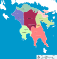
Achean league 150aC-it.svg 785 × 509; 6.25 MB
-
Adriatic sea pliocene (vector).svg 1,759 × 2,167; 2 MB
-
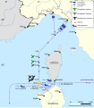
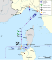
Affondamento corazzata Roma 1943-9-9 mappa 2.svg 705 × 809; 565 KB
-
Affondamento corazzata Roma 1943-9-9 mappa.svg 705 × 809; 565 KB
-
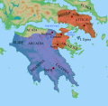
Ancient peloponnese.svg 778 × 800; 87 KB
-
Arcipelaghi italiani.svg 1,034 × 1,299; 1.55 MB
-
Arcipelago toscano.svg 600 × 490; 901 KB
-
Areale Testudo graeca.svg 334 × 134; 211 KB
-
Aree protette della Lombardia.svg 1,175 × 1,123; 289 KB
-
Arturo Ferrarin - Roma-Tokyo.svg 3,555 × 1,568; 11.01 MB
-
Asia in 1335-it.svg 1,100 × 837; 1.03 MB
-
Assedio dell'aeroporto di Kuwayris 10 nov 2015.svg 562 × 284; 265 KB
-
Assedio dell'aeroporto di Kuwayris 14 sett 2015.svg 562 × 284; 254 KB
-
Austria Hungary ethnic it.svg 1,381 × 1,078; 1.27 MB
-
Azawad map-italian.jpg 660 × 706; 130 KB
-
Base navale di Pearl Harbor.png 1,292 × 1,760; 635 KB
-
Battaglia dello Scire.svg 932 × 1,462; 3.39 MB
-
Battaglia di Ostrach.svg 1,779 × 851; 528 KB
-
Battaglia di Stockach.svg 927 × 568; 398 KB
-
Battaglie del Danubio 1799.svg 1,024 × 780; 410 KB
-
Battle of Legnano 1176-05-29.gif 2,082 × 1,633; 113 KB
-
Battle of Marathon Initial Situation (alt) (it).svg 741 × 560; 222 KB
-
Battle of Marathon Initial Situation (it).svg 741 × 560; 222 KB
-
Battle of Thermopylae-it.svg 682 × 500; 383 KB
-
BattleofKerenMap1941-it.svg 1,174 × 806; 71 KB
-
Beaker culture diffusion.svg 383 × 339; 2.61 MB
-
Bhutan map blank (1992-2007).svg 800 × 450; 247 KB
-
Boeotia ancient-it.svg 627 × 442; 436 KB
-
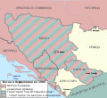
Bosnie et Sandjak 1904 mk.svg 2,000 × 1,826; 132 KB
-
Bosnie et Sandjak 1904.svg 2,000 × 1,826; 139 KB
-
Campagna dell'Africa Orientale Italiana.png 2,321 × 2,864; 867 KB
-
Cartina Comune BZ Braies.png 680 × 430; 17 KB
-
Cartina Comune BZ Caldaro sulla strada del vino.png 680 × 430; 17 KB
-
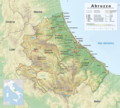
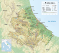
Cartina fisica Abruzzo 2019.png 2,620 × 2,363; 7 MB
-
Cartina fisica Abruzzo 2019.xcf 2,620 × 2,363; 12.83 MB
-
Cartina via delle Forze Armate (Milano) con ex comuni.svg 1,148 × 700; 1.82 MB
-
Central Asia 1029-1030-it.png 1,742 × 1,500; 857 KB
-
Central dsongdey in Bhutan (1992-2007).svg 800 × 450; 247 KB
-
Central europe 9th century-it.svg 425 × 338; 44 KB
-
Chagang-do in North Korea 2010.svg 1,606 × 1,616; 413 KB
-
Colonie greche eoliche ioniche doriche in Anatolia.svg 2,553 × 2,595; 3.46 MB
-
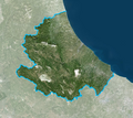
Confini Abruzzo-var.png 874 × 781; 952 KB
-
Confini Campania-var.png 1,081 × 826; 1.11 MB
-
Confini del Molise-var.png 658 × 586; 603 KB
-
Confini della Basilicata-var.png 934 × 776; 997 KB
-
Confini della Calabria-var.png 454 × 605; 224 KB
-
Confini della Puglia-var.png 890 × 699; 508 KB
-
Contrade di Legnano.svg 1,067 × 880; 5.03 MB
-
Contrade di Milano.svg 971 × 861; 3.42 MB
-
Controffensiva etiope - dicembre 1935.svg 1,861 × 1,292; 5.79 MB
-
Corfu Channel topographic map-en.svg 595 × 755; 2.23 MB
-
Corvus cornix map.svg 2,500 × 1,367; 1.46 MB
-
Crescita del territorio della Libia.PNG 789 × 768; 231 KB
-
Cultura di Canegrate map.svg 558 × 447; 692 KB
-
Czech Republic map.svg 730 × 782; 244 KB
-
Dagestan-it.svg 391 × 528; 812 KB
-
Dalmazia - Croazia meridionale.jpg 1,359 × 1,064; 546 KB
-
Deuxième croisade-it.svg 1,866 × 1,169; 340 KB
-
Dialetti italiani meridionali estremi.svg 612 × 609; 530 KB
-
Dialetti siciliani 1888 Schneegans.svg 522 × 379; 41 KB
-
Dialetti siciliani colors.svg 316 × 245; 66 KB
-
Dialetti siciliani.svg 316 × 245; 81 KB
-
Dialetto alassino.svg 1,138 × 601; 149 KB
-
Diffusione cultura vaso campaniforme.svg 383 × 339; 2.59 MB
-
Diocesi di Massa Marittima.png 2,823 × 2,327; 304 KB
-
Diocesi di Treviso.png 761 × 424; 38 KB
-
Dito di Caprivi - mappa.svg 1,065 × 609; 1.47 MB
-
Eastern dsongdey in Bhutan (1992-2007).svg 800 × 450; 247 KB
-
Egypt 2nd invasion-it.svg 578 × 462; 37 KB
-
Egypt 3rd invasion-it.svg 578 × 462; 43 KB
-
Egypt 4th invasion-it.svg 578 × 462; 41 KB
-
Elezioni presidenziali USA del 1800.svg 600 × 565; 442 KB
-
Ellesponto map.svg 345 × 335; 183 KB
-
Ethiopia Map 1930 it.svg 559 × 609; 538 KB
-
Ethiopia Map 1934 it.svg 559 × 609; 578 KB
-
Ethiopia War Map (1935-feb 1936) it.svg 559 × 562; 732 KB
-
Ethiopia War Map (may 1936) it.svg 559 × 562; 1,008 KB
-
Etruria nuragica.svg 1,594 × 1,266; 743 KB
-
EU NUTS 2 Adriatic Euroregion.svg 535 × 389; 1,022 KB
-
Europe 814-it.svg 512 × 336; 910 KB
-
Europe islands.svg 700 × 545; 1.78 MB
-
Europe orthographic Caucasus Urals boundary.svg 537 × 536; 77 KB
-
Europe polar stereographic Caucasus Urals boundary.svg 700 × 545; 1.32 MB
-
Foreign embassies in Naples.svg 914 × 403; 1.24 MB
-
Foreign embassies in Rome and in Naples.svg 914 × 403; 1.29 MB
-
FORMA URBIS DI MEDIOLANUM.svg 683 × 641; 2.47 MB
-
Gallipolimap-it.svg 600 × 550; 34 KB
-
Giudicati sardi 2.svg 389 × 599; 67 KB
-
Giudicato di Arborea 2.svg 500 × 550; 245 KB
-
Great Moravia during Svatopluk (it).svg 512 × 341; 466 KB
-
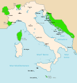
Greater Italy 1919 map.svg 3,823 × 4,150; 697 KB
-
Greece (ancient) Attica (cropped).svg 856 × 773; 1.75 MB
-
Greece (ancient) Attica (relief-cropped).png 640 × 578; 380 KB
-
Greece (ancient) Attica.svg 7,460 × 7,505; 1.74 MB
-
Greece (ancient) Central (cropped).svg 1,937 × 1,253; 1.75 MB
-
Greece (ancient) Central (relief-cropped).png 640 × 414; 305 KB
-
Greece (ancient) Central.svg 7,460 × 7,505; 1.74 MB
-
Greece (ancient) Chalcidice (cropped).svg 1,591 × 1,204; 1.75 MB
-
Greece (ancient) Chalcidice (relief-cropped).png 1,024 × 774; 615 KB
-
Greece (ancient) Chalcidice.svg 7,460 × 7,505; 1.64 MB
-
Greece (ancient) Crete (cropped).svg 2,743 × 1,313; 1.75 MB
-
Greece (ancient) Crete (relief-cropped).png 1,024 × 486; 378 KB
-
Greece (ancient) Crete.svg 7,460 × 7,505; 1.74 MB
-
Greece (ancient) Epirus (cropped).svg 1,740 × 1,559; 1.76 MB
-
Greece (ancient) Epirus (relief-cropped).png 640 × 603; 346 KB
-
Greece (ancient) Epirus.svg 7,460 × 7,505; 1.74 MB
-
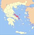
Greece (ancient) Euboea (cropped).svg 1,599 × 1,229; 1.75 MB
-
Greece (ancient) Euboea (relief-cropped).png 1,024 × 796; 717 KB
-
Greece (ancient) Euboea.svg 7,460 × 7,505; 1.74 MB
-
Greece (ancient) IonianIslands (cropped).svg 1,161 × 1,815; 1.75 MB
-
Greece (ancient) IonianIslands (relief-cropped).png 828 × 1,280; 292 KB
-
Greece (ancient) IonianIslands.svg 7,460 × 7,505; 1.75 MB
-
Greece (ancient) Macedonia (cropped).svg 2,697 × 1,837; 1.75 MB
-
Greece (ancient) Macedonia (relief-cropped).png 1,024 × 716; 590 KB
-
Greece (ancient) Macedonia.svg 7,460 × 7,505; 1.75 MB
-
Greece (ancient) NorthAegean (cropped).svg 1,839 × 2,761; 1.75 MB
-
Greece (ancient) NorthAegean (relief-cropped).png 640 × 961; 462 KB
-
Greece (ancient) NorthAegean.svg 7,460 × 7,505; 1.75 MB
-
Greece (ancient) Peloponnesus (cropped).svg 2,108 × 2,411; 1.75 MB
-
Greece (ancient) Peloponnesus (relief-cropped).png 920 × 1,024; 955 KB
-
Greece (ancient) Peloponnesus.svg 7,460 × 7,505; 1.75 MB
-
Greece (ancient) SouthAegean (cropped).svg 3,546 × 2,844; 1.75 MB
-
Greece (ancient) SouthAegean (relief-cropped).png 1,024 × 843; 710 KB
-
Greece (ancient) SouthAegean.svg 7,460 × 7,505; 1.75 MB
-
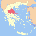
Greece (ancient) Thessaly (cropped).svg 2,695 × 1,393; 1.75 MB
-
Greece (ancient) Thessaly (relief-cropped).png 640 × 336; 203 KB
-
Greece (ancient) Thessaly.svg 7,460 × 7,505; 1.75 MB
-
Greecemap-it.svg 993 × 793; 3.2 MB
-
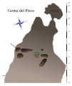
Grotta del Pisco.svg 631 × 750; 47 KB
-
Guadalcanal and Florida Islands.png 800 × 604; 638 KB
-
Guadalcanal Aug 7 landings (it).svg 520 × 398; 414 KB
-
Guerre Gotiche prima fase 535-540.svg 1,278 × 817; 1.27 MB
-
Hamgyongbuk-do in North Korea 2010.svg 1,606 × 1,616; 323 KB
-
Hamgyongnam-do in North Korea 2010.svg 1,606 × 1,616; 323 KB
-
Hattuscha Overview Map-it.svg 640 × 899; 152 KB
-
Hilfe Geotools Beispiel 2.svg 454 × 230; 105 KB
-
Historical Pakistan - it.gif 634 × 646; 28 KB
-
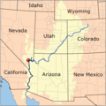
Hover Dam 2.png 1,000 × 1,004; 369 KB
-
Hover Dam.png 1,000 × 1,004; 356 KB
-
Hungary 11th cent-it.png 3,000 × 2,078; 1.24 MB
-
Hwanghaebuk-do in North Korea 2010.svg 1,606 × 1,616; 317 KB
-
Hwanghaenam-do in North Korea 2010.svg 1,606 × 1,616; 323 KB
-
Idioma véneto.PNG 1,001 × 767; 204 KB
-
IdrografiaMilano2018.svg 2,287 × 989; 23.74 MB
-
Invasione italiana della Somalia brittanica (1940) mappa.svg 1,057 × 674; 55 KB
-
Ionian Revolt Campaign Map-it.svg 1,331 × 1,755; 1.74 MB
-
Irrigazione mesopotamica.svg 476 × 245; 11 KB
-
Isola Calva - Locator map - Terrain-background.jpg 1,000 × 1,500; 220 KB
-
Isole della Sardegna.svg 400 × 550; 622 KB
-
Isole della Sicilia.svg 560 × 620; 328 KB
-
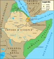
IT Etiopia map.png 325 × 350; 47 KB
-
Italia 1494 topo.svg 3,522 × 2,368; 2.04 MB
-
Italia WLM mappa.svg 1,035 × 1,300; 1.72 MB
-
Italian social republic map ITA.png 953 × 912; 70 KB
-
Italy 1494 AD-it.svg 688 × 930; 418 KB
-
Italy 1796 it.svg 3,662 × 4,309; 573 KB
-
Italy location map 1905.svg 1,034 × 1,299; 639 KB
-
Italy provincial location map 2015.svg 1,034 × 1,299; 3.03 MB
-
Italy Sicily map crop.svg 522 × 379; 79 KB
-
Kaesong in North Korea 2010.svg 1,606 × 1,616; 324 KB
-
Kangwon-do in North Korea 2010.svg 1,606 × 1,616; 318 KB
-
Karte Quartiere Bezirk Lugano 2013-it (vector).svg 898 × 1,026; 611 KB
-
Kingdom of the Two Sicilies stub icon.svg 450 × 600; 976 KB
-
Knowledge of Spanish in European Union.svg 570 × 600; 276 KB
-
Lechaeum-it.svg 398 × 304; 143 KB
-
Lingue semitiche.svg 339 × 535; 137 KB
-
Linguistic map of Italy.png 1,591 × 2,054; 316 KB
-
Litorale del Cavallino.png 386 × 206; 69 KB
-
Lobo diffusion map.svg 914 × 403; 1.23 MB
-
Location map of Novate Mezzola, Novate Brianza, Novate Milanese-it.svg 270 × 325; 591 KB
-
Map athenian empire 431 BC-it.svg 993 × 794; 2.92 MB
-
Map Cleomenean War-it.svg 750 × 741; 1.24 MB
-
Map Corinth War-it.svg 936 × 909; 965 KB
-
Map Crusader states 1165-it.svg 955 × 1,315; 129 KB
-
Map Crusader states 1197-it.svg 507 × 690; 77 KB
-
Map Greco-Persian Wars-blank.svg 993 × 794; 3.12 MB
-
Map Greco-Persian Wars-it.svg 993 × 795; 3.16 MB
-
Map of Arabic speaking localities in Israel-it.png 4,773 × 7,667; 671 KB
-
Map of comune of Agordo (province of Belluno, region Veneto, Italy).svg 4,108 × 4,413; 100 KB
-
Map of comune of Alano di Piave (province of Belluno, region Veneto, Italy).svg 4,108 × 4,413; 98 KB
-
Map of comune of Alleghe (province of Belluno, region Veneto, Italy).svg 4,108 × 4,413; 100 KB
-
Map of comune of Alpago (province of Belluno, region Veneto, Italy).svg 4,108 × 4,413; 102 KB
-
Map of comune of Arsiè (province of Belluno, region Veneto, Italy).svg 4,108 × 4,413; 100 KB
-
Map of comune of Auronzo di Cadore (province of Belluno, region Veneto, Italy).svg 4,108 × 4,413; 100 KB
-
Map of comune of Barbarano Mossano (province of Vicenza, region Veneto, Italy).svg 2,691 × 4,175; 124 KB
-
Map of comune of Belluno (province of Belluno, region Veneto, Italy).svg 4,108 × 4,413; 100 KB
-
Map of comune of Borca di Cadore (province of Belluno, region Veneto, Italy).svg 4,108 × 4,413; 100 KB
-
Map of comune of Borgo Valbelluna (province of Belluno, region Veneto, Italy).svg 4,108 × 4,413; 100 KB
-
Map of comune of Calalzo di Cadore (province of Belluno, region Veneto, Italy).svg 4,108 × 4,413; 100 KB
-
Map of comune of Canale d'Agordo (province of Belluno, region Veneto, Italy).svg 4,108 × 4,413; 100 KB


