File:Map showing detailed topography of the country traversed by the reconnaissance expedition through southern and southeastern Nevada LOC 2007632279.tif
Jump to navigation
Jump to search

Size of this JPG preview of this TIF file: 335 × 600 pixels. Other resolutions: 134 × 240 pixels | 268 × 480 pixels | 429 × 768 pixels | 572 × 1,024 pixels | 1,143 × 2,048 pixels | 6,306 × 11,292 pixels.
Original file (6,306 × 11,292 pixels, file size: 203.73 MB, MIME type: image/tiff)
Captions
Captions
Add a one-line explanation of what this file represents
Summary
[edit]| Description |
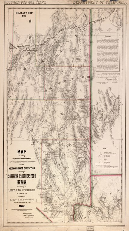
English: Covers Elko, White Pine, Lander, Nye, and Lincoln counties in Nevada. Relief shown by hachures and spot heights. Gift; Miss Eleanor Sherman Fitch; July 7, 1942. "Officially compiled and published at the Engineer Office, Head Quarters Department of California in 1869 and 70, by order of Brigadier General E. O. C. Ord, Commdg. [signed in facsimile] Geo. M. Wheeler, Lieutenant of Engineers in charge. Head Quarters Dept. of Cal., Oct. 26th 1870." LC Civil War maps (2nd ed.), S182 Available also through the Library of Congress Web site as a raster image. Copy imperfect: Holes and losses along top and bottom edges repaired with tape. Includes text. In red on verso: 23. |
||
| Title | Map showing detailed topography of the country traversed by the reconnaissance expedition through southern and southeastern Nevada | ||
| Shelf ID | G4350 1870 .H2 | ||
| Date | |||
| Source | https://www.loc.gov/item/2007632279/ | ||
| Author | Hamel, P. W.; Wheeler, George M. (George Montague); Lockwood, D. W. (Daniel Wright) | ||
| Permission (Reusing this file) |
|
||
| Other versions |
|
||
| Location | United States · Nevada | ||
| Part of | Military Battles And Campaigns · American Memory · Civil War Maps · Catalog · Geography And Map Division | ||
| Subject | United States · Maps · Nevada · Military Topography · Maps, Topographic |


Licensing
[edit]|
This is a faithful photographic reproduction of a two-dimensional, public domain work of art. The work of art itself is in the public domain for the following reason:
The official position taken by the Wikimedia Foundation is that "faithful reproductions of two-dimensional public domain works of art are public domain".
This photographic reproduction is therefore also considered to be in the public domain in the United States. In other jurisdictions, re-use of this content may be restricted; see Reuse of PD-Art photographs for details. | ||||
File history
Click on a date/time to view the file as it appeared at that time.
| Date/Time | Thumbnail | Dimensions | User | Comment | |
|---|---|---|---|---|---|
| current | 02:30, 31 May 2018 |  | 6,306 × 11,292 (203.73 MB) | Fæ (talk | contribs) | LOC Maps https://www.loc.gov/item/2007632279/ #15845 |
You cannot overwrite this file.
File usage on Commons
The following page uses this file: