File:Map of the United States and territories, showing the extent of public surveys and other details LOC 83691754.jpg
Jump to navigation
Jump to search

Size of this preview: 800 × 423 pixels. Other resolutions: 320 × 169 pixels | 640 × 338 pixels | 1,024 × 541 pixels | 1,280 × 677 pixels | 2,560 × 1,353 pixels | 16,793 × 8,876 pixels.
Original file (16,793 × 8,876 pixels, file size: 21.13 MB, MIME type: image/jpeg)
Captions
Captions
Add a one-line explanation of what this file represents
Summary
[edit]| Warning | The original file is very high-resolution. It might not load properly or could cause your browser to freeze when opened at full size. |
|---|
| Description |
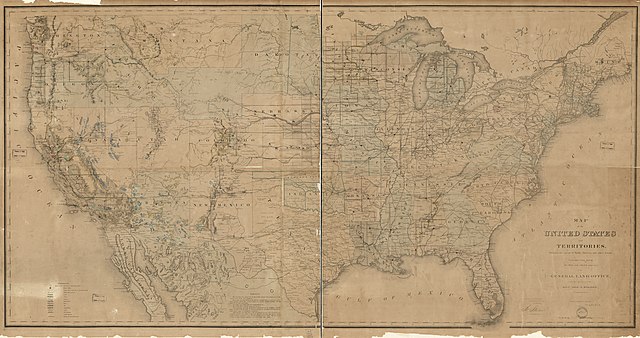
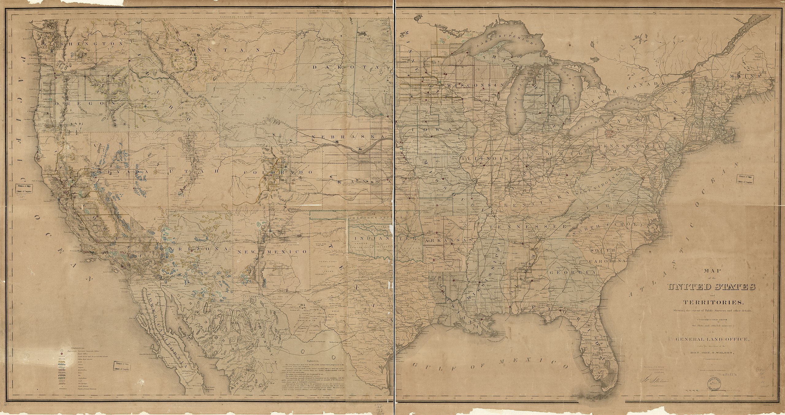
English: Relief shown by hachures. Also shows mine and mineral resources and Surveyor General and Land Office locations. From the General Land Office annual report, 1867. Available also through the Library of Congress Web site as a raster image. Includes notes. Vault |
||
| Title | Map of the United States and territories, showing the extent of public surveys and other details | ||
| Shelf ID | G3701.B5 1867 .U5 | ||
| Date | |||
| Source | https://www.loc.gov/item/83691754/ | ||
| Author | United States. General Land Office; Gorlinki, Joseph | ||
| Permission (Reusing this file) |
|
||
| Other versions |
|
||
| Location | United States | ||
| Part of | American Memory · General Maps · Catalog · Geography And Map Division | ||
| Subject | United States · Maps · Surveys · Mines And Mineral Resources |


Licensing
[edit]
|
This is a faithful photographic reproduction of a two-dimensional, public domain work of art. The work of art itself is in the public domain for the following reason:
The official position taken by the Wikimedia Foundation is that "faithful reproductions of two-dimensional public domain works of art are public domain".
This photographic reproduction is therefore also considered to be in the public domain in the United States. In other jurisdictions, re-use of this content may be restricted; see Reuse of PD-Art photographs for details. | ||||
File history
Click on a date/time to view the file as it appeared at that time.
| Date/Time | Thumbnail | Dimensions | User | Comment | |
|---|---|---|---|---|---|
| current | 01:24, 8 June 2018 | | 16,793 × 8,876 (21.13 MB) | Fæ (talk | contribs) | LOC Maps https://www.loc.gov/item/83691754/ #23282 |
You cannot overwrite this file.
File usage on Commons
The following page uses this file: