File:Map of the District North of Red River & North Western District, La. LOC 83695471.jpg
Jump to navigation
Jump to search

Size of this preview: 693 × 599 pixels. Other resolutions: 278 × 240 pixels | 555 × 480 pixels | 888 × 768 pixels | 1,184 × 1,024 pixels | 2,368 × 2,048 pixels | 3,289 × 2,845 pixels.
Original file (3,289 × 2,845 pixels, file size: 1.05 MB, MIME type: image/jpeg)
Captions
Captions
Add a one-line explanation of what this file represents
Summary
[edit]| Description |
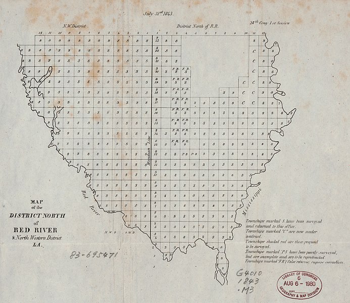
English: "July 31st, 1843." Shows the area enclosed by the Mississippi River, the Red River, and the northern border of Louisiana. Available also through the Library of Congress Web site as a raster image. |
||
| Title | Map of the District North of Red River & North Western District, La. | ||
| Shelf ID | G4010 1843 .M3 | ||
| Date | |||
| Source | https://www.loc.gov/item/83695471/ | ||
| Author | United States. Congress House | ||
| Permission (Reusing this file) |
|
||
| Other versions |
|
||
| Location | United States · Louisiana. · Louisiana | ||
| Part of | American Memory · General Maps · Catalog · Geography And Map Division | ||
| Subject | United States · Maps · Louisiana |


Licensing
[edit]
|
This is a faithful photographic reproduction of a two-dimensional, public domain work of art. The work of art itself is in the public domain for the following reason:
The official position taken by the Wikimedia Foundation is that "faithful reproductions of two-dimensional public domain works of art are public domain".
This photographic reproduction is therefore also considered to be in the public domain in the United States. In other jurisdictions, re-use of this content may be restricted; see Reuse of PD-Art photographs for details. | ||||
File history
Click on a date/time to view the file as it appeared at that time.
| Date/Time | Thumbnail | Dimensions | User | Comment | |
|---|---|---|---|---|---|
| current | 11:24, 29 May 2019 | | 3,289 × 2,845 (1.05 MB) | Fæ (talk | contribs) | LOC Maps https://www.loc.gov/item/83695471/ #15888 |
You cannot overwrite this file.
File usage on Commons
The following page uses this file: