File:Map of the Caucasus and portion of Turkey in Asia. (IA bp 33297).pdf
Jump to navigation
Jump to search

Size of this JPG preview of this PDF file: 800 × 537 pixels. Other resolutions: 320 × 215 pixels | 640 × 430 pixels | 1,024 × 688 pixels | 1,429 × 960 pixels.
Original file (1,429 × 960 pixels, file size: 454 KB, MIME type: application/pdf)
Captions
Captions
Add a one-line explanation of what this file represents
Summary
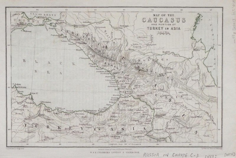
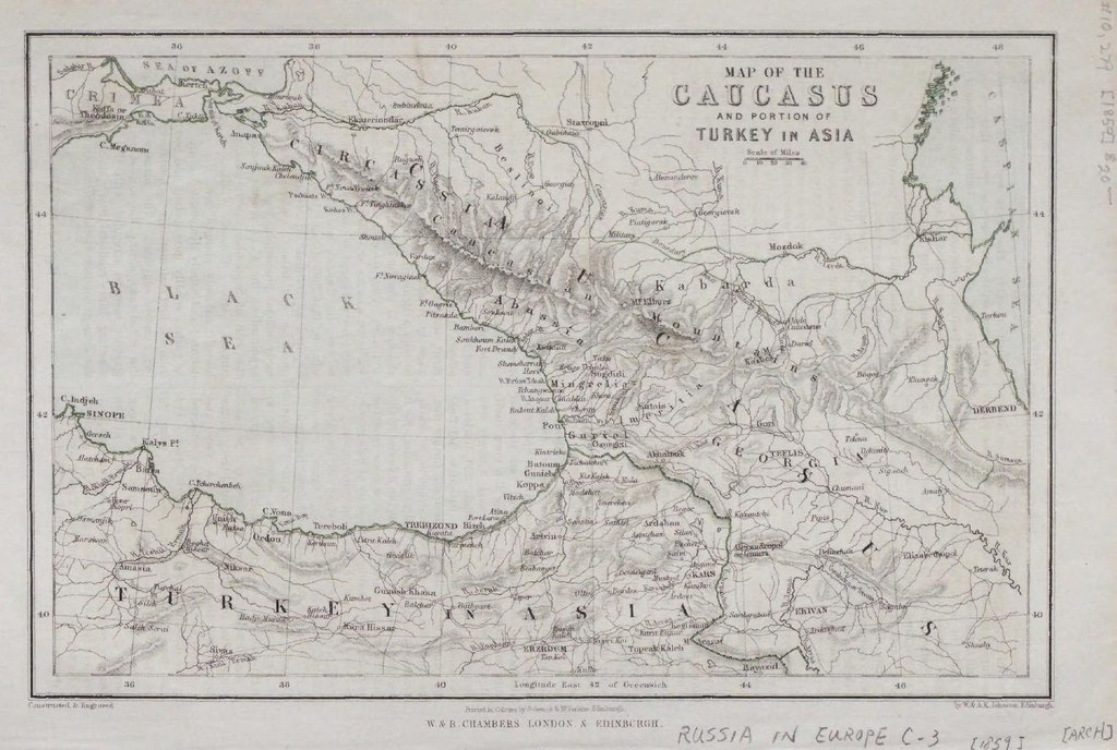
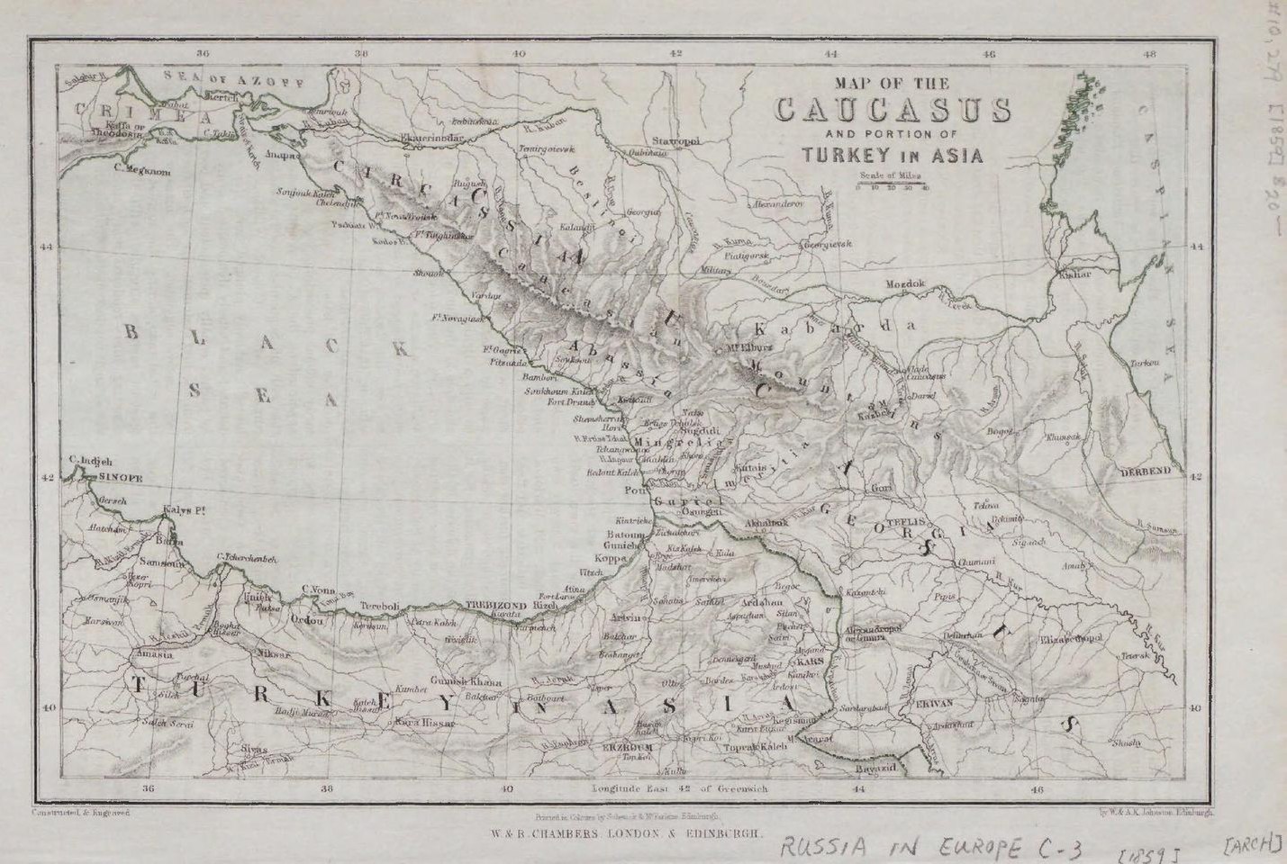
[edit]| Map of the Caucasus and portion of Turkey in Asia.
( |
|
|---|---|
| Title |
Map of the Caucasus and portion of Turkey in Asia. |
| Publisher |
W. & R. Chambers, London |
| Description |
From the Whistance-Smith Collection.;B&w with col. outline, 13.3 x 21 cm.;Includes region of Caucasus between Black and Caspian seas and North eastern Turkey.;"W. & A. K. Johnston, Edinburgh";Includes place names hydrology and roads.;Relief shown by hachures. Subjects: Russia in Europe--Physical sciences |
| Language | English |
| Publication date | [1859] |
| Current location |
IA Collections: wcw_gale; wcw; university_of_alberta_libraries; toronto |
| Accession number |
bp_33297 |
| Notes | Scale: Ca. 1:5,000,000 |
| Source | |
Licensing
[edit]|
This work is in the public domain in its country of origin and other countries and areas where the copyright term is the author's life plus 70 years or fewer. | |
| This file has been identified as being free of known restrictions under copyright law, including all related and neighboring rights. | |
File history
Click on a date/time to view the file as it appeared at that time.
| Date/Time | Thumbnail | Dimensions | User | Comment | |
|---|---|---|---|---|---|
| current | 13:08, 27 August 2021 |  | 1,429 × 960 (454 KB) | Fæ (talk | contribs) | IA Query "collection:(wcw) date:[1000 TO 1899]" bp_33297 Category:William C. Wonders Map Collection (COM:IA books#query) (1859 #318) |
You cannot overwrite this file.
File usage on Commons
The following page uses this file: