File:Map of the Canadian Pacific Railway, and its connections. (IA bp 33347).pdf
Jump to navigation
Jump to search

Size of this JPG preview of this PDF file: 800 × 400 pixels. Other resolutions: 320 × 160 pixels | 640 × 320 pixels | 1,024 × 512 pixels | 1,280 × 640 pixels | 3,752 × 1,875 pixels.
Original file (3,752 × 1,875 pixels, file size: 2.4 MB, MIME type: application/pdf)
Captions
Captions
Add a one-line explanation of what this file represents
Summary
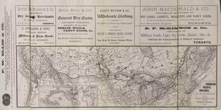
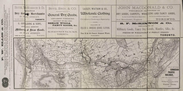
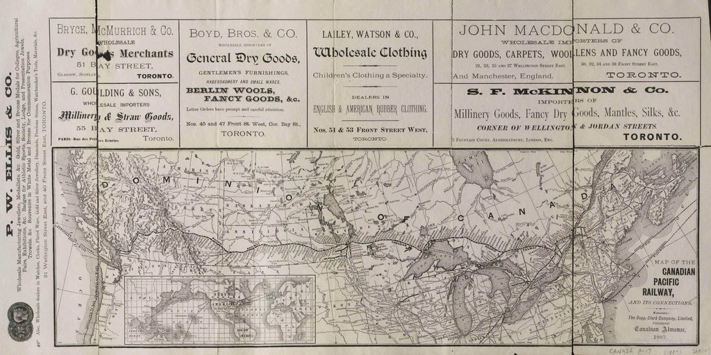
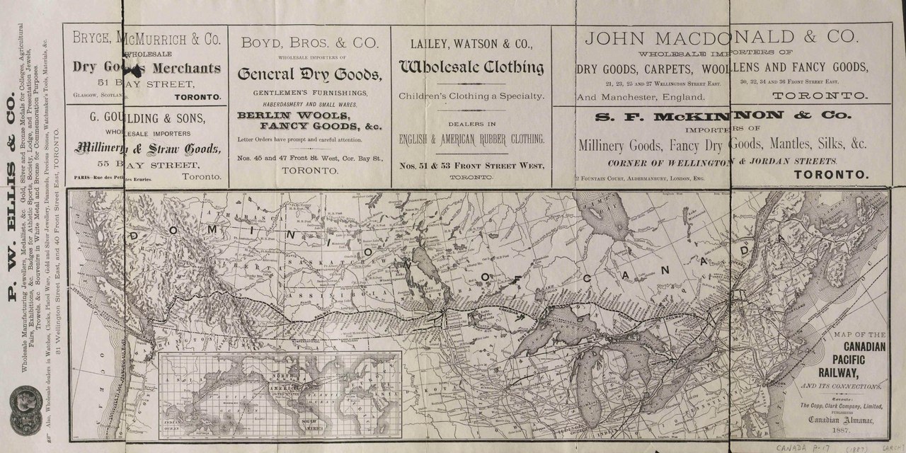
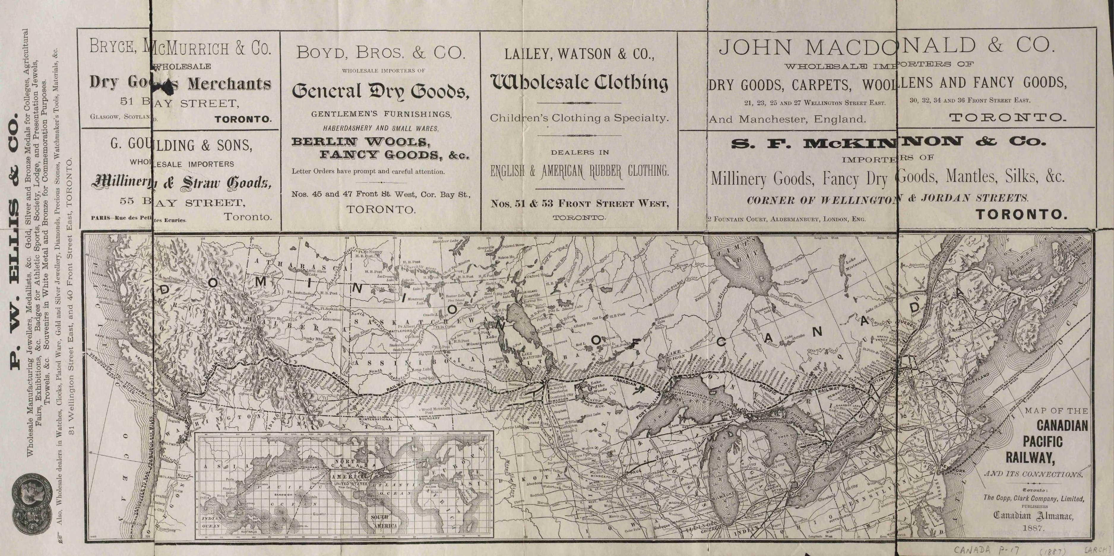
[edit]| Map of the Canadian Pacific Railway, and its connections.
( |
|
|---|---|
| Title |
Map of the Canadian Pacific Railway, and its connections. |
| Publisher |
Burland, Lafrican & Co., Montreal |
| Description |
Inset: North American centered world map with major oceanic shipping routes to/from Canada.;Advertisements above map.;On sheet 33.3 x 66.3 cm., folded as inserted.;Includes main railway lines, station names & connections into Northern United States.;Hydrology & Hudson Bay posts. Subjects: Canada--Transportation and communication |
| Language | English |
| Publication date | 1887 |
| Current location |
IA Collections: wcw_gale; wcw; university_of_alberta_libraries; toronto |
| Accession number |
bp_33347 |
| Source | |
Licensing
[edit]|
This work is in the public domain in its country of origin and other countries and areas where the copyright term is the author's life plus 70 years or fewer. | |
| This file has been identified as being free of known restrictions under copyright law, including all related and neighboring rights. | |
File history
Click on a date/time to view the file as it appeared at that time.
| Date/Time | Thumbnail | Dimensions | User | Comment | |
|---|---|---|---|---|---|
| current | 13:09, 27 August 2021 |  | 3,752 × 1,875 (2.4 MB) | Fæ (talk | contribs) | IA Query "collection:(wcw) date:[1000 TO 1899]" bp_33347 Category:William C. Wonders Map Collection (COM:IA books#query) (1887 #322) |
You cannot overwrite this file.
File usage on Commons
The following page uses this file: