File:Map of part of Matabeliland - btv1b8441512d.jpg
Jump to navigation
Jump to search
Size of this preview: 476 × 600 pixels. Other resolutions: 190 × 240 pixels | 381 × 480 pixels | 609 × 768 pixels | 812 × 1,024 pixels | 1,625 × 2,048 pixels | 6,228 × 7,849 pixels.
Original file (6,228 × 7,849 pixels, file size: 5.8 MB, MIME type: image/jpeg)
Captions
Captions
Add a one-line explanation of what this file represents
Summary
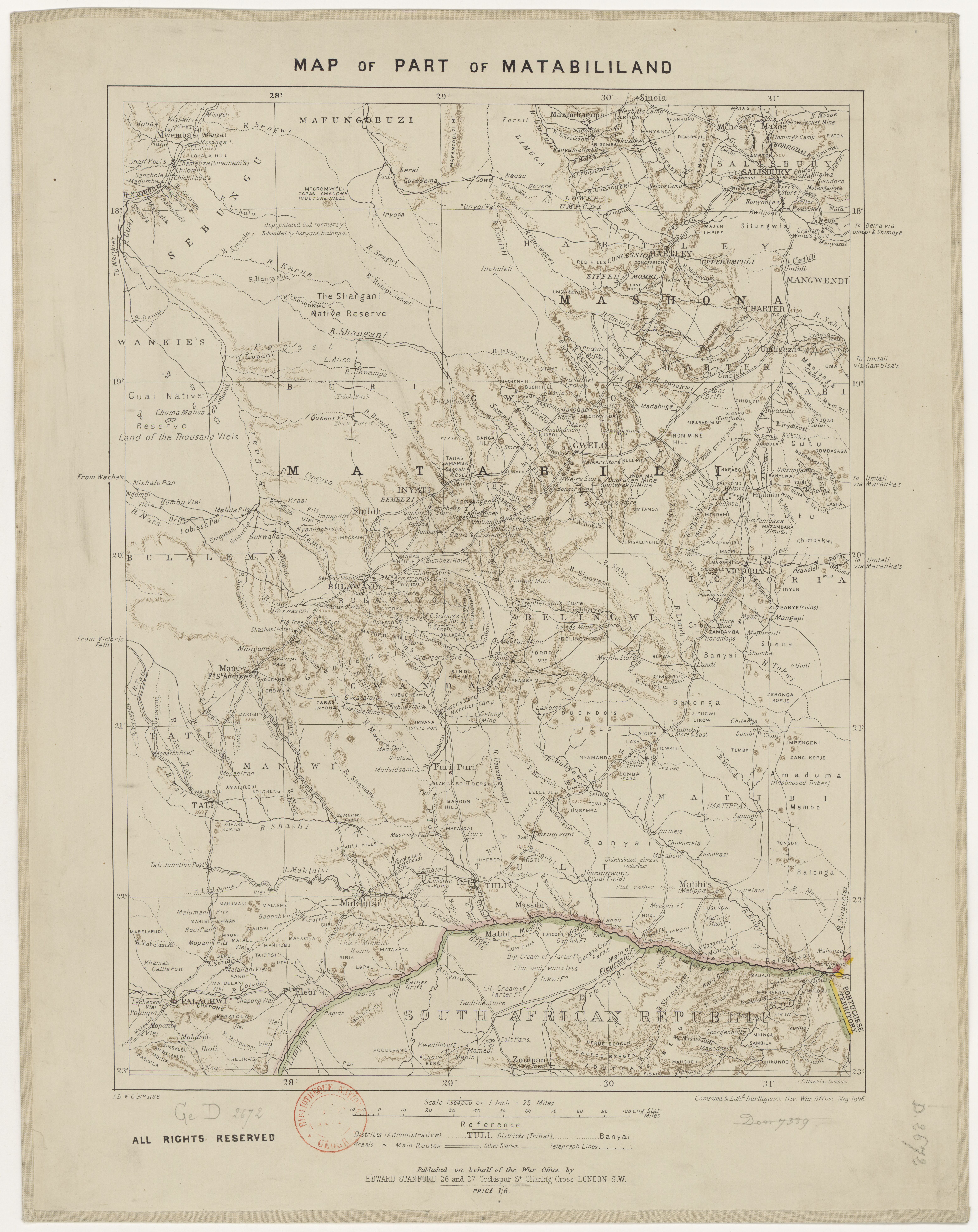
[edit]| Map of part of Matabeliland
( |
|||||||||||||||||||||||||||
|---|---|---|---|---|---|---|---|---|---|---|---|---|---|---|---|---|---|---|---|---|---|---|---|---|---|---|---|
| Author |
Grande-Bretagne. War office. Intelligence branch. Auteur du texte |
||||||||||||||||||||||||||
| Title |
Map of part of Matabeliland |
||||||||||||||||||||||||||
| Description |
Français : Sujet : Matabeleland
Échelle(s) : 1:1 584 000 Couverture : Zimbabwe Langue : anglais Éditeur : Intelligence div. war office |
||||||||||||||||||||||||||
| Date | 1896 | ||||||||||||||||||||||||||
| Dimensions | height: 46 cm (18.1 in); width: 30 cm (11.8 in) | ||||||||||||||||||||||||||
| Collection |
|
||||||||||||||||||||||||||
| References |
Français : Notice du catalogue : http://catalogue.bnf.fr/ark:/12148/cb40731376m |
||||||||||||||||||||||||||
| Source/Photographer |
Français : Bibliothèque nationale de France, GED-2672
Bibliothèque nationale de France |
||||||||||||||||||||||||||
| Permission (Reusing this file) |
|
||||||||||||||||||||||||||

File history
Click on a date/time to view the file as it appeared at that time.
| Date/Time | Thumbnail | Dimensions | User | Comment | |
|---|---|---|---|---|---|
| current | 03:17, 28 July 2022 | | 6,228 × 7,849 (5.8 MB) | Gzen92Bot (talk | contribs) | Gallica btv1b8441512d |
You cannot overwrite this file.
File usage on Commons
The following page uses this file: