File:Map of Robeson County, North Carolina.jpg
Jump to navigation
Jump to search
Size of this preview: 474 × 599 pixels. Other resolutions: 190 × 240 pixels | 380 × 480 pixels | 608 × 768 pixels | 810 × 1,024 pixels | 1,621 × 2,048 pixels | 6,313 × 7,976 pixels.
Original file (6,313 × 7,976 pixels, file size: 6.99 MB, MIME type: image/jpeg)
Captions
Captions
Add a one-line explanation of what this file represents
Summary
[edit]
| Description |
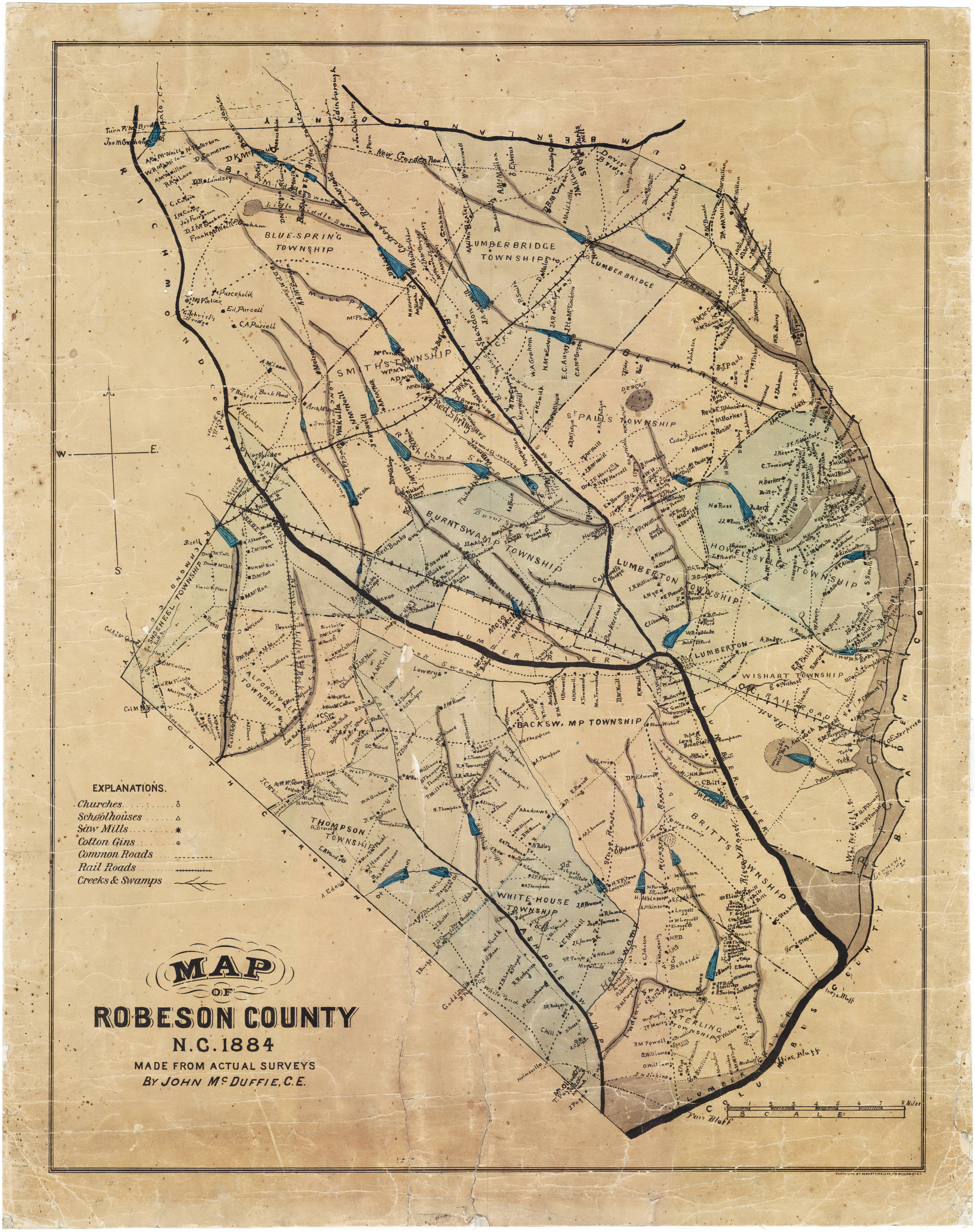
English: 1884 map of Robeson County, North Carolina. Map shows townships, churches, mills, schools, sawmills, cotton gins, retail stores, landowners, swamp lands, and the rail road. |
| Date | |
| Source | https://dc.lib.unc.edu/cdm/ref/collection/ncmaps/id/253 |
| Author | John McDuffie |
Licensing
[edit]
This work is in the public domain in the United States because it was published (or registered with the U.S. Copyright Office) before January 1, 1929.
Public domain works must be out of copyright in both the United States and in the source country of the work in order to be hosted on the Commons. If the work is not a U.S. work, the file must have an additional copyright tag indicating the copyright status in the source country.
Note: This tag should not be used for sound recordings. |
File history
Click on a date/time to view the file as it appeared at that time.
| Date/Time | Thumbnail | Dimensions | User | Comment | |
|---|---|---|---|---|---|
| current | 19:15, 24 October 2021 | | 6,313 × 7,976 (6.99 MB) | Indy beetle (talk | contribs) | Uploaded a work by John McDuffie from https://dc.lib.unc.edu/cdm/ref/collection/ncmaps/id/253 with UploadWizard |
You cannot overwrite this file.
File usage on Commons
There are no pages that use this file.