Category:Maps of Robeson County, North Carolina
Jump to navigation
Jump to search
Counties of North Carolina: Alamance · Alexander · Alleghany · Anson · Ashe · Avery · Beaufort · Bertie · Bladen · Brunswick · Buncombe · Burke · Cabarrus · Caldwell · Camden · Carteret · Caswell · Catawba · Chatham · Cherokee · Chowan · Clay · Cleveland · Columbus · Craven · Cumberland · Currituck · Dare · Davidson · Davie · Duplin · Durham · Edgecombe · Forsyth · Franklin · Gaston · Gates · Graham · Granville · Greene · Guilford · Halifax · Harnett · Haywood · Henderson · Hertford · Hoke · Hyde · Iredell · Jackson · Johnston · Jones · Lee · Lenoir · Lincoln · Macon · Madison · Martin · McDowell · Mecklenburg · Mitchell · Montgomery · Moore · Nash · New Hanover · Northampton · Onslow · Orange · Pamlico · Pasquotank · Pender · Perquimans · Person · Pitt · Polk · Randolph · Richmond · Robeson · Rockingham · Rowan · Rutherford · Sampson · Scotland · Stanly · Stokes · Surry · Swain · Transylvania · Tyrrell · Union · Vance · Wake · Warren · Washington · Watauga · Wayne · Wilkes · Wilson · Yadkin · Yancey
Wikimedia category | |||||
| Upload media | |||||
| Instance of | |||||
|---|---|---|---|---|---|
| Category combines topics | |||||
| Robeson County | |||||
county in North Carolina, United States _17_(cropped).jpg) _at_Robeson_County_Line.jpg)  | |||||
| Instance of | |||||
| Named after |
| ||||
| Location | North Carolina | ||||
| Capital | |||||
| Inception |
| ||||
| Population |
| ||||
| Area |
| ||||
| Different from | |||||
| official website | |||||
 | |||||
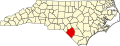
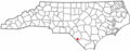
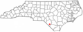
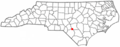
Robeson County is located in North Carolina in the United States. Its county seat is Lumberton.
Subcategories
This category has only the following subcategory.
Media in category "Maps of Robeson County, North Carolina"
The following 22 files are in this category, out of 22 total.
-
 1872 map of central Robeson County.png 646 × 308; 213 KB
-
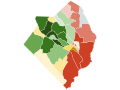
 Lumberton-Laurinburg CSA.png 654 × 266; 29 KB
-
 Map of North Carolina highlighting Robeson County.svg 2,687 × 1,019; 157 KB
-

-
 Map of Robeson County, North Carolina.jpg 6,313 × 7,976; 6.99 MB
-
 NCMap-doton-Elrod.PNG 300 × 117; 9 KB
-
 NCMap-doton-Fairmont.PNG 300 × 117; 9 KB
-
 NCMap-doton-LumberBridge.PNG 300 × 117; 9 KB
-
 NCMap-doton-Orrum.PNG 300 × 117; 9 KB
-
 NCMap-doton-Parkton.PNG 300 × 117; 9 KB
-
 NCMap-doton-Pembroke.PNG 300 × 117; 9 KB
-
 NCMap-doton-Proctorville.PNG 300 × 117; 9 KB
-
 NCMap-doton-Raemon.PNG 300 × 117; 9 KB
-
 NCMap-doton-Raynham.PNG 300 × 117; 9 KB
-
 NCMap-doton-RedSprings.PNG 300 × 117; 9 KB
-
 NCMap-doton-Renhert.PNG 300 × 117; 9 KB
-
 NCMap-doton-Rex.PNG 300 × 117; 9 KB
-
 NCMap-doton-Rowland.PNG 300 × 117; 9 KB
-
 NCMap-doton-Shannon.PNG 300 × 117; 9 KB
-
 NCMap-doton-StPauls.PNG 300 × 117; 9 KB
-
 North Carolina Map Highlighting Robeson County.PNG 531 × 201; 15 KB
-
 Robeson race 2020.svg 512 × 384; 53 KB


