File:Map of New York highlighting Kings County.svg
Jump to navigation
Jump to search

Size of this PNG preview of this SVG file: 787 × 600 pixels. Other resolutions: 315 × 240 pixels | 630 × 480 pixels | 1,008 × 768 pixels | 1,280 × 975 pixels | 2,560 × 1,950 pixels | 1,100 × 838 pixels.
Original file (SVG file, nominally 1,100 × 838 pixels, file size: 66 KB)
Captions
Captions
Add a one-line explanation of what this file represents
Summary
[edit]
| Description |
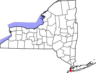
English: This is a locator map showing Kings County in New York. For more information, see Commons:United States county locator maps. |
| Date | |
| Source |
Own work: English: The maps use data from nationalatlas.gov, specifically countyp020.tar.gz on the Raw Data Download page. The maps also use state outline data from statesp020.tar.gz. The Florida maps use hydrogm020.tar.gz to display Lake Okeechobee. |
| Author | David Benbennick |
Licensing
[edit]
| I, the copyright holder of this work, release this work into the public domain. This applies worldwide. In some countries this may not be legally possible; if so: I grant anyone the right to use this work for any purpose, without any conditions, unless such conditions are required by law. |
File history
Click on a date/time to view the file as it appeared at that time.
| Date/Time | Thumbnail | Dimensions | User | Comment | |
|---|---|---|---|---|---|
| current | 15:22, 25 June 2024 | | 1,100 × 838 (66 KB) | Nux (talk | contribs) | uniform colors with good contrast |
| 20:26, 16 June 2024 |  | 1,650 × 1,257 (66 KB) | Nux (talk | contribs) | fix rendering (remove clipping) | |
| 15:32, 12 February 2006 |  | 6,599 × 5,030 (112 KB) | David Benbennick (talk | contribs) | {{subst:User:Dbenbenn/clm|county=Kings County|state=New York|type=county}} |
You cannot overwrite this file.
File usage on Commons
There are no pages that use this file.
File usage on other wikis
The following other wikis use this file:
- Usage on azb.wikipedia.org
- Usage on bn.wikipedia.org
- Usage on bpy.wikipedia.org
- Usage on cy.wikipedia.org
- Usage on de.wikipedia.org
- Usage on en.wikipedia.org
- Brooklyn
- List of counties in New York
- Rockaway Inlet
- Wikipedia:WikiProject New York City
- Commodore Barry Park
- National Register of Historic Places listings in Brooklyn
- Wingate, Brooklyn
- Bridge Plaza, Brooklyn
- Template:BrooklynNY-geo-stub
- Canarsie Pol
- John J. Carty Park
- Battle Hill (Brooklyn)
- Fulton Park (Brooklyn)
- Park Place Historic District (Brooklyn)
- Mau Mau Island
- Mussel Island
- Russell D. Ramsey Triangle
- Chief Charles A. Joshua Plaza
- Albee Square
- Walt Whitman Park (Brooklyn)
- User:AridCeption/sandbox
- File talk:Map of New York highlighting Kings County.svg
- Usage on es.wikipedia.org
- Usage on fa.wikipedia.org
- Usage on fi.wikipedia.org
- Usage on frr.wikipedia.org
- Usage on fr.wikipedia.org
- Usage on hu.wikipedia.org
- Usage on hy.wikipedia.org
- Usage on ja.wikipedia.org
- Usage on ko.wikipedia.org
- Usage on ku.wikipedia.org
- Usage on ky.wikipedia.org
- Usage on ml.wikipedia.org
- Usage on nds.wikipedia.org
- Usage on nl.wikipedia.org
- Usage on pl.wikipedia.org
- Usage on pnb.wikipedia.org
- Usage on pt.wikipedia.org
- Usage on ru.wikipedia.org
- Usage on sh.wikipedia.org
View more global usage of this file.