File:Map of Greece, Archipelago and part of Anadoli; Louis Stanislas d'Arcy Delarochette 1791.jpg
Jump to navigation
Jump to search

Size of this preview: 800 × 561 pixels. Other resolutions: 320 × 225 pixels | 640 × 449 pixels | 1,024 × 719 pixels | 1,280 × 898 pixels | 2,560 × 1,797 pixels | 9,411 × 6,605 pixels.
Original file (9,411 × 6,605 pixels, file size: 15.99 MB, MIME type: image/jpeg)
Captions
Captions
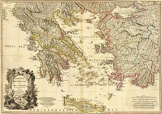
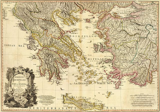
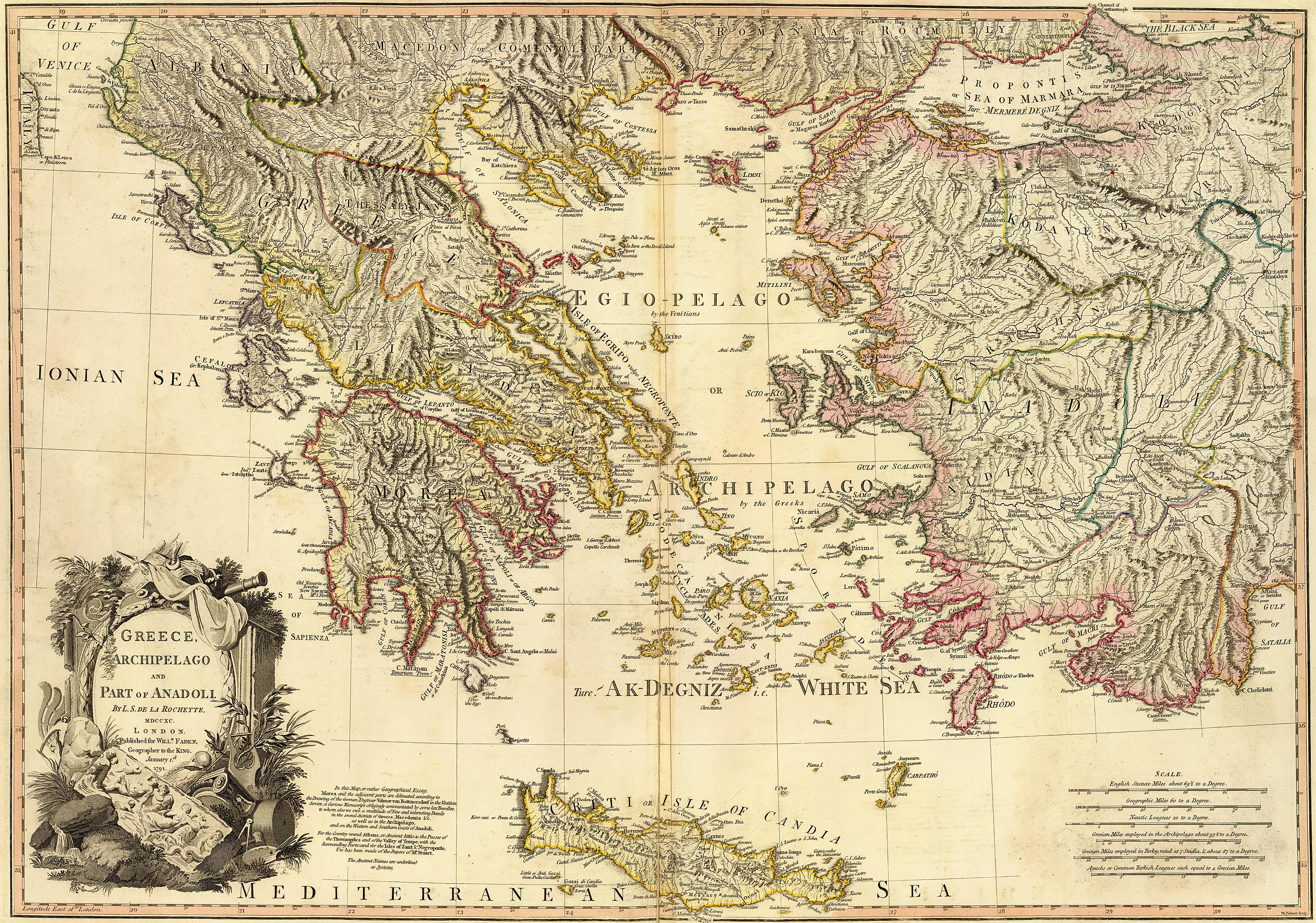
Ionia is the west coast region of Anatolia (present-day Turkey)
Summary
[edit]| Description |
Greece, Archipelago and part of Anadoli. Published for Willm. Faden, Geographer to the King. W. Palmer sculp. . Scale: 1,350,000 |
| Date | |
| Source | http://www.davidrumsey.com/luna/servlet/detail/RUMSEY~8~1~24845~960053?trs=120&mi=23&qvq=mgid%3A2728# |
| Author | Louis Stanislas d'Arcy Delarochette |
| Other versions |
|
.jpg)
.jpg)
.jpg)
Licensing
[edit]|
This work is in the public domain in its country of origin and other countries and areas where the copyright term is the author's life plus 100 years or fewer. This work is in the public domain in the United States because it was published (or registered with the U.S. Copyright Office) before January 1, 1929. | |
| This file has been identified as being free of known restrictions under copyright law, including all related and neighboring rights. | |
| Warning | The original file is very high-resolution. It might not load properly or could cause your browser to freeze when opened at full size. |
|---|
| Annotations | This image is annotated: View the annotations at Commons |

File history
Click on a date/time to view the file as it appeared at that time.
| Date/Time | Thumbnail | Dimensions | User | Comment | |
|---|---|---|---|---|---|
| current | 15:05, 9 June 2016 | | 9,411 × 6,605 (15.99 MB) | HerrAdams (talk | contribs) | Removed border by cropping 20 % horizontally and 13 % vertically using CropTool with lossless mode. |
| 17:11, 4 May 2016 |  | 11,730 × 7,600 (20.32 MB) | Mattes (talk | contribs) | == {{int:filedesc}} == {{Information |Description= Greece, Archipelago and part of Anadoli. By L.S. de la Rochette, MDCCXC. London. Published for Willm. Faden, Geographer to the King. January 1st, 1791. W. Palmer sculp. . Scale: 1,350,000 |Source=http:... |
You cannot overwrite this file.
File usage on Commons
The following page uses this file:
File usage on other wikis
The following other wikis use this file:
- Usage on en.wikipedia.org
- Aegean civilization
- Dorians
- Ostracism
- History of Cyprus
- Timeline of ancient Greece
- Ancient Greece
- Miletus
- Minoan civilization
- Pelasgians
- Greek War of Independence
- Ionians
- Greek Dark Ages
- Cycladic culture
- Hellenistic period
- History of Greece
- Mycenaean Greece
- Hellenistic Greece
- Byzantine Greece
- Ottoman Greece
- Dorian invasion
- Template:History of Greece
- Aeolians
- Helladic chronology
- Archaic Greece
- Greek junta
- Military history of Greece
- Greece in the Roman era
- Ionian League
- 4th of August Regime
- Names of the Greeks
- National Schism
- History of modern Macedonia (Greece)
- Chronology of ancient Greek mathematicians
- History of the Hellenic Republic
- Timeline of modern Greek history
- Second Hellenic Republic
- Economic history of Greece and the Greek world
- Talk:History of the Assyrians
- Classical Greece
- User:Athinaios/Sandbox
- Hellenic State (1941–1944)
- Frankokratia
- Timeline of ancient Greek mathematicians
- Timeline of calculus and mathematical analysis
- History of Sparta
- Greece in the Balkan Wars
- Background of the Greek War of Independence
- Achaeans (tribe)
- Category:History of Greece by period
- Venetian rule in the Ionian Islands
View more global usage of this file.