File:Map of France, Spain and Portugal. (IA bp 33017).pdf
Jump to navigation
Jump to search

Size of this JPG preview of this PDF file: 495 × 599 pixels. Other resolutions: 198 × 240 pixels | 397 × 480 pixels | 635 × 768 pixels | 846 × 1,024 pixels | 1,839 × 2,225 pixels.
Original file (1,839 × 2,225 pixels, file size: 2 MB, MIME type: application/pdf)
Captions
Captions
Add a one-line explanation of what this file represents
Summary
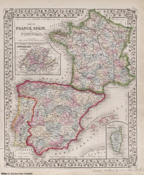
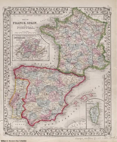
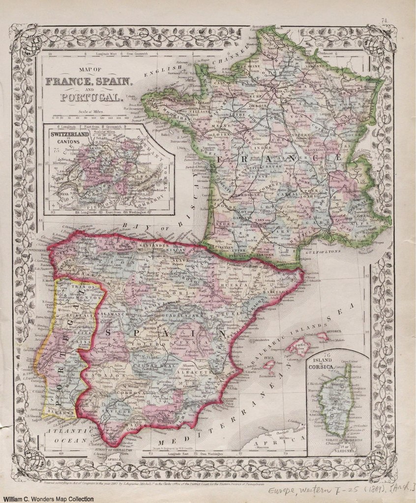
[edit]| Map of France, Spain and Portugal.
( |
|
|---|---|
| Title |
Map of France, Spain and Portugal. |
| Publisher |
S. Augustus Mitchell, [Philadelphia] |
| Description |
Includes place names, administrative divisions and geographical features.;From the Whistance-Smith Collection.;Insets: "Switzerland in cantons" and "Island of Corsica.";Hand col., 32 x 28 cm. on atlas sheet 39 x 31 cm.;Wide ornate border.;[Plate] '74." Subjects: Europe, Western--Political geography |
| Language | English |
| Publication date | 1867 |
| Current location |
IA Collections: wcw_gale; wcw; university_of_alberta_libraries; toronto |
| Accession number |
bp_33017 |
| Notes | Scale: Ca. 1:5,068,800 |
| Source | |
Licensing
[edit]|
This work is in the public domain in its country of origin and other countries and areas where the copyright term is the author's life plus 70 years or fewer. | |
| This file has been identified as being free of known restrictions under copyright law, including all related and neighboring rights. | |
File history
Click on a date/time to view the file as it appeared at that time.
| Date/Time | Thumbnail | Dimensions | User | Comment | |
|---|---|---|---|---|---|
| current | 12:59, 27 August 2021 |  | 1,839 × 2,225 (2 MB) | Fæ (talk | contribs) | IA Query "collection:(wcw) date:[1000 TO 1899]" bp_33017 Category:William C. Wonders Map Collection (COM:IA books#query) (1867 #291) |
You cannot overwrite this file.
File usage on Commons
The following page uses this file: