File:Map of Bremerhaven 1849.jpg
Jump to navigation
Jump to search

Size of this preview: 800 × 600 pixels. Other resolutions: 320 × 240 pixels | 640 × 480 pixels | 1,024 × 767 pixels | 1,280 × 959 pixels | 1,772 × 1,328 pixels.
Original file (1,772 × 1,328 pixels, file size: 2.13 MB, MIME type: image/jpeg)
Captions
Captions
Add a one-line explanation of what this file represents
Summary
[edit]
| Description |
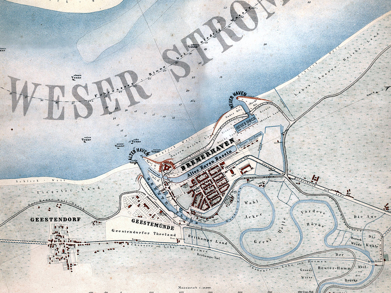
English: Map of the city of Bremerhaven, Germany from the year 1849.
Deutsch: „Bremerhaven mit den in Ausführung begriffenen neuen Havenanlagen“. Karte der Stadt Bremerhaven aus dem Jahr 1849.
Español: Mapa de la ciudad de Bremerhaven del año 1849.
Català: Mapa de la ciutat de Bremerhaven de l’any 1849. |
| Date | |
| Source | Hochschule Bremerhaven: Die Gebäude der Hochschule Bremerhaven. Wirtschaftsverlag NW, Bremerhaven 2005, ISBN 3-86509-250-0 |
| Author | Georg Hunckel |
| Permission (Reusing this file) |
Public domain because of age. |
| Other versions | Derivative works of this file: Map of Bremerhaven 1849 2011 11 27 Hochhaus.jpg |
Licensing
[edit]
|
This work is in the public domain in its country of origin and other countries and areas where the copyright term is the author's life plus 70 years or fewer. | |
| This file has been identified as being free of known restrictions under copyright law, including all related and neighboring rights. | |
File history
Click on a date/time to view the file as it appeared at that time.
| Date/Time | Thumbnail | Dimensions | User | Comment | |
|---|---|---|---|---|---|
| current | 17:03, 29 January 2008 | | 1,772 × 1,328 (2.13 MB) | Gepardenforellenfischer (talk | contribs) | {{Information |Description= {{en|Map of the city of Bremerhaven from the year 1849.}} {{de|Karte der Stadt Bremerhaven aus dem Jahr 1849.}} {{es|Mapa de la ciudad de Bremerhaven del año 1849.}} {{ca|Mapa de la ciutat de Bremerhaven de l’any 1849.}} |So |
You cannot overwrite this file.
File usage on Commons
The following 3 pages use this file:
File usage on other wikis
The following other wikis use this file:
- Usage on be.wikipedia.org
- Usage on cs.wikipedia.org
- Usage on de.wikipedia.org
- Usage on hu.wikipedia.org
- Usage on hy.wikipedia.org
- Usage on la.wikipedia.org
- Usage on nl.wikipedia.org
- Usage on ru.wikipedia.org
- Usage on zh.wikipedia.org