File:Map indicating Bathurst Inlet, Nunavut, Canada.png
Jump to navigation
Jump to search

No higher resolution available.
Map_indicating_Bathurst_Inlet,_Nunavut,_Canada.png (330 × 250 pixels, file size: 11 KB, MIME type: image/png)
Captions
Captions
Add a one-line explanation of what this file represents
Summary
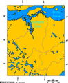
[edit]Map indicating Bathurst Inlet, Nunavut, Canada.
Nunavut
Northwest Territories
© Her Majesty the Queen in Right of Canada, Department of Natural Resources. All rights reserved.
Licence Agreement
Licensing
[edit]
|
The copyright holder of this work allows anyone to use it for any purpose including unrestricted redistribution, commercial use, and modification.
Usage notes:
|
See also
[edit]-
 Lambert Projection of Western Nunavut
 -

-
 Crown copyright map of Bathurst Inlet
 -

-
 Lambert Projection showing Bathurst Inlet, and environs
 -
 Orthographic projection over Bathurst Inlet, Nunavut
 -
 Communities where Inuinnaqtun is spoken


File history
Click on a date/time to view the file as it appeared at that time.
| Date/Time | Thumbnail | Dimensions | User | Comment | |
|---|---|---|---|---|---|
| current | 15:07, 21 March 2006 | | 330 × 250 (11 KB) | David Kernow~commonswiki (talk | contribs) | Map indicating Bathurst Inlet, Nunavut, Canada. {{legend|#ffff66|Nunavut}} {{legend|#ffccff|Northwest Territories}} <br> © Her Majesty the Queen in Right of Canada, Department of Natural Resources. All rights reserved.<br>[http: |
You cannot overwrite this file.
File usage on Commons
The following 7 pages use this file:
- File:Communities where Inuinnaqtun is spoken.png
- File:Lambert Projection of Western Nunavut.png
- File:Lambert Projection showing Bathurst Inlet, Nunavut, and environs.png
- File:Lambert Projection showing the Diavik Diamond Mine, near Barthurst Inlet, Nunavut.png
- File:Lambert Projection showing the Ekati and Diavik Diamond Mine, near Barthurst Inlet, Nunavut.png
- File:Map indicating Bathurst Inlet, Nunavut, Canada.png
- File:Orthographic projection over Bathurst Inlet, Nunavut.png
File usage on other wikis
The following other wikis use this file:
- Usage on en.wikipedia.org