File:Map en county of Toulouse 1154.jpg
Jump to navigation
Jump to search
No higher resolution available.
Map_en_county_of_Toulouse_1154.jpg (394 × 293 pixels, file size: 74 KB, MIME type: image/jpeg)
Captions
Captions
Add a one-line explanation of what this file represents
Summary
[edit]| Description |
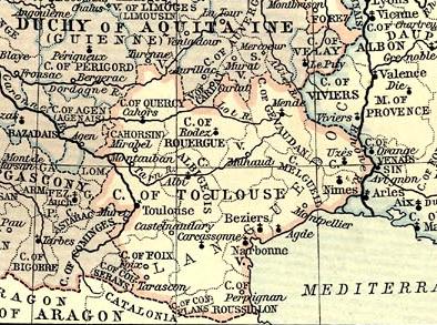
English: Map of County of Toulouse in 1154.
Français : Carte du comté de Toulouse en 1154. |
|||||||||||||||||||||||
| Source |
|
|||||||||||||||||||||||
| Author |
|
|||||||||||||||||||||||
.png)
Licensing
[edit]
|
This work is in the public domain in its country of origin and other countries and areas where the copyright term is the author's life plus 70 years or fewer. | |
| This file has been identified as being free of known restrictions under copyright law, including all related and neighboring rights. | |
File history
Click on a date/time to view the file as it appeared at that time.
| Date/Time | Thumbnail | Dimensions | User | Comment | |
|---|---|---|---|---|---|
| current | 18:32, 26 November 2008 | | 394 × 293 (74 KB) | Odejea (talk | contribs) | {{Information |Description={{en|1=Map of County of Toulouse in 1154.}} {{fr|1=Carte du comté de Toulouse en 1154.}} |Source=Atlas historique de William R. Shepherd |Author=William R. Shepherd |Date= | |
You cannot overwrite this file.
File usage on Commons
There are no pages that use this file.
File usage on other wikis
The following other wikis use this file:
- Usage on be.wikipedia.org
- Usage on br.wikipedia.org
- Usage on cs.wikipedia.org
- Usage on el.wikipedia.org
- Usage on en.wikipedia.org
- Usage on eo.wikipedia.org
- Usage on et.wikipedia.org
- Usage on eu.wikipedia.org
- Usage on it.wikipedia.org
- Usage on oc.wikipedia.org
- Usage on ru.wikipedia.org