File:Map Vogtei Dorla.png
Jump to navigation
Jump to search

Size of this preview: 728 × 599 pixels. Other resolutions: 292 × 240 pixels | 583 × 480 pixels | 933 × 768 pixels | 1,266 × 1,042 pixels.
Original file (1,266 × 1,042 pixels, file size: 395 KB, MIME type: image/png)
Captions
Captions
Add a one-line explanation of what this file represents
Summary
[edit]
| Description |
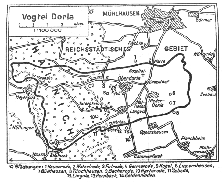
English: Map of the historical district Vogtei Dorla in Thuringia.
Deutsch: Plan des historischen Gebietes Vogtei Dorla in Thüringen. |
| Date | |
| Source | Der Pflüger, JG 1929, S. 243 |
| Author | N.N. |
Karte zu einem Artikel zur Geschichte von Oppershausen.
Licensing
[edit]
|
This work is in the public domain in its country of origin and other countries and areas where the copyright term is the author's life plus 70 years or fewer. | |
| This file has been identified as being free of known restrictions under copyright law, including all related and neighboring rights. | |
File history
Click on a date/time to view the file as it appeared at that time.
| Date/Time | Thumbnail | Dimensions | User | Comment | |
|---|---|---|---|---|---|
| current | 17:08, 23 April 2009 | | 1,266 × 1,042 (395 KB) | Metilsteiner (talk | contribs) | {{Information |Description={{en|1=Map of the historical district ''Vogtei Dorla'' in Thuringia. }} {{de|1=Plan des historischen Gebietes ''Vogtei Dorla'' in Thüringen. }} |Source=Der Pflüger, JG 1929, S. 243 |Author=N.N. |Date=1929 |Permission= |other_v |
You cannot overwrite this file.
File usage on Commons
There are no pages that use this file.
File usage on other wikis
The following other wikis use this file:
- Usage on de.wikipedia.org