File:Map - NL - Municipality code 0518 (2009).svg
Jump to navigation
Jump to search

Size of this PNG preview of this SVG file: 300 × 160 pixels. Other resolutions: 320 × 171 pixels | 640 × 341 pixels | 1,024 × 546 pixels | 1,280 × 683 pixels | 2,560 × 1,365 pixels.
Original file (SVG file, nominally 300 × 160 pixels, file size: 530 KB)
Captions
Captions
Add a one-line explanation of what this file represents
| Description |
|
|||
| Date | ||||
| Source | own work , using CBS data | |||
| Author | Michiel1972 (talk) 22:53, 24 January 2009 (UTC) | |||
| Permission (Reusing this file) |
Attribution ShareAlike 3.0 |

This file is licensed under the Creative Commons Attribution-Share Alike 3.0 Unported license.
- You are free:
- to share – to copy, distribute and transmit the work
- to remix – to adapt the work
- Under the following conditions:
- attribution – You must give appropriate credit, provide a link to the license, and indicate if changes were made. You may do so in any reasonable manner, but not in any way that suggests the licensor endorses you or your use.
- share alike – If you remix, transform, or build upon the material, you must distribute your contributions under the same or compatible license as the original.
File history
Click on a date/time to view the file as it appeared at that time.
| Date/Time | Thumbnail | Dimensions | User | Comment | |
|---|---|---|---|---|---|
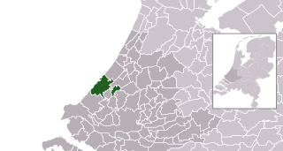
| current | 22:53, 24 January 2009 | | 300 × 160 (530 KB) | Michiel1972 (talk | contribs) | {{Information |Description=*Location maps for the 441 municipalities in the Netherlands. Boundaries 1/1/2009 *Automatically generated with script *File name contains "Municipality code" (CBS-code) as specified in: [http://www.cbs.nl/nl-NL/menu/methoden/c |
You cannot overwrite this file.
File usage on Commons
The following 21 pages use this file:
- Den Haag
- Category:Births in The Hague
- Category:Boroughs of The Hague
- Category:Churches in The Hague
- Category:Courtyards (hofjes) in The Hague
- Category:Deaths in The Hague
- Category:Education in The Hague
- Category:Geography of The Hague
- Category:Hospitals in The Hague
- Category:Maps of The Hague
- Category:Religion in The Hague
- Category:Sports in The Hague
- Category:Streets in The Hague
- Category:The Hague
- Category:The Hague in the 17th century
- Category:The Hague in the 18th century
- Category:The Hague in the 19th century
- Category:The Hague in the 20th century
- Category:The Hague in the 21st century
- Category:Transport in The Hague
- Category:Views of The Hague
File usage on other wikis
The following other wikis use this file:
- Usage on af.wikipedia.org
- Usage on arc.wikipedia.org
- Usage on ar.wikipedia.org
- Usage on arz.wikipedia.org
- Usage on ast.wikipedia.org
- Usage on bn.wikipedia.org
- Usage on ca.wikipedia.org
- Usage on el.wikipedia.org
- Usage on en.wikipedia.org
- Usage on eu.wikipedia.org
- Usage on ext.wikipedia.org
- Usage on fa.wikipedia.org
- Usage on fr.wikipedia.org
- Usage on fr.wikinews.org
- Usage on ga.wikipedia.org
- Usage on gl.wikipedia.org
- Usage on hi.wikipedia.org
- Usage on ht.wikipedia.org
- Usage on hu.wikipedia.org
- Usage on it.wikipedia.org
- Usage on la.wikipedia.org
- Usage on lb.wikipedia.org
- Usage on lij.wikipedia.org
- Usage on mdf.wikipedia.org
- Usage on mk.wikipedia.org
- Usage on ml.wikipedia.org
- Usage on ms.wikipedia.org
- Usage on mzn.wikipedia.org
- Usage on nl.wikipedia.org
- Usage on oc.wikipedia.org
- Usage on ru.wikipedia.org
- Usage on sd.wikipedia.org
- Usage on stq.wikipedia.org
- Usage on tl.wikipedia.org
- Usage on tr.wikipedia.org
- Usage on uk.wikipedia.org
- Usage on ur.wikipedia.org
- Usage on vi.wikipedia.org
- Usage on vo.wikipedia.org
- Usage on www.wikidata.org
- Usage on zh.wikipedia.org
.svg&oldid=493758096)